Winkelwagen
Geen items in winkelwagen
Ga naar winkelwagen
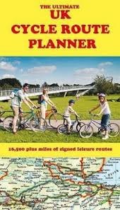
Opruiming Fietskaart Ultimate UK cycle route planner - map | Excellent Books (9781901464214)
OPRUIMING
- ISBN / CODE: 9781901464214
- Editie: 2012
- Schaal: 1:600000
- Uitgever: Excellent Books
- Soort: Fietskaart, Opruiming
- Taal: Engels
- Schrijf als eerste een review
-
€ 5,00
Uitverkocht, nooit meer leverbaar
Beschrijving
opruiming
All of the UK's signed cycle routes brought together on one map - now a comprehensively updated and expanded 2nd edition. Using the outstanding quality and detail of Times Comprehensive Atlas mapping, Sustrans' National Cycle Network and other popular cycle trails are featured and defined - traffic free or on road. Family cyclists will love the listed traffic-free trails.
Other routes include regional routes such as county cycle ways and those National Trails on which bikes are allowed such as the Pennine Bridleway and the Ridgeway. Many hundreds of miles of minor road routes have been added for the 2nd edition and links to signed cross-channel routes such as the Avenue Verte (London-Paris) are shown so that long distance route planning is also made easy.
A bespoke key makes the map easy to understand at a glance. The UK's rail network and its myriad of stations is detailed, showing at a glance where and how cyclists can combine bike and train to get access to the country's best cycling.
As the scale of the map makes it suitable for planning rather than navigation, full details are given of where you can get larger scale maps of popular rides, such as the C2C, the Devon Coast to Coast and the Way of the Roses. Also shown are the 2014 Tour de France route sections within the UK.
* Superb quality mapping showing thousands of villages, towns and cities linked by the UK's ever expanding
cycle network.
* Compiled by specialist cycle guide publisher Excellent Books, run by established cycle journalist Richard
Peace.
* Sustrans' National Cycle Network, minor roads, National Trails, the UK rail and canal network - all this brought together on one map to make a unique and invaluable planning tool.
* Printed on FSC (Forest Stewardship Council) paper from renewable forest sources.
Reviews
Geen reviews gevonden voor dit product.
Schrijf een review
Graag horen wij wat u van dit artikel vindt. Vindt u het goed, leuk, mooi, slecht, lelijk, onbruikbaar of erg handig: schrijf gerust alles op! Het is niet alleen leuk om te doen maar u informeert andere klanten er ook nog mee!
Alle gerelateerde rubrieken >
Ook interessant voor europa/engeland
-

Wegenatlas AA Glovebox Atlas Britain
€ 8,50Wegenatlassen Engeland -

Fietsgids Land's End to John o' Groa
€ 20,95Fietsgidsen Engeland -

Reisgids England - Engeland | Rough
€ 26,50Reisgidsen Engeland -

Campergids Take the Slow Road Engela
€ 22,00Campergidsen Wales -

Reisverhaal Magisch en mystiek Engel
€ 21,95Reisverhalen Engeland