Wegenkaart - landkaart Guernsey - Sark (Kanaaleilanden) | ITMB (9781553415961)
- ISBN / CODE: 9781553415961
- Editie: 2008
- Schaal: 1:12500
- Uitgever: ITMB
- Soort: Wegenkaart
- Taal: Engels
- Beoordeling: 4,0 ★★★★★ (2 reviews) Schrijf een review
-
€ 13,95
Uitverkocht, nooit meer leverbaar
Beschrijving
Goede detailkaart van het eiland. Met alle toeristische informatie.
Legend Includes:
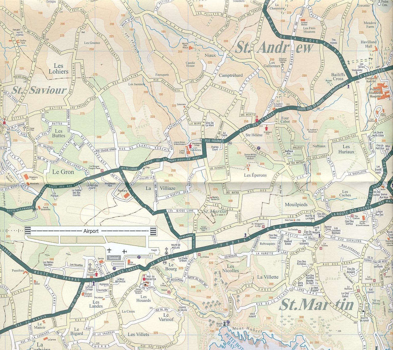
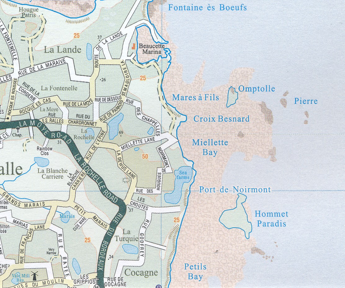
Roads by classification, hotels, schools, parking, gas stations, golf courses, churches, distance between points, and other information.
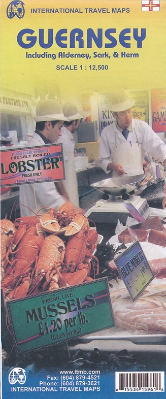
Just when you thought ITMB couldn't get more bizarre, out pops Guernsey! Well, why not. The Bailiwick of Guernsey, along with the feudal holding of Sark, constitutes one of the world's most enduring political entities. It was brought to England in 1066 by the invading Duke of Normandy, and is still the personal property of the reigning British monarch almost a thousand years later. More importantly, it is NOT part of the UK, is internally self-governing, has its own stamps and coins, and is NOT mapped by Ordnance Survey. It is also NOT a member of the EU, but it is a part of Great Britain, thanks to the Queen. It is also an extremely popular travel destination – exotic, kinky, more English than England, and fiercely proud of its silly idiosyncrasies. This is a beautifully prepared and detailed map of the island, its main town of St. Peter’s Port, and of the adjacent islands of Alderney, Sark, and Herm; altogether, a wonderful map of a luverley place to visit and absolutely unique.
Reviews
Prima kaart, zelfs met de namen van de straten op het eiland, alleen jammer dat deze straten niet altijd op Guernsey werden aangegeven. Ook voor wandeltochten is deze kaart uitstekend bruikbaar. Heb er dankbaar gebruik van kunnen maken.
★★★★★ door Durk Osinga 27 juni 2017 | Heeft dit artikel gekochtVond u dit een nuttige review? (login om te beoordelen)
goed gedetailleerde kaart, uitstekend voor wandeltochten hen ontdekken van de eilanden, in tegenstelling van normale Engelse kaarten (veel minder gedetailleerd als west Europese kaarten) is deze kaart zeer bruikbaar
★★★★★ door Henri 25 maart 2013Vond u dit een nuttige review? (login om te beoordelen)
Schrijf een review
Graag horen wij wat u van dit artikel vindt. Vindt u het goed, leuk, mooi, slecht, lelijk, onbruikbaar of erg handig: schrijf gerust alles op! Het is niet alleen leuk om te doen maar u informeert andere klanten er ook nog mee!
Ook interessant voor europa/engeland/kanaaleilanden
-

Reisgids Deel 10: Noord-Frankrijk, J
€ 26,75Reisgidsen Kanaaleilanden -

Reisgids Jersey | Rough Guides
€ 12,50Reisgidsen Kanaaleilanden -

Reisgids Marco Polo NL Jersey en Gue
€ 14,95Reisgidsen Kanaaleilanden -

Wandelgids Walking on Guernsey, Alde
€ 19,95Wandelgidsen Kanaaleilanden -

Reisgids Dominicus Kanaaleilanden: G
€ 21,99Reisgidsen Kanaaleilanden