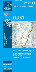
Wandelkaart - Topografische kaart 2126O Luant | IGN - Institut Géographique National (9782758501930)
- ISBN / CODE: 9782758501930
- Editie: meest recente versie
- Schaal: 1:25000
- Uitgever: IGN - Institut Géographique National
- Soort: Topografische kaart, Wandelkaart
- Serie: Serie bleue
- Taal: Frans
- Schrijf als eerste een review
-
€ 16,95
Uitverkocht, nooit meer leverbaar
-
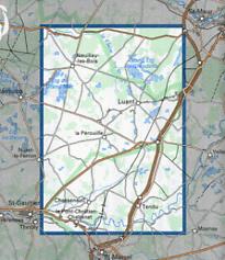
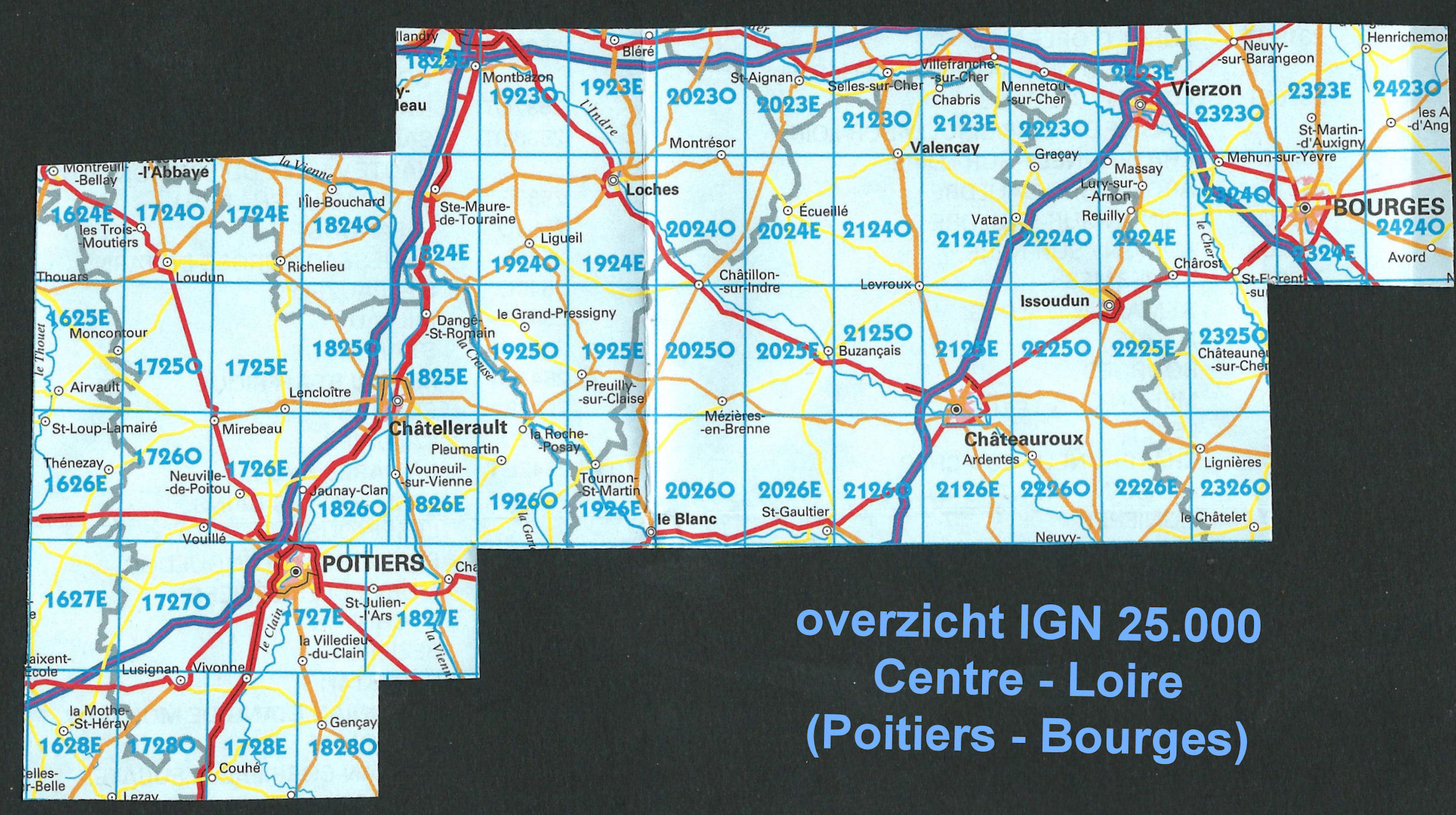
Topografischekaarten IGN 25.000 Loire - Centre: ZUIDELIJK GEDEELTE Bourges - Poitiers

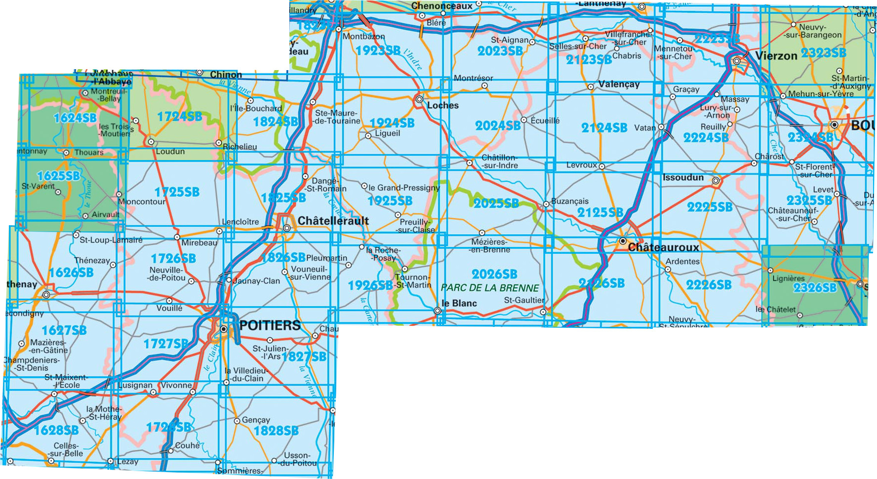
Producten op deze overzichtskaart:
Klik op een product om naar de pagina van dat product te gaan.
- Wandelkaart - Topografische kaart 1627SB Mazieres-en-Gatine, Vasles | IGN - Institut Géographique National
- Wandelkaart - Topografische kaart 1724SB Loudun – Richelieu | IGN - Institut Géographique National
- Wandelkaart - Topografische kaart 1725SB Lencloitre, St-Jean-de-Sauves | IGN - Institut Géographique National
- Wandelkaart - Topografische kaart 1726SB Neuville-de-Poitou, Vouille, Mirebeau | IGN - Institut Géographique National
- Wandelkaart - Topografische kaart 1727SB Poitiers - Coulombiers | IGN - Institut Géographique National
- Wandelkaart - Topografische kaart 1728SB Vivonne - Lusignan | IGN - Institut Géographique National
- Topografische kaart - Wandelkaart 1823SB Chambray-les-Tours | IGN - Institut Géographique National
- Wandelkaart - Topografische kaart 1824SB Sainte-Maure-de-Touraine, L'Ile Bouchard | IGN - Institut Géographique National
- Wandelkaart - Topografische kaart 1825SB Chatellerault - Descartes | IGN - Institut Géographique National
- Wandelkaart - Topografische kaart 1826SB Vouneuil-sur-Vienne, Archigny, Jaunay-Clan | IGN - Institut Géographique National
- Wandelkaart - Topografische kaart 1827SB Poitiers - Chauvigny | IGN - Institut Géographique National
- Wandelkaart - Topografische kaart 1923SB Bléré - Chenonceaux - Veigné | IGN - Institut Géographique National
- Wandelkaart - Topografische kaart 1924SB Loches - Ligueil | IGN - Institut Géographique National
- Wandelkaart - Topografische kaart 1925SB Preuilly-sur-Claise, le Grand-Pressigny | IGN - Institut Géographique National
- Wandelkaart - Topografische kaart 1926SB Le Blanc, Pleumartin, La Roche-Posay | IGN - Institut Géographique National
- Wandelkaart - Topografische kaart 2022SB Montrichard, Contres | IGN - Institut Géographique National
- Wandelkaart - Topografische kaart 2023SB Montrichard, St-Aignan | IGN - Institut Géographique National
- Wandelkaart - Topografische kaart 2024SB Chatillon-sur-Indre, Ecueille | IGN - Institut Géographique National
- Wandelkaart - Topografische kaart 2025SB Buzançais, Mézières-en-Brenne | IGN - Institut Géographique National
- Wandelkaart - Topografische kaart 2026SB St-Gaultier, Rosney | IGN - Institut Géographique National
- Wandelkaart - Topografische kaart 2122SB Romorantin-Lanthenay | IGN - Institut Géographique National
- Wandelkaart - Topografische kaart 2123SB Selles-sur-Cher, Chabris | IGN - Institut Géographique National
- Wandelkaart - Topografische kaart 2124SB Lucay-le-Male | IGN - Institut Géographique National
- Wandelkaart - Topografische kaart 2125SB Châteauroux, Levroux, Villedieu-sur-Indre | IGN - Institut Géographique National
- Wandelkaart - Topografische kaart 2126SB Le Poinçonnet, Velles, Luant | IGN - Institut Géographique National
- Wandelkaart - Topografische kaart 2223SB Vierzon, Mennetou-sur-Cher | IGN - Institut Géographique National
- Wandelkaart - Topografische kaart 2224SB Vatan, Charost | IGN - Institut Géographique National
- Wandelkaart - Topografische kaart 2225SB Issoudun, Neuvy-Paillouxt | IGN - Institut Géographique National
- Wandelkaart - Topografische kaart 2226SB Ardentes - La Berthenoux | IGN - Institut Géographique National
- Wandelkaart - Topografische kaart 2323SB St-Martin-d'Auxigny, Foëcy | IGN - Institut Géographique National
- Wandelkaart - Topografische kaart 2324SB Bourges, Mehun-sur-Yèvre | IGN - Institut Géographique National
-
Wandelkaarten IGN 25.000 Loire - Centre: ZUIDELIJK GEDEELTE Bourges - Poitiers

Producten op deze overzichtskaart:
Klik op een product om naar de pagina van dat product te gaan.
- Wandelkaart - Topografische kaart 1627SB Mazieres-en-Gatine, Vasles | IGN - Institut Géographique National
- Wandelkaart - Topografische kaart 1724SB Loudun – Richelieu | IGN - Institut Géographique National
- Wandelkaart - Topografische kaart 1725SB Lencloitre, St-Jean-de-Sauves | IGN - Institut Géographique National
- Wandelkaart - Topografische kaart 1726SB Neuville-de-Poitou, Vouille, Mirebeau | IGN - Institut Géographique National
- Wandelkaart - Topografische kaart 1727SB Poitiers - Coulombiers | IGN - Institut Géographique National
- Wandelkaart - Topografische kaart 1728SB Vivonne - Lusignan | IGN - Institut Géographique National
- Topografische kaart - Wandelkaart 1823SB Chambray-les-Tours | IGN - Institut Géographique National
- Wandelkaart - Topografische kaart 1824SB Sainte-Maure-de-Touraine, L'Ile Bouchard | IGN - Institut Géographique National
- Wandelkaart - Topografische kaart 1825SB Chatellerault - Descartes | IGN - Institut Géographique National
- Wandelkaart - Topografische kaart 1826SB Vouneuil-sur-Vienne, Archigny, Jaunay-Clan | IGN - Institut Géographique National
- Wandelkaart - Topografische kaart 1827SB Poitiers - Chauvigny | IGN - Institut Géographique National
- Wandelkaart - Topografische kaart 1923SB Bléré - Chenonceaux - Veigné | IGN - Institut Géographique National
- Wandelkaart - Topografische kaart 1924SB Loches - Ligueil | IGN - Institut Géographique National
- Wandelkaart - Topografische kaart 1925SB Preuilly-sur-Claise, le Grand-Pressigny | IGN - Institut Géographique National
- Wandelkaart - Topografische kaart 1926SB Le Blanc, Pleumartin, La Roche-Posay | IGN - Institut Géographique National
- Wandelkaart - Topografische kaart 2022SB Montrichard, Contres | IGN - Institut Géographique National
- Wandelkaart - Topografische kaart 2023SB Montrichard, St-Aignan | IGN - Institut Géographique National
- Wandelkaart - Topografische kaart 2024SB Chatillon-sur-Indre, Ecueille | IGN - Institut Géographique National
- Wandelkaart - Topografische kaart 2025SB Buzançais, Mézières-en-Brenne | IGN - Institut Géographique National
- Wandelkaart - Topografische kaart 2026SB St-Gaultier, Rosney | IGN - Institut Géographique National
- Wandelkaart - Topografische kaart 2122SB Romorantin-Lanthenay | IGN - Institut Géographique National
- Wandelkaart - Topografische kaart 2123SB Selles-sur-Cher, Chabris | IGN - Institut Géographique National
- Wandelkaart - Topografische kaart 2124SB Lucay-le-Male | IGN - Institut Géographique National
- Wandelkaart - Topografische kaart 2125SB Châteauroux, Levroux, Villedieu-sur-Indre | IGN - Institut Géographique National
- Wandelkaart - Topografische kaart 2126SB Le Poinçonnet, Velles, Luant | IGN - Institut Géographique National
- Wandelkaart - Topografische kaart 2223SB Vierzon, Mennetou-sur-Cher | IGN - Institut Géographique National
- Wandelkaart - Topografische kaart 2224SB Vatan, Charost | IGN - Institut Géographique National
- Wandelkaart - Topografische kaart 2225SB Issoudun, Neuvy-Paillouxt | IGN - Institut Géographique National
- Wandelkaart - Topografische kaart 2226SB Ardentes - La Berthenoux | IGN - Institut Géographique National
- Wandelkaart - Topografische kaart 2323SB St-Martin-d'Auxigny, Foëcy | IGN - Institut Géographique National
- Wandelkaart - Topografische kaart 2324SB Bourges, Mehun-sur-Yèvre | IGN - Institut Géographique National
Overzichtskaarten
Beschrijving
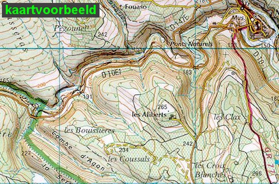
Let op: deze kaartenserie (de O en E versies) wijkt af van de OT en ET versie, het zijn zuiver topografische kaarten zonder ingetekende wandelroutes of GR paden. Ook andere toeristische aspecten staan niet als zodanig ingetekend. Wel zijn ze bijzonder goed en gedetaileerd. Een gemiddeld kaartlezer kan hier zonder meer de weg op vinden. Van dit gebied zijn op deze schaal geen andere kaarten beschikbaar.
Reviews
Geen reviews gevonden voor dit product.
Schrijf een review
Graag horen wij wat u van dit artikel vindt. Vindt u het goed, leuk, mooi, slecht, lelijk, onbruikbaar of erg handig: schrijf gerust alles op! Het is niet alleen leuk om te doen maar u informeert andere klanten er ook nog mee!
Ook interessant voor europa/frankrijk/loire-centre
-

Wandelkaart - Topografische kaart 21
€ 16,95Topografische kaarten Centre - Val de Loire -

Wandelkaart - Topografische kaart 23
€ 16,95Topografische kaarten Centre - Val de Loire -

Wandelkaart - Topografische kaart 25
€ 16,95Topografische kaarten Centre - Val de Loire -

Wandelkaart - Topografische kaart 21
€ 16,95Topografische kaarten Centre - Val de Loire -

Wandelkaart - Topografische kaart 21
€ 16,95Topografische kaarten Centre - Val de Loire