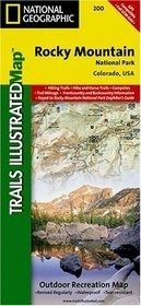
Wandelkaart 138 Rocky Mountain National Park | National Geographic (9781566953153)
- ISBN / CODE: 9781566953153
- Schaal: 1:50000
- Uitgever: National Geographic
- Soort: Wandelkaart
- Taal: Engels
- Schrijf als eerste een review
-
€ 17,95
Uitverkocht, nooit meer leverbaar
.jpg)
Beschrijving
Prachtige geplastificeerde kaart van het bekende nationaal park. Met alle recreatieve voorzieningen als campsites, maar ook met topografische details en wandelroutes ed. Door uitgekiend kleurgebruik zeer prettig in gebruik. Scheur en watervast!
Coverage includes Rocky Mountain National Park, Arapaho and Roosevelt National Forest, Never Summer Wilderness, Arapaho National Recreation Area, and the cities of Granby and Estes Park. Revisions to this map include easy-to-read trail mileage and markers, hiking-only and hike and horse trails are easily distinguished, Federal, State and Private lands are clearly marked, and the Continental Divide Trail is highlighted.
Revisions to this map include easy-to-read trail mileage and markers, hiking-only and hike and horse trails are easily distinguished, Federal, State and Private lands are clearly marked, the Continental Divide Trail is highlighted, and the map is keyed to the updated Rocky Mountain National Park Dayhiker's Guide. Includes UTM grids for use with your GPS unit.
Reviews
Geen reviews gevonden voor dit product.
Schrijf een review
Graag horen wij wat u van dit artikel vindt. Vindt u het goed, leuk, mooi, slecht, lelijk, onbruikbaar of erg handig: schrijf gerust alles op! Het is niet alleen leuk om te doen maar u informeert andere klanten er ook nog mee!
Ook interessant voor noord-amerika/verenigde-staten-van-amerika/nationale-parken
-

Natuurgids Adventure Set Denali Nati
€ 18,50Natuurgidsen Nationale Parken Verenigde Staten van Amerika -

Wegenkaart - landkaart 06 Southwest,
€ 14,50Wegenkaarten Nationale Parken Verenigde Staten van Amerika -

Campinggids - Campergids - Wandelgid
€ 23,95Campergidsen Nationale Parken Verenigde Staten van Amerika -

Wandelkaart - Topografische kaart 14
€ 17,95Topografische kaarten Nationale Parken Verenigde Staten van Amerika -

Reisgids Wyoming | Moon Travel Guide
€ 18,95Reisgidsen Nationale Parken Verenigde Staten van Amerika