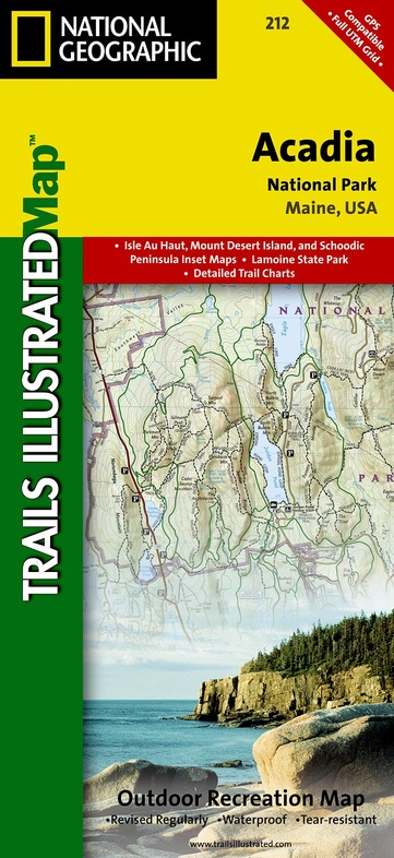
Wandelkaart - Topografische kaart 212 Acadia National Park | National Geographic (9781566953528)
Maine, USA
- ISBN / CODE: 9781566953528
- Schaal: 1:35000
- Uitgever: National Geographic
- Soort: Topografische kaart, Wandelkaart
- Taal: Engels
- Schrijf als eerste een review
-
€ 16,95
Op voorraad. Voor 17.00 uur op werkdagen besteld, morgen in huis in Nederland Levertijd Belgie
Gratis verzending in Nederland vanaf €35,-
-
Overzicht Wandelkaarten Maine Trails Illustrated National Geographic
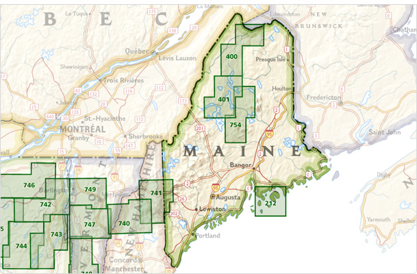
Producten op deze overzichtskaart:
Klik op een product om naar de pagina van dat product te gaan.
Overzichtskaarten
Beschrijving
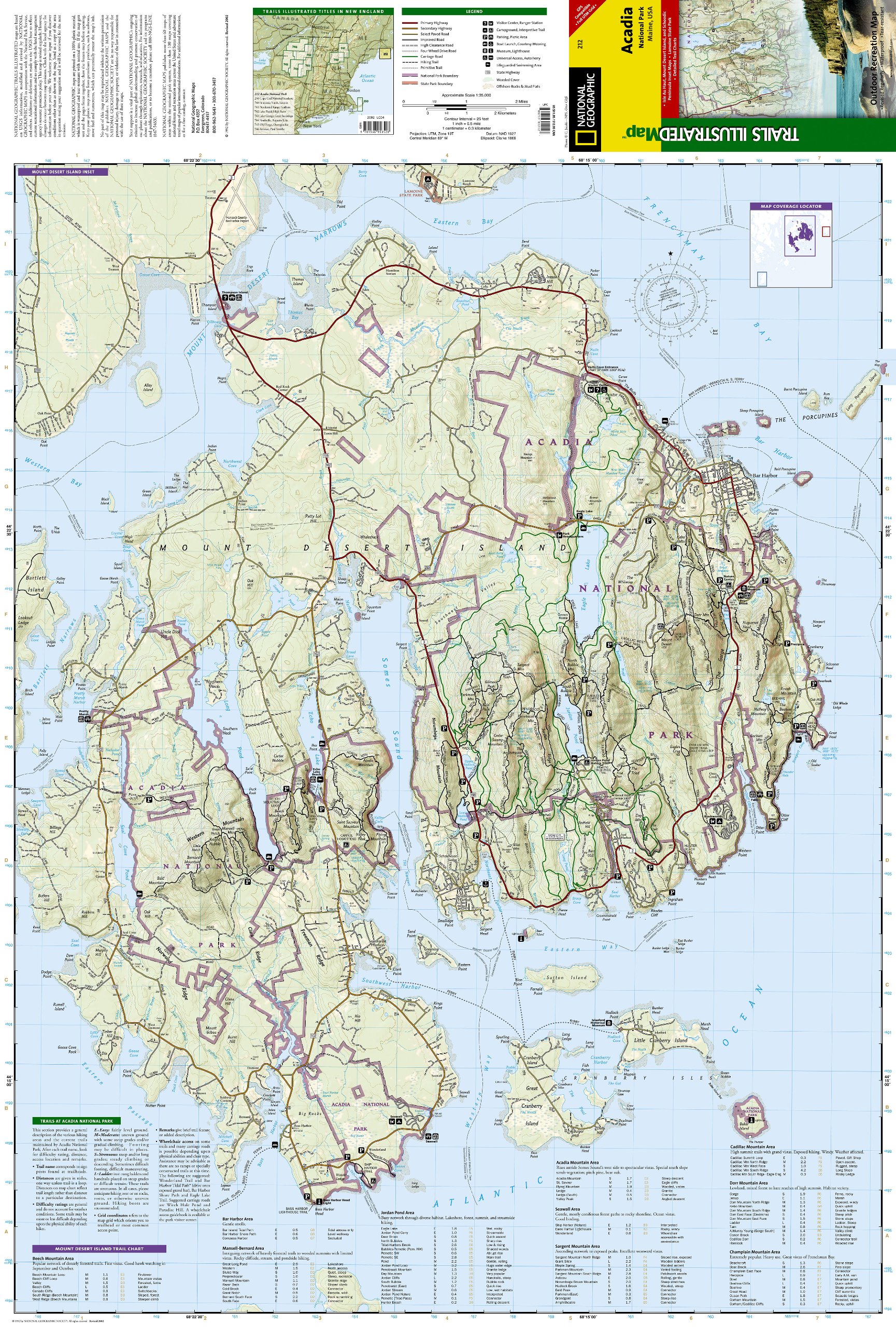
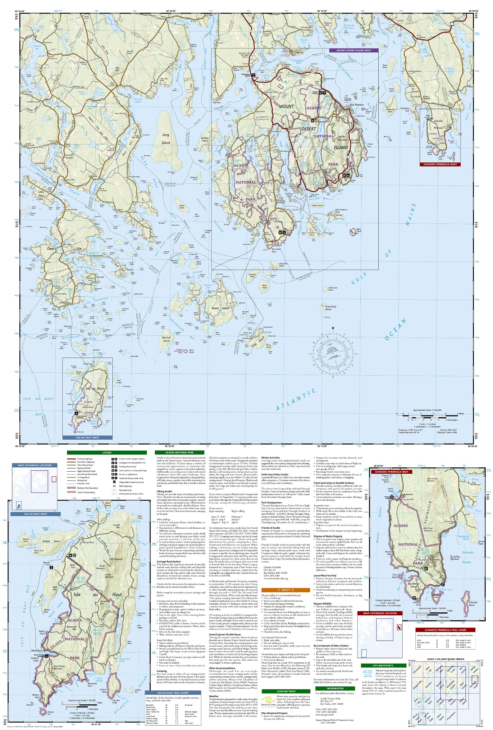
Prachtige geplastificeerde kaart van het nationaal park. Met alle recreatieve voorzieningen als campsites, maar ook met topografische details en wandelroutes ed. Door uitgekiend kleurgebruik zeer prettig in gebruik. Scheur en watervast!
Trails Illustrated maps are the most trusted and popular recreation maps available. Continually setting the standard for accuracy, each map is crafted in conjunction with local land managers, and undergoes rigorous review and enhancement before being printed on waterproof, tear-resistant material.
Each Trails Illustrated map contains detailed topographic information, clearly marked and named trails, recreational points of interest, and navigational aids. National Park series maps contain useful details for planning your visit. State series titles cover popular recreation areas, ideal for done-in-a-day activities.
Features Mount Desert Island, Sestern Mountain, Norwood Ridge, Freeman Ridge, Isle au Haut, Marshall Island, Swans Island, Western Bay, Mount Desert Narrows, Eastern May, Frenchman Bay, Eastern Way, Eastern Passage, Long Pond, Seal Cove Pond, Echo Lake, Somes Sound, Upper and Lower Hadlock Pond, Jordan Pond, and Eagle Lake. (Maine)
Reviews
Geen reviews gevonden voor dit product.
Schrijf een review
Graag horen wij wat u van dit artikel vindt. Vindt u het goed, leuk, mooi, slecht, lelijk, onbruikbaar of erg handig: schrijf gerust alles op! Het is niet alleen leuk om te doen maar u informeert andere klanten er ook nog mee!
Ook interessant voor noord-amerika/verenigde-staten-van-amerika/nationale-parken
-

Natuurgids Adventure Set Denali Nati
€ 18,50Natuurgidsen Nationale Parken Verenigde Staten van Amerika -

Reisgids Acadia National Park - New
€ 19,95Reisgidsen Nationale Parken Verenigde Staten van Amerika -

Reisinspiratieboek The Parklands | G
€ 55,95Reisinspiratieboeken Nationale Parken Verenigde Staten van Amerika -

Wandelkaart Lake Placid, High Peaks:
€ 16,95Wandelkaarten Nationale Parken Verenigde Staten van Amerika -

Wegenkaart - landkaart 04 New Englan
€ 14,50Wegenkaarten Noordoost USA