Wegenatlas - Atlas Cape Town to Port Elizabeth (including East London) Road Atlas | MapStudio (9781770262195)
- ISBN / CODE: 9781770262195
- Editie: 2010
- Schaal: 1:750000
- Uitgever: MapStudio
- Soort: Atlas, Wegenatlas
- Taal: Engels
- Schrijf als eerste een review
-
€ 17,95
Uitverkocht, nooit meer leverbaar
Beschrijving
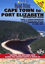
The Cape Town to Port Elizabeth Road Atlas covers the main coastal route of the Western Cape and Garden Route between Cape Town and East London. The atlas provides tourist friendly information, tourism contact details and resources. Included are 1:750 000 scaled maps of the region, a detailed index and street plans of Cape Town, Knysna, Port Elizabeth (including Summerstrand), East London, Mossel Bay, Stellenbosch, Franschhoek, Worcester, Struis Bay, Hermanus, Swellendam, Montagu, Cape Infanta, Hartenbos, Oudtshoorn, George, Wilderness, Sedgefield, St Francis Bay, Jeffrey's Bay, Kenton on Sea, Grahamstown, Port Alfred, Beacon Bay and Kei Mouth.
Reviews
Geen reviews gevonden voor dit product.
Schrijf een review
Graag horen wij wat u van dit artikel vindt. Vindt u het goed, leuk, mooi, slecht, lelijk, onbruikbaar of erg handig: schrijf gerust alles op! Het is niet alleen leuk om te doen maar u informeert andere klanten er ook nog mee!
Ook interessant voor afrika/zuid-afrika
-

Reisgids - Reishandboek Addo Self-dr
€ 39,95Reisgidsen Zuid-Afrika -

Stadsplattegrond Pocket map Pretoria
€ 11,50Stadsplattegronden Zuid-Afrika -

Wegenkaart - landkaart Zuid Afrika -
€ 13,95Wegenkaarten Zuid-Afrika -

Natuurgids Madikwe Game Reserve | HP
€ 22,50Natuurgidsen Zuid-Afrika -

Reisverhaal Ek sien jou! | Esther Bo
€ 12,50Reisverhalen Zuid-Afrika