Historische Kaarten - Europa
 Historische Kaart Militair Erfgoed - In Flanders fields Belgium | NGI - Nationaal Geografisch Instituut
Kaart voor militair erfgoed in West Vlaanderen, zowelvoor WO l als voor WO ll. The Western Front in Flanders on a detailed map at 1:100,000 highlighting locations of numerous monuments, …
★★★★★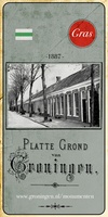 Historische Kaart Groningen uit 1887 | GRAS
In het laatste kwart van de 19de eeuw werd de stad Groningen eindelijk verlost van haar vestingwallen. Eindelijk, want lange tijd moest de vesting onaangeroerd blijven. Groningen was immers een …
★★★★★ Historische Kaart Stadskaart Groningen - Het kadastraal minuutplan 1832 | GRAS
In de zestiende eeuw verscheen de eerste echte plattegrond van de stad Groningen, toen nog Groeninghen geheten. Het was het begin van een lange cartografische traditie die geresulteerd heeft in …
 Historische Kaart Plattegrond van Groningen - De kaart van Siebe Jan Bouma 1925 | GRAS
Deze plattegrond van Groningen geeft in zijn (carto)grafie een uniek tijdsbeeld. Het is het moment waarop de stad aan het begin staat van grootschalige uitbreidingen en volop investeert in openbare …
 Historische Kaart Tabula Groeninghen - De kaart van Jacob van Deventer 1565 | GRAS
n de zestiende eeuw verscheen de eerste echte plattegrond van de stad Groningen, toen nog Groeninghen geheten. Het was het begin van een lange cartografische traditie die geresulteerd heeft in …
★★★★★ Civitate Orbis Terrarum Stadscaerte Groninga - 1575 | Platform Gras
In de zestiende eeuw verscheen de eerste echte plattegrond van de stad Groningen, toen nog Groeninghen geheten. Het was het begin van een lange cartografische traditie die geresulteerd heeft in …
★★★★★ Historische Kaart Hamburgum – De kaart van Georg Braun en Franz Hogenberg 1572 | GRAS
In de zestiende eeuw verscheen de eerste echte plattegrond van de stad Hamburg, toen nog Hamburgum geheten. Het was het begin van een lange cartografische traditie die geresulteerd heeft in …
★★★★★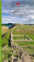 Historische Kaart An Archaeological Map of Hadrian's Wall | English Heritage
It was more than just a wall: it was a whole military zone designed to control movement across the northern frontier of the Roman province of Britannia. Great earthwork barriers …
 Historische Kaart Exploring the World Heritage Site – Stonehenge and Avebury | English Heritage
The Stonehenge and Avebury World Heritage Site is internationally important for its outstanding prehistoric monuments. Stonehenge is the most architecturally sophisticated prehistoric stone circle in the world, while Avebury is …
 Historische Kaart Major & Mrs Holt's Battle Map of The Somme | Pen and Sword publications
This is the only map available that shows the exact locations of 300 memorials and places of interest on the battlefields of the Somme This Sixth Edition also covers …
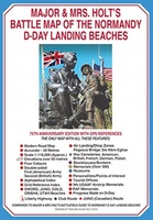 Historische Kaart Major & Mrs Holt's Battle Map of The Normandy D-Day Landing Beaches | Pen and Sword publications
This is the only detailed battle map of the D-Day Beaches area that shows the locations of 400 memorials The map is double sided showing the US beaches on …
 Historische Kaart Major & Mrs Holt's Battle Map of Market Garden | Pen and Sword publications
This is the only map of its kind devised and created by Major and Mrs Holt and is used by many guides It shows the locations of 300 memorials …
★★★★★ Historische Kaart Battle of the Somme 1916 | IGN - Institut Géographique National
Speciale themakaart over de slag bij de Somme in de 1e Wereldoorlog. Veel details over slagvelden, troepenbewegingen en andere locaties. Gedetailleerd genoeg om alle plekken in het veld terug te …
★★★★★ Historische Kaart Bataille de Verdun 1916 - Slag om Verdun | IGN - Institut Géographique National
Speciale themakaart over de slag bij Verdun in de 1e Wereldoorlog. Veel details over slagvelden, troepenbewegingen en andere locaties. Gedetailleerd genoeg om alle plekken in het veld terug te vinden. …
★★★★★ Historische Kaart Waterloo 1815 | NGI - Nationaal Geografisch Instituut
Unieke historische kaart van Waterloo en dirercte omgeving waarbij de Slag om Waterloo in 1915 geografisch wordt weergegeven. Men heeft hiervoor een topografische kaart 1:50.000 gebruikt met daarop ingetekend de …
 Historische Kaart Grande Guerre - Chemin des Dames 1917 | IGN - Institut Géographique National
Historische kaart van het gebied rond Chemin des Dames. De Chemin des Dames is een bijzondere weg gelegen in het noorden van Frankrijk, midden in de driehoek Soissons, Laon en …
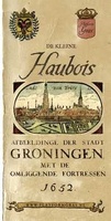 Historische Kaart Groningen - De Kleine Haubois 1652 | GRAS
Afbeeldinge der Stadt Groningen met de omliggende fortressen Wie kent niet de kaarten van Egbert Haubois (1643) en stadsarchitect Siebe Jan Bouma (1925)? Iedere kaart is een kunstwerk …
★★★★★★★★★★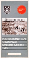 Historische Kaart Plattegrond van Groningen - Smulders Kompas 1965 | GRAS
In de zestiende eeuw verscheen de eerste echte plattegrond van de stad Groningen, destijds nog Groeninghen geheten. Het was het begin van een lange cartografische traditie die geresulteerd heeft in …
 Historische Kaart Verdun - Eerste Wereldoorlog | War travel
Themakaart over de geschiedenis van de Eerste Wereldoorlog in en rond Verdun. Met gedetailleerde inzetten van Verdun, Argonne en Saint-Michel. Aandacht voor monumenten, musea, vestingen, loopgraven en kerkhoven. Mooi kleurgebruik, …
 Historische Kaart Scotland Clans and Tartans Map | Collins
Prachtige kaart van Schotland waarin duideljk wordt welke cland er zijn geweest en nog zijn. Met een mooi overzicht van alle Tartans (Stoffen) die er aan gekoppeld zijn. Discover …
Laatste reviews

Op de hoogte gehouden van de vertraging. Zodra binnen, snel verstuurd. Hartelijk dank!
★★★★★ door Els van Blokland 24 april 2024 | Heeft dit artikel gekocht
Wij zijn erg blij met deze wandelkaart, alles staat zeer duidelijk aangegeven, voordeel is dat de kaart geplastificeerd is, deze kaart is het geld zeker …
★★★★★ door Rene van den Driesche 24 april 2024 | Heeft dit artikel gekocht
Uit het ruime aanbod kaarten een kaart met veel details gekozen, waarmee de voorbereiding van reis leuk wordt
★★★★★ door Ad 24 april 2024 | Heeft dit artikel gekocht
Handige informatieve kaart van de kust van Normandie van D Day.Wij gebruiken de kaart voor het voorbereiden van de Herdenking 80 jaar.
★★★★★ door Mary 24 april 2024 | Heeft dit artikel gekocht

