Fietskaarten - Engeland
De beste fietskaarten van de mooiste fietsroutes in Engeland kopen? Bestel online bij Reisboekwinkel de Zwerver!
Ontdek de mooiste fietsroutes voor uw fietsvakantie in Engeland met gedetailleerde fietskaarten
Ontdek tijdens uw fietsvakantie in Engeland prachtige fietsroutes met gedetailleerde fietskaarten, zoals die van Ordnance Survey, Sustrans en Cordee. Geniet van de adembenemende landschappen terwijl u fietst door bekende regio's, zoals het idyllische Lake District, het schilderachtige Cotswolds of de ruige landschappen van Dartmoor.
Tijdens uw fietsvakantie in de schitterende regio's van Engeland, is het aan te raden om zowel fietskaarten als fietsgidsen te gebruiken. Deze twee hulpmiddelen vullen elkaar uitstekend aan en bieden u een uitgebreide en betrouwbare navigatie. Laat u inspireren door de fietsgidsen van Cicerone of de fietsgidsen van Excellent Books, zodat u moeiteloos kunt genieten van de indrukwekkende regio's van Engeland tijdens uw fietsvakantie.
Overzichtskaarten
-
Overzicht Tour Maps Ordnance Survey
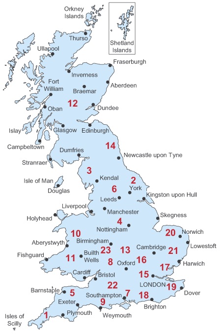
Producten op deze overzichtskaart:
Klik op een product om naar de pagina van dat product te gaan.
- Fietskaart 01 Tour Map Cornwall | Ordnance Survey
- Fietskaart 03 Tour Map Lake District & Cumbria | Ordnance Survey
- Fietskaart 04 Tour Map Peak district & Derbyshire | Ordnance Survey
- Fietskaart 05 Tour Map Devon & Somerset West | Ordnance Survey
- Fietskaart 08 Tour Map The Cotswolds & Gloucestershire | Ordnance Survey
- Fietskaart - Wegenkaart - landkaart 10 Tour Map North & Mid Wales - Gogledd a Chanolbarth Cymru | Ordnance Survey
- Fietskaart - Wegenkaart - landkaart 11 Tour Map South & Mid Wales - De a Chanolbarth Cymru | Ordnance Survey
- Wegenkaart - landkaart 12 Tour Map Scotland | Ordnance Survey
-
Overzichtskaart Fietskaarten 1:110.000 Engeland, Wales, Schotland en Noord-Ierland | Sustrans
.jpg)
Producten op deze overzichtskaart:
Klik op een product om naar de pagina van dat product te gaan.
 Fietskaart 01 Tour Map Cornwall | Ordnance Survey
Overzichtelijke, gedetailleerde kaart met veel toeristische informatie, waaronder campings en jeugdherbergen. Groot voordeel, naast de prima schaal, is dat de routes van het National Cycle Network duidelijk staan ingetekend. De …
★★★★★ Fietskaart 07 Cycling guides Kent | Goldeneye
Kent is a county of great variety and it is this factor that makes it such an interesting destination for cycling. The close proximity to London and its suburbs makes …
★★★★★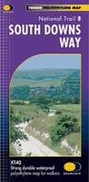 Wandelkaart - Fietskaart South Downs Way | Harvey Maps
Mooie, geplastificcerde kaart van de South Downs Way. De kaart is geschikt voor zowel wandelaars, fietsers als ruiters. Met veel extra informatie en uitsnedes van de route. Suitable …
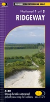 Wandelkaart - Fietskaart Ridgeway | Harvey Maps
Mooie, duidelijke kaart van de Ridgeway in Engeland. Geplastificeerd met veel extra informatie en uitsnedes van de route. Leap forward in technical excellence. Tough, light and 100% wateproof …
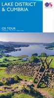 Fietskaart 03 Tour Map Lake District & Cumbria | Ordnance Survey
De Ordnance Survey Tour Maps met schaal 1:100.000 zijn uitstekend geschikt om zelf je fietsvakantie te plannen in Engeland. Ze laten alle alle grote en kleinere wegen zien. Bovendien staan …
★★★★★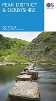 Fietskaart 04 Tour Map Peak district & Derbyshire | Ordnance Survey
De Ordnance Survey Tour Maps met schaal 1:100.000 zijn uitstekend geschikt om zelf je fietsvakantie te plannen in Engeland. Ze laten alle alle grote en kleinere wegen zien. Bovendien staan …
★★★★★ Fietskaart 05 Tour Map Devon & Somerset West | Ordnance Survey
De Ordnance Survey Tour Maps met schaal 1:130.000 zijn uitstekend geschikt om zelf je fietsvakantie te plannen in Engeland. Ze laten alle alle grote en kleinere wegen zien. Bovendien staan …
★★★★★ Fietskaart 08 Tour Map The Cotswolds & Gloucestershire | Ordnance Survey
De Ordnance Survey Tour Maps met schaal 1:100.000 zijn uitstekend geschikt om zelf je fietsvakantie te plannen in Engeland. Ze laten alle alle grote en kleinere wegen zien. Bovendien staan …
★★★★★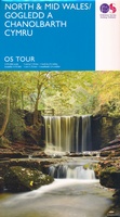 Fietskaart - Wegenkaart - landkaart 10 Tour Map North & Mid Wales - Gogledd a Chanolbarth Cymru | Ordnance Survey
De Ordnance Survey Tour Maps zijn uitstekend geschikt om zelf je vakantie te plannen in Engeland. Ook erg handig zijn de vermeldingen van campings, jeugdherbergen en andere accommodaties! De …
★★★★★★★★★★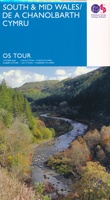 Fietskaart - Wegenkaart - landkaart 11 Tour Map South & Mid Wales - De a Chanolbarth Cymru | Ordnance Survey
De Ordnance Survey Tour Maps zijn uitstekend geschikt om zelf je vakantie te plannen in Engeland. Ook erg handig zijn de vermeldingen van campings, jeugdherbergen en andere accommodaties! De kaarten …
★★★★★ Fietskaart The Ultimate UK Cycle Route Planner | Excellent Books
Fully updated and revised 4th edition for 2022 with an increased sheet size. One of the best selling UK cycle publications giving an overview of all the main signed UK …
★★★★★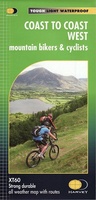 Fietskaart mountainbike Coast to Coast WEST | Harvey Maps
Deze kaart toont het westelijke deel van de route tussen St Bees/Ravenglass en Kirkby Stephen/Aysgarth via Ambleside/Windermere. Er zijn meerdere alternatieve routes ingetekend op een duidelijke topografische ondergrond. De …
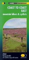 Fietskaart mountainbike Coast to Coast OOST | Harvey Maps
Deze kaart toont het oostelijke deel van de route tussen Kirkby Stephen/Aysgarth en Robin Hood's Bay/Ravenscar via Richmond/Osmotherley. Er zijn meerdere alternatieve routes ingetekend op een duidelijke topografische ondergrond. …
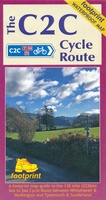 Fietskaart The C2C Cycle Route - Coast to Coast | Footprint maps
- Britains most popular loing distance route. - New clear mapping, based on OS data,ata a scale of 1:90 000 - Waterproof paper and compact size - Excellent value for …
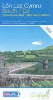 Fietskaart Cycle Route Map Lôn Las Cymru South | Sustrans
Het is niet een heel overzichtelijke kaart, het zijn juist blokken van een deel van de route waarop deze staat ingetekend. Daarin juist wel heel goed met handige stedenkaarten en …
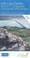 Fietskaart Cycle Route Map Lôn Las Cymru North | Sustrans
Het is niet een heel overzichtelijke kaart, het zijn juist blokken van een deel van de route waarop deze staat ingetekend. Daarin juist wel heel goed met handige stedenkaarten en …
 Fietskaart Cycle Map Pennine Cycleway South | Sustrans
The official route map for the 136-mile (219km) southern part of the Pennine Cycleway on National Cycle Network Route 68 from Derby to Settle. This linear map shows the …
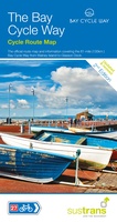 Fietskaart Cycle Map The Bay Cycle Way | Sustrans
Het is niet een heel overzichtelijke kaart, het zijn juist blokken van een deel van de route waarop deze staat ingetekend. Daarin juist wel heel goed met handige stedenkaarten en …
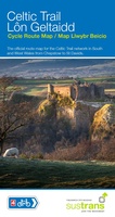 Fietskaart Cycle Map Celtic Trail - Lon Geltaidd | Sustrans
Het is niet een heel overzichtelijke kaart, het zijn juist blokken van een deel van de route waarop deze staat ingetekend. Daarin juist wel heel goed met handige stedenkaarten en …
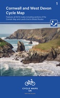 Fietskaart 01 Cycle Maps UK Cornwall and West Devon | Cordee
Een nieuwe fietskaarten serie van Groot-Brittannië. Gedrukt op scheur- en watervast papier en mooi handzaam klein formaat. Deze kaarten zijn met name heel goed om de Lange Afstands Fietsroutes (LF) …
De mooiste fietsroutes ontdekken in Engeland met gedetailleerde fietskaarten
Ontdek welke schaal fietskaarten het beste past bij uw fietsvakantie
Scheur- en watervaste wegenkaarten van fietsgebieden in Engeland
Met gedetailleerde fietskaarten van Engeland ontdekt u de mooiste fietsroutes!
Laatste reviews

Op de hoogte gehouden van de vertraging. Zodra binnen, snel verstuurd. Hartelijk dank!
★★★★★ door Els van Blokland 24 april 2024 | Heeft dit artikel gekocht
Wij zijn erg blij met deze wandelkaart, alles staat zeer duidelijk aangegeven, voordeel is dat de kaart geplastificeerd is, deze kaart is het geld zeker …
★★★★★ door Rene van den Driesche 24 april 2024 | Heeft dit artikel gekocht
Uit het ruime aanbod kaarten een kaart met veel details gekozen, waarmee de voorbereiding van reis leuk wordt
★★★★★ door Ad 24 april 2024 | Heeft dit artikel gekocht
Handige informatieve kaart van de kust van Normandie van D Day.Wij gebruiken de kaart voor het voorbereiden van de Herdenking 80 jaar.
★★★★★ door Mary 24 april 2024 | Heeft dit artikel gekocht