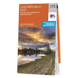
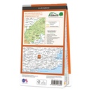
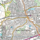
Wandelkaart - Topografische kaart 172 OS Explorer Map Chiltern Hills East | Ordnance Survey (9780319243657)
High Wycombe, Maidenhead & Rickmansworth
- ISBN / CODE: 9780319243657
- Editie: 2015
- Schaal: 1:25000
- Uitgever: Ordnance Survey
- Soort: Topografische kaart, Wandelkaart
- Serie: OS Explorer Map
- Taal: Engels
- Hoogte: 23.0 cm
- Breedte: 13.0 cm
- Dikte: 1.0 cm
- Gewicht: 150.0 g
- Uitvoering: Papier
- Bindwijze: -
- Beoordeling: 4,0 ★★★★★ (1 review) Schrijf een review
-
€ 19,50
Leverbaar in 3 - 5 werkdagen in huis in Nederland Levertijd Belgie
Gratis verzending in Nederland vanaf €35,-
-
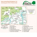
Overzichtskaart Explorer 25.000 topografische kaarten zuid Engeland

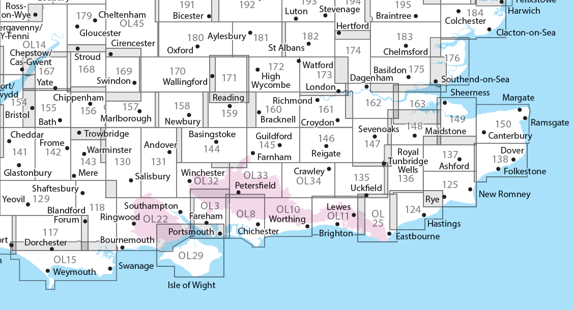
Producten op deze overzichtskaart:
Klik op een product om naar de pagina van dat product te gaan.
- Wandelkaart - Topografische kaart 117 OS Explorer Map Cerne Abbas & Bere Regis | Ordnance Survey
- Wandelkaart - Topografische kaart 118 OS Explorer Map Shaftesbury & Cranborne Chase | Ordnance Survey
- Wandelkaart - Topografische kaart 129 OS Explorer Map Yeovil & Sherborne | Ordnance Survey
- Wandelkaart - Topografische kaart 130 OS Explorer Map Salisbury & Stonehenge | Ordnance Survey
- Wandelkaart - Topografische kaart 131 OS Explorer Map Romsey, Andover & Test Valley | Ordnance Survey
- Wandelkaart - Topografische kaart 135 OS Explorer Map Ashdown Forest (greenw) | Ordnance Survey
- Wandelkaart - Topografische kaart 141 OS Explorer Map Cheddar Gorge, Mendip Hills West | Ordnance Survey
- Wandelkaart - Topografische kaart 142 OS Explorer Map Shepton Mallet , Mendip Hills East | Ordnance Survey
- Wandelkaart - Topografische kaart 143 OS Explorer Map Warminster, Trowbridge | Ordnance Survey
- Wandelkaart - Topografische kaart 144 OS Explorer Map Basingstoke, Alto, Whitchurch | Ordnance Survey
- Wandelkaart - Topografische kaart 145 OS Explorer Map Guildford, Farnham | Ordnance Survey
- Wandelkaart - Topografische kaart 146 OS Explorer Map Dorking, Box Hill, Reigate | Ordnance Survey
- Wandelkaart - Topografische kaart 147 OS Explorer Map Sevenoaks and Tonbridge | Ordnance Survey
- Wandelkaart - Topografische kaart 154 OS Explorer Map Bristol West, Portishead | Ordnance Survey
- Wandelkaart - Topografische kaart 155 OS Explorer Map Bristol, Bath | Ordnance Survey
- Wandelkaart - Topografische kaart 156 OS Explorer Map Chippenham, Bradford-on-Avon | Ordnance Survey
- Wandelkaart - Topografische kaart 157 OS Explorer Map Marlborough, Savernake Forest | Ordnance Survey
- Wandelkaart - Topografische kaart 158 OS Explorer Map Newbury, Hungerford | Ordnance Survey
- Wandelkaart - Topografische kaart 159 OS Explorer Map Reading, Wokingham & Pangbourne Map | Thames Path | Ordnance Survey
- Wandelkaart - Topografische kaart 160 OS Explorer Map Windsor, Weybridge, Bracknell | Thames Path | Ordnance Survey
- Wandelkaart - Topografische kaart 161 OS Explorer Map London South (greenw.m) | Ordnance Survey
- Wandelkaart - Topografische kaart 162 OS Explorer Map Greenwich, Gravesend | Ordnance Survey
- Wandelkaart - Topografische kaart 167 OS Explorer Map Thornbury, Dursley, Yate | Ordnance Survey
- Wandelkaart - Topografische kaart 168 OS Explorer Map Stroud, Tetbury, Malmesbury | Ordnance Survey
- Wandelkaart - Topografische kaart 169 OS Explorer Map Cirencester, Swindon | Ordnance Survey
- Wandelkaart - Topografische kaart 170 OS Explorer Map Abingdon, Wantage & Vale of White Horse | Ordnance Survey
- Wandelkaart - Topografische kaart 171 OS Explorer Map Chiltern Hills West | Ordnance Survey
- Wandelkaart - Topografische kaart 172 OS Explorer Map Chiltern Hills East | Ordnance Survey
- Wandelkaart - Topografische kaart 173 OS Explorer Map London North | Ordnance Survey
- Wandelkaart - Topografische kaart 174 OS Explorer Map Epping Forest, Lee Valley | Ordnance Survey
- Wandelkaart - Topografische kaart 179 OS Explorer Map Gloucester, Cheltenham, Stroud | Ordnance Survey
- Wandelkaart - Topografische kaart 180 OS Explorer Map Oxford | Ordnance Survey
- Wandelkaart - Topografische kaart 182 OS Explorer Map St-Albans, Hatfield | Ordnance Survey
- Wandelkaart - Topografische kaart OL03 OS Explorer Map Meon Valley - Portsmouth, Gosport & Fareham | Ordnance Survey
- Wandelkaart - Topografische kaart OL08 OS Explorer Map Chichester, South Harting & Selsey | Ordnance Survey
- Wandelkaart - Topografische kaart OL10 OS Explorer Map Arundel - Pulborough - Worthing | Ordnance Survey
- Wandelkaart - Topografische kaart OL11 OS Explorer Map Brighton & Hove, Lewes & Burgess Hill | Ordnance Survey
- Wandelkaart - Topografische kaart OL14 OS Explorer Map Wye Valley - Forest of Dean - Dyfryn Gwy | Ordnance Survey
- Wandelkaart - Topografische kaart OL15 OS Explorer Map Purbeck and South Dorset | Ordnance Survey
- Wandelkaart - Topografische kaart OL25 OS Explorer Map Eastbourne & Beachy Head | Ordnance Survey
- Wandelkaart - Topografische kaart OL29 OS Explorer Map Isle of Wight | Ordnance Survey
- Wandelkaart - Topografische kaart OL32 OS Explorer Map Winchester | Ordnance Survey
- Wandelkaart - Topografische kaart OL33 OS Explorer Map Haslemere & Petersfield | Ordnance Survey
- Wandelkaart - Topografische kaart OL34 OS Explorer Map Crawley & Horsham | Ordnance Survey
-
Overzichtskaart Explorer 25.000 topografische kaarten zuidoost Engeland - Kent - Londen

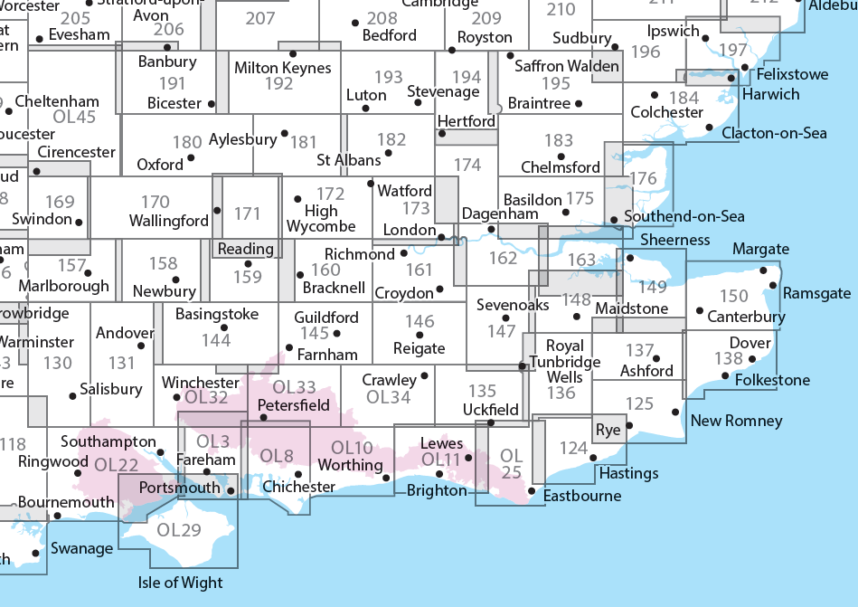
Producten op deze overzichtskaart:
Klik op een product om naar de pagina van dat product te gaan.
- Wandelkaart - Topografische kaart 124 OS Explorer Map Hastings & Bexhill | Ordnance Survey
- Wandelkaart - Topografische kaart 125 OS Explorer Map Romney Marsh & Rye & Winchelsea | Ordnance Survey
- Wandelkaart - Topografische kaart 131 OS Explorer Map Romsey, Andover & Test Valley | Ordnance Survey
- Wandelkaart - Topografische kaart 135 OS Explorer Map Ashdown Forest (greenw) | Ordnance Survey
- Wandelkaart - Topografische kaart 136 OS Explorer Map High Weald | Ordnance Survey
- Wandelkaart - Topografische kaart 137 OS Explorer Map Ashford | Ordnance Survey
- Wandelkaart - Topografische kaart 138 OS Explorer Map Dover, Folkstone, Hythe | Ordnance Survey
- Wandelkaart - Topografische kaart 144 OS Explorer Map Basingstoke, Alto, Whitchurch | Ordnance Survey
- Wandelkaart - Topografische kaart 145 OS Explorer Map Guildford, Farnham | Ordnance Survey
- Wandelkaart - Topografische kaart 146 OS Explorer Map Dorking, Box Hill, Reigate | Ordnance Survey
- Wandelkaart - Topografische kaart 147 OS Explorer Map Sevenoaks and Tonbridge | Ordnance Survey
- Wandelkaart - Topografische kaart 148 OS Explorer Map Maidstone, Medway Towns | Ordnance Survey
- Wandelkaart - Topografische kaart 149 OS Explorer Map Sittingbourne, Faversham | Ordnance Survey
- Wandelkaart - Topografische kaart 150 OS Explorer Map Canterbury, Isle of Thanet | Ordnance Survey
- Wandelkaart - Topografische kaart 158 OS Explorer Map Newbury, Hungerford | Ordnance Survey
- Wandelkaart - Topografische kaart 159 OS Explorer Map Reading, Wokingham & Pangbourne Map | Thames Path | Ordnance Survey
- Wandelkaart - Topografische kaart 160 OS Explorer Map Windsor, Weybridge, Bracknell | Thames Path | Ordnance Survey
- Wandelkaart - Topografische kaart 161 OS Explorer Map London South (greenw.m) | Ordnance Survey
- Wandelkaart - Topografische kaart 162 OS Explorer Map Greenwich, Gravesend | Ordnance Survey
- Wandelkaart - Topografische kaart 163 OS Explorer Map Gravesend, Rochester | Ordnance Survey
- Wandelkaart - Topografische kaart 170 OS Explorer Map Abingdon, Wantage & Vale of White Horse | Ordnance Survey
- Wandelkaart - Topografische kaart 171 OS Explorer Map Chiltern Hills West | Ordnance Survey
- Wandelkaart - Topografische kaart 172 OS Explorer Map Chiltern Hills East | Ordnance Survey
- Wandelkaart - Topografische kaart 173 OS Explorer Map London North | Ordnance Survey
- Wandelkaart - Topografische kaart 174 OS Explorer Map Epping Forest, Lee Valley | Ordnance Survey
- Wandelkaart - Topografische kaart 175 OS Explorer Map Southend-on-Sea, Basildon | Ordnance Survey
- Wandelkaart - Topografische kaart 176 OS Explorer Map Blackwater Estuary | Ordnance Survey
- Wandelkaart - Topografische kaart 180 OS Explorer Map Oxford | Ordnance Survey
- Wandelkaart - Topografische kaart 181 OS Explorer Map Chiltern Hills North | Ordnance Survey
- Wandelkaart - Topografische kaart 182 OS Explorer Map St-Albans, Hatfield | Ordnance Survey
- Wandelkaart - Topografische kaart 183 OS Explorer Map Chelmsford, the Rodings | Ordnance Survey
- Wandelkaart - Topografische kaart 184 OS Explorer Map Colchester, Harwich, Clacton-on-Sea | Ordnance Survey
- Wandelkaart - Topografische kaart 191 OS Explorer Map Banbury, Bicester, Chipping Norton | Ordnance Survey
- Wandelkaart - Topografische kaart 192 OS Explorer Map Buckingham, Milton Keynes | Ordnance Survey
- Wandelkaart - Topografische kaart 193 OS Explorer Map Luton, Stevenage | Ordnance Survey
- Wandelkaart - Topografische kaart 194 OS Explorer Map Hertford, Bishop's Stortford | Ordnance Survey
- Wandelkaart - Topografische kaart 195 OS Explorer Map Braintree, Saffron, Walden | Ordnance Survey
- Wandelkaart - Topografische kaart 196 OS Explorer Map Sudbury, Hadleigh, Dedham Vale | Ordnance Survey
- Wandelkaart - Topografische kaart 197 OS Explorer Map Ipswich, Felixstowe, Harwich | Ordnance Survey
- Wandelkaart - Topografische kaart OL03 OS Explorer Map Meon Valley - Portsmouth, Gosport & Fareham | Ordnance Survey
- Wandelkaart - Topografische kaart OL08 OS Explorer Map Chichester, South Harting & Selsey | Ordnance Survey
- Wandelkaart - Topografische kaart OL10 OS Explorer Map Arundel - Pulborough - Worthing | Ordnance Survey
- Wandelkaart - Topografische kaart OL11 OS Explorer Map Brighton & Hove, Lewes & Burgess Hill | Ordnance Survey
- Wandelkaart - Topografische kaart OL22 OS Explorer Map New Forest | Ordnance Survey
- Wandelkaart - Topografische kaart OL25 OS Explorer Map Eastbourne & Beachy Head | Ordnance Survey
- Wandelkaart - Topografische kaart OL29 OS Explorer Map Isle of Wight | Ordnance Survey
- Wandelkaart - Topografische kaart OL32 OS Explorer Map Winchester | Ordnance Survey
- Wandelkaart - Topografische kaart OL33 OS Explorer Map Haslemere & Petersfield | Ordnance Survey
- Wandelkaart - Topografische kaart OL34 OS Explorer Map Crawley & Horsham | Ordnance Survey
-
Overzichtskaart Explorer 25.000 wandelkaarten zuid Engeland

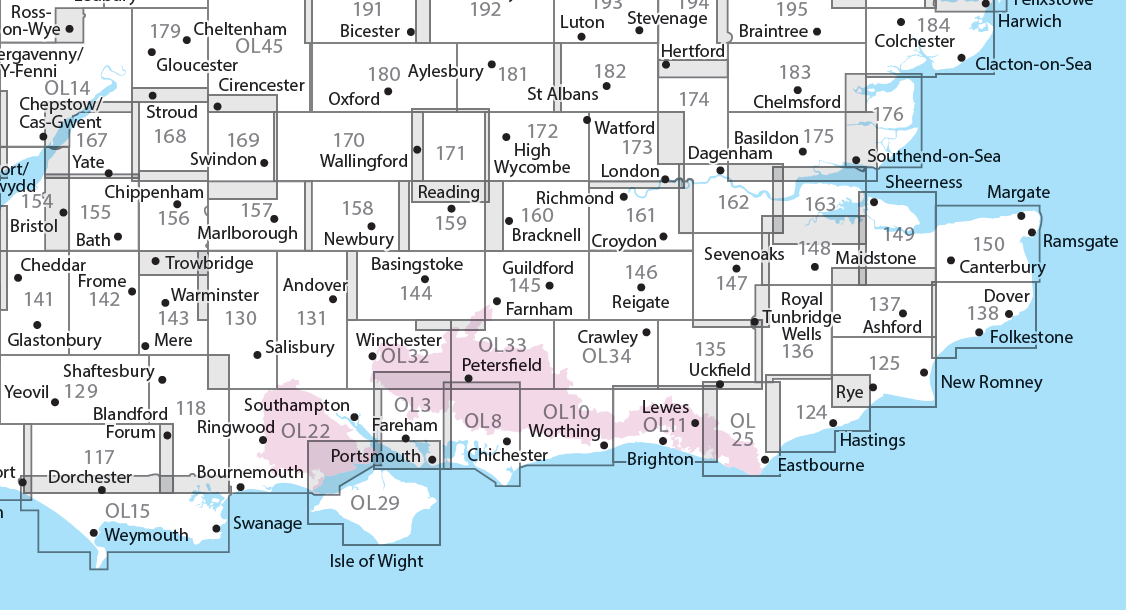
Producten op deze overzichtskaart:
Klik op een product om naar de pagina van dat product te gaan.
- Wandelkaart - Topografische kaart 117 OS Explorer Map Cerne Abbas & Bere Regis | Ordnance Survey
- Wandelkaart - Topografische kaart 118 OS Explorer Map Shaftesbury & Cranborne Chase | Ordnance Survey
- Wandelkaart - Topografische kaart 129 OS Explorer Map Yeovil & Sherborne | Ordnance Survey
- Wandelkaart - Topografische kaart 130 OS Explorer Map Salisbury & Stonehenge | Ordnance Survey
- Wandelkaart - Topografische kaart 131 OS Explorer Map Romsey, Andover & Test Valley | Ordnance Survey
- Wandelkaart - Topografische kaart 135 OS Explorer Map Ashdown Forest (greenw) | Ordnance Survey
- Wandelkaart - Topografische kaart 141 OS Explorer Map Cheddar Gorge, Mendip Hills West | Ordnance Survey
- Wandelkaart - Topografische kaart 142 OS Explorer Map Shepton Mallet , Mendip Hills East | Ordnance Survey
- Wandelkaart - Topografische kaart 143 OS Explorer Map Warminster, Trowbridge | Ordnance Survey
- Wandelkaart - Topografische kaart 144 OS Explorer Map Basingstoke, Alto, Whitchurch | Ordnance Survey
- Wandelkaart - Topografische kaart 145 OS Explorer Map Guildford, Farnham | Ordnance Survey
- Wandelkaart - Topografische kaart 146 OS Explorer Map Dorking, Box Hill, Reigate | Ordnance Survey
- Wandelkaart - Topografische kaart 147 OS Explorer Map Sevenoaks and Tonbridge | Ordnance Survey
- Wandelkaart - Topografische kaart 154 OS Explorer Map Bristol West, Portishead | Ordnance Survey
- Wandelkaart - Topografische kaart 155 OS Explorer Map Bristol, Bath | Ordnance Survey
- Wandelkaart - Topografische kaart 156 OS Explorer Map Chippenham, Bradford-on-Avon | Ordnance Survey
- Wandelkaart - Topografische kaart 157 OS Explorer Map Marlborough, Savernake Forest | Ordnance Survey
- Wandelkaart - Topografische kaart 158 OS Explorer Map Newbury, Hungerford | Ordnance Survey
- Wandelkaart - Topografische kaart 159 OS Explorer Map Reading, Wokingham & Pangbourne Map | Thames Path | Ordnance Survey
- Wandelkaart - Topografische kaart 160 OS Explorer Map Windsor, Weybridge, Bracknell | Thames Path | Ordnance Survey
- Wandelkaart - Topografische kaart 161 OS Explorer Map London South (greenw.m) | Ordnance Survey
- Wandelkaart - Topografische kaart 162 OS Explorer Map Greenwich, Gravesend | Ordnance Survey
- Wandelkaart - Topografische kaart 167 OS Explorer Map Thornbury, Dursley, Yate | Ordnance Survey
- Wandelkaart - Topografische kaart 168 OS Explorer Map Stroud, Tetbury, Malmesbury | Ordnance Survey
- Wandelkaart - Topografische kaart 169 OS Explorer Map Cirencester, Swindon | Ordnance Survey
- Wandelkaart - Topografische kaart 170 OS Explorer Map Abingdon, Wantage & Vale of White Horse | Ordnance Survey
- Wandelkaart - Topografische kaart 171 OS Explorer Map Chiltern Hills West | Ordnance Survey
- Wandelkaart - Topografische kaart 172 OS Explorer Map Chiltern Hills East | Ordnance Survey
- Wandelkaart - Topografische kaart 173 OS Explorer Map London North | Ordnance Survey
- Wandelkaart - Topografische kaart 174 OS Explorer Map Epping Forest, Lee Valley | Ordnance Survey
- Wandelkaart - Topografische kaart 179 OS Explorer Map Gloucester, Cheltenham, Stroud | Ordnance Survey
- Wandelkaart - Topografische kaart 180 OS Explorer Map Oxford | Ordnance Survey
- Wandelkaart - Topografische kaart 182 OS Explorer Map St-Albans, Hatfield | Ordnance Survey
- Wandelkaart - Topografische kaart OL03 OS Explorer Map Meon Valley - Portsmouth, Gosport & Fareham | Ordnance Survey
- Wandelkaart - Topografische kaart OL08 OS Explorer Map Chichester, South Harting & Selsey | Ordnance Survey
- Wandelkaart - Topografische kaart OL10 OS Explorer Map Arundel - Pulborough - Worthing | Ordnance Survey
- Wandelkaart - Topografische kaart OL11 OS Explorer Map Brighton & Hove, Lewes & Burgess Hill | Ordnance Survey
- Wandelkaart - Topografische kaart OL14 OS Explorer Map Wye Valley - Forest of Dean - Dyfryn Gwy | Ordnance Survey
- Wandelkaart - Topografische kaart OL15 OS Explorer Map Purbeck and South Dorset | Ordnance Survey
- Wandelkaart - Topografische kaart OL25 OS Explorer Map Eastbourne & Beachy Head | Ordnance Survey
- Wandelkaart - Topografische kaart OL29 OS Explorer Map Isle of Wight | Ordnance Survey
- Wandelkaart - Topografische kaart OL32 OS Explorer Map Winchester | Ordnance Survey
- Wandelkaart - Topografische kaart OL33 OS Explorer Map Haslemere & Petersfield | Ordnance Survey
- Wandelkaart - Topografische kaart OL34 OS Explorer Map Crawley & Horsham | Ordnance Survey
-
Overzichtskaart Explorer 25.000 wandelkaarten zuidoost Engeland - Kent - Londen

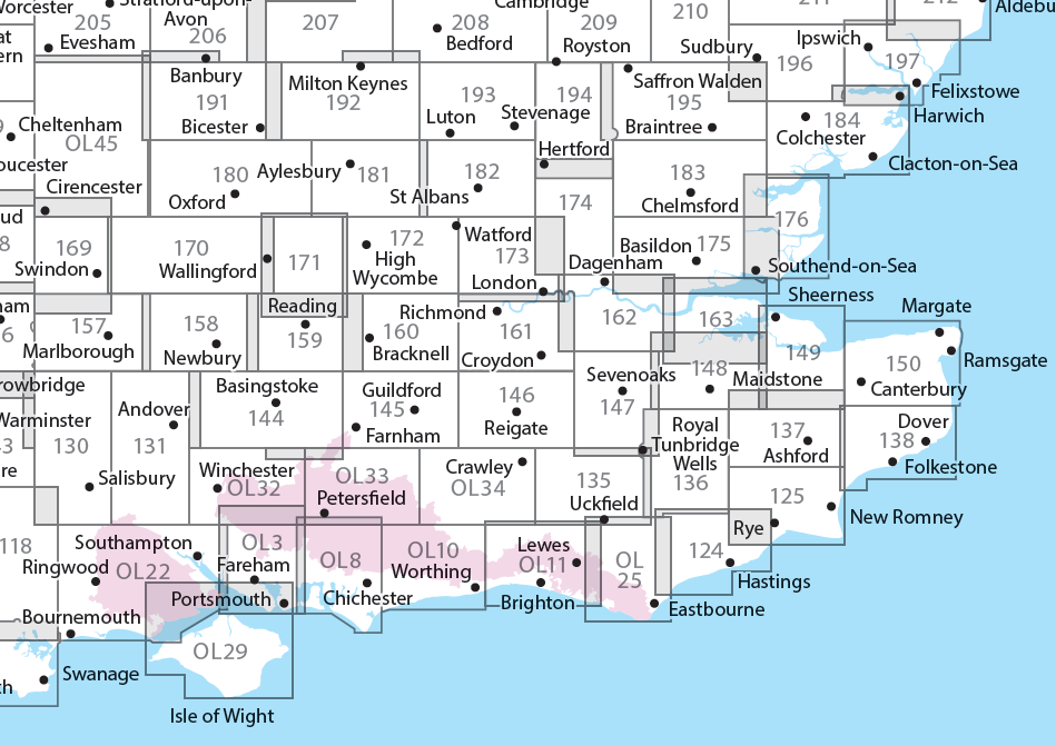
Producten op deze overzichtskaart:
Klik op een product om naar de pagina van dat product te gaan.
- Wandelkaart - Topografische kaart 124 OS Explorer Map Hastings & Bexhill | Ordnance Survey
- Wandelkaart - Topografische kaart 125 OS Explorer Map Romney Marsh & Rye & Winchelsea | Ordnance Survey
- Wandelkaart - Topografische kaart 131 OS Explorer Map Romsey, Andover & Test Valley | Ordnance Survey
- Wandelkaart - Topografische kaart 135 OS Explorer Map Ashdown Forest (greenw) | Ordnance Survey
- Wandelkaart - Topografische kaart 136 OS Explorer Map High Weald | Ordnance Survey
- Wandelkaart - Topografische kaart 137 OS Explorer Map Ashford | Ordnance Survey
- Wandelkaart - Topografische kaart 138 OS Explorer Map Dover, Folkstone, Hythe | Ordnance Survey
- Wandelkaart - Topografische kaart 144 OS Explorer Map Basingstoke, Alto, Whitchurch | Ordnance Survey
- Wandelkaart - Topografische kaart 145 OS Explorer Map Guildford, Farnham | Ordnance Survey
- Wandelkaart - Topografische kaart 146 OS Explorer Map Dorking, Box Hill, Reigate | Ordnance Survey
- Wandelkaart - Topografische kaart 147 OS Explorer Map Sevenoaks and Tonbridge | Ordnance Survey
- Wandelkaart - Topografische kaart 148 OS Explorer Map Maidstone, Medway Towns | Ordnance Survey
- Wandelkaart - Topografische kaart 149 OS Explorer Map Sittingbourne, Faversham | Ordnance Survey
- Wandelkaart - Topografische kaart 150 OS Explorer Map Canterbury, Isle of Thanet | Ordnance Survey
- Wandelkaart - Topografische kaart 158 OS Explorer Map Newbury, Hungerford | Ordnance Survey
- Wandelkaart - Topografische kaart 159 OS Explorer Map Reading, Wokingham & Pangbourne Map | Thames Path | Ordnance Survey
- Wandelkaart - Topografische kaart 160 OS Explorer Map Windsor, Weybridge, Bracknell | Thames Path | Ordnance Survey
- Wandelkaart - Topografische kaart 161 OS Explorer Map London South (greenw.m) | Ordnance Survey
- Wandelkaart - Topografische kaart 162 OS Explorer Map Greenwich, Gravesend | Ordnance Survey
- Wandelkaart - Topografische kaart 163 OS Explorer Map Gravesend, Rochester | Ordnance Survey
- Wandelkaart - Topografische kaart 170 OS Explorer Map Abingdon, Wantage & Vale of White Horse | Ordnance Survey
- Wandelkaart - Topografische kaart 171 OS Explorer Map Chiltern Hills West | Ordnance Survey
- Wandelkaart - Topografische kaart 172 OS Explorer Map Chiltern Hills East | Ordnance Survey
- Wandelkaart - Topografische kaart 173 OS Explorer Map London North | Ordnance Survey
- Wandelkaart - Topografische kaart 174 OS Explorer Map Epping Forest, Lee Valley | Ordnance Survey
- Wandelkaart - Topografische kaart 175 OS Explorer Map Southend-on-Sea, Basildon | Ordnance Survey
- Wandelkaart - Topografische kaart 176 OS Explorer Map Blackwater Estuary | Ordnance Survey
- Wandelkaart - Topografische kaart 180 OS Explorer Map Oxford | Ordnance Survey
- Wandelkaart - Topografische kaart 181 OS Explorer Map Chiltern Hills North | Ordnance Survey
- Wandelkaart - Topografische kaart 182 OS Explorer Map St-Albans, Hatfield | Ordnance Survey
- Wandelkaart - Topografische kaart 183 OS Explorer Map Chelmsford, the Rodings | Ordnance Survey
- Wandelkaart - Topografische kaart 184 OS Explorer Map Colchester, Harwich, Clacton-on-Sea | Ordnance Survey
- Wandelkaart - Topografische kaart 191 OS Explorer Map Banbury, Bicester, Chipping Norton | Ordnance Survey
- Wandelkaart - Topografische kaart 192 OS Explorer Map Buckingham, Milton Keynes | Ordnance Survey
- Wandelkaart - Topografische kaart 193 OS Explorer Map Luton, Stevenage | Ordnance Survey
- Wandelkaart - Topografische kaart 194 OS Explorer Map Hertford, Bishop's Stortford | Ordnance Survey
- Wandelkaart - Topografische kaart 195 OS Explorer Map Braintree, Saffron, Walden | Ordnance Survey
- Wandelkaart - Topografische kaart 196 OS Explorer Map Sudbury, Hadleigh, Dedham Vale | Ordnance Survey
- Wandelkaart - Topografische kaart 197 OS Explorer Map Ipswich, Felixstowe, Harwich | Ordnance Survey
- Wandelkaart - Topografische kaart OL03 OS Explorer Map Meon Valley - Portsmouth, Gosport & Fareham | Ordnance Survey
- Wandelkaart - Topografische kaart OL08 OS Explorer Map Chichester, South Harting & Selsey | Ordnance Survey
- Wandelkaart - Topografische kaart OL10 OS Explorer Map Arundel - Pulborough - Worthing | Ordnance Survey
- Wandelkaart - Topografische kaart OL11 OS Explorer Map Brighton & Hove, Lewes & Burgess Hill | Ordnance Survey
- Wandelkaart - Topografische kaart OL22 OS Explorer Map New Forest | Ordnance Survey
- Wandelkaart - Topografische kaart OL25 OS Explorer Map Eastbourne & Beachy Head | Ordnance Survey
- Wandelkaart - Topografische kaart OL29 OS Explorer Map Isle of Wight | Ordnance Survey
- Wandelkaart - Topografische kaart OL32 OS Explorer Map Winchester | Ordnance Survey
- Wandelkaart - Topografische kaart OL33 OS Explorer Map Haslemere & Petersfield | Ordnance Survey
- Wandelkaart - Topografische kaart OL34 OS Explorer Map Crawley & Horsham | Ordnance Survey
Overzichtskaarten
Beschrijving
- Bathe in natural beauty, from carpets of bluebells in the beech woods to red kites on the chalk grasslands and wildflower meadows where rare butterflies like the Adonis Blue flutter
- Discover stately homes and historic houses including the gorgeous Italianate mansion of Clevedon, the charming Tudor manor Chenies and Milton’s Cottage where Paradise Lost was finished
- Walk, cycle or hike a wide range of recreational paths including the Chiltern Way, South Bucks Way, Shakespeare’s Way and the Thames Path
Dit product heeft meerdere varianten:
Reviews
Kaart is uitstekend geschikt voor wandelen. Erg handig dat de schaal Europees is, dus geen gedoe met omrekenen van miles.
★★★★★ door Rene Toxopeus 2 december 2014Vond u dit een nuttige review? (login om te beoordelen)
Schrijf een review
Graag horen wij wat u van dit artikel vindt. Vindt u het goed, leuk, mooi, slecht, lelijk, onbruikbaar of erg handig: schrijf gerust alles op! Het is niet alleen leuk om te doen maar u informeert andere klanten er ook nog mee!

