Categorieën
- Boeken
-
Kaarten
- Camperkaarten
- Educatieve kaarten
- Fietskaarten
- Fietsknooppuntenkaarten
- Historische Kaarten
- Pelgrimsroutes (kaarten)
- Spoorwegenkaarten
- Stadsplattegronden
- Toerskikaarten
- Topografische kaarten
- Wandelatlassen
- Wandelkaarten
- Wandelknooppuntenkaarten
- Waterkaarten
- Wegenatlassen
-
Wegenkaarten
- Afrika
- Azië
-
Europa
- Albanië
- Andorra
- Armenië
- Azerbeidzjan
- Belarus - Witrusland
- België
- Bosnië - Hercegovina
- Bulgarije
- Cyprus
- Denemarken
- Duitsland
-
Engeland
- North East England
- ♦ Northumberland National Park
- Yorkshire and the Humber
- ♦ Yorkshire Dales Nationaal Park
- ♦ North York Moors Nationaal Park
- North West England
- ♦ Lake District Nationaal Park
- ♦ North Pennines AONB
- 🥾 Hadrian's Wall Path
- East Midlands
- West Midlands
- ♦ Peak District Nationaal Park
- Wales
- ♦ Pembrokeshire Coast National Park
- ♦ Snowdonia Nationaal Park
- ♦ Brecon Beacons Nationaal Park
- East of England - East Anglia
- South West England
- Dorset
- ♦ Cotswolds AONB
- ♦ Devon - Cornwall
- 🥾 South West Coast Path
- ♦ New Forrest National Park
- ♦ Dartmoor National Park
- ■ Bristol
- South East England
- ♦ Kent
- ♦ South Downs Nationaal Park
- ♦ Isle of Wight
- ■ Londen
- ■ Oxford
- Kanaaleilanden
- ♦ Guernsey
- ♦ Jersey
- Estland
- Faroer
- Finland
- Frankrijk
- Georgië
- Griekenland
- Groenland
- Hongarije
- IJsland
- Ierland
- Italië
- Kosovo
- Kroatië
- Letland
- Liechtenstein
- Litouwen
- Luxemburg
- Malta
- Moldavië
- Monaco
- Montenegro
- Nederland
- Noord-Ierland
- Noord-Macedonië
- Noorwegen
- Oekraïne
- Oostenrijk
- Polen
- Portugal
- Roemenië
- Rusland
- Scandinavië
- Schotland
- Servië
- Slovenië
- Slowakije
- Spanje
- Tsjechië
- Turkije
- Vaticaanstad
- Zweden
- Zwitserland
- Midden-Amerika
- Midden-Oosten
- Noord-Amerika
- Oceanië
- Wereld
- Zuid-Amerika
- Wintersportkaarten
- Opruiming
- Puzzels
- Travel Gadgets
- Wandkaarten
- Wereldbollen
Veilig online betalen
Betaal veilig via uw eigen bankomgeving
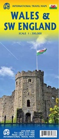
Wegenkaart - landkaart Wales & southwest England | ITMB (9781771298988)
- ISBN / CODE: 9781771298988
- Editie: 29-05-2017
- Druk: 1
- Aantal blz.: 1
- Schaal: 1:300000
- Uitgever: ITMB
- Soort: Wegenkaart
- Taal: Engels
- Hoogte: 25.0 cm
- Breedte: 10.0 cm
- Gewicht: 52.0 g
- Uitvoering: Papier
- Bindwijze: -
- Schrijf als eerste een review
-
€ 13,95
Leverbaar in 3 - 5 werkdagen in huis in Belgie Levertijd Nederland Leverbaar in 3 - 5 werkdagen in huis in Nederland Levertijd Belgie
Gratis verzending in Nederland vanaf €35,-
- Afbeeldingen
- Inkijkexemplaar
Beschrijving
Een degelijke kaart met aanduidingen van o.a. nationale parken, vliegveld, benzinepompen.
Finally, we have been able to create our own map of the lovely country of Wales. I use the word ‘country’ in its truest sense, as Wales was invaded and taken over by the English centuries ago. Regardless, the Welsh language and Welsh culture continue to flourish, although English is commonly spoken. We have visited Wales on several occasions and find that the attractions are so numerous that we could never see them all. There are too many castles to count, but some of the best preserved in the British Isles are in Wales, notable Caernarfon, but nearby Harlech is a World Heritage Site. St, David’s must be one of the smallest and loveliest cathedrals in the world, and Tintern Abbey ruins among the most poignant anywhere. We took Johnny to Abergavenny for lunch in March, not that it made any difference; he just pined for a McDonalds. This map is double-sided, with Wales on one side and the West Country (southwest England) graces the other side. Excellent coverage of Cornwall, Devon, and Somerset is provided, along with a fair portion of Dorset and Wiltshire. The eastern extreme of the map is Salisbury/Swindon, so a lot of ground is still being covered. The peculiar way that motorways are designated means that ‘true’ motorways are shown in blue while equally good non-motorways are in green casing, with not a tinker’s difference between them. My own favorite place is Mousehole, on Mount’s Bay; Tintagel ranks a close second. The map is loaded with touristic attractions; both well-known and more local. For something really unusual, visit Hay-on-Wye, west of Hereford. It is actually in England, smack on the border, and its claim to fame is that it is the world’s largest concentration of bookstores – an amazing place! This was obviously a fun map to make, as it includes so many ‘favorite’ places. This map will be invaluable for anyone visiting Wales!
Reviews
Geen reviews gevonden voor dit product.
Schrijf een review
Graag horen wij wat u van dit artikel vindt. Vindt u het goed, leuk, mooi, slecht, lelijk, onbruikbaar of erg handig: schrijf gerust alles op! Het is niet alleen leuk om te doen maar u informeert andere klanten er ook nog mee!
Ook interessant voor europa/engeland/wales
-

Wandelkaart - Topografische kaart 14
€ 19,50Topografische kaarten ♦ Devon - Cornwall -

Wegenkaart - landkaart Cornwall | Go
€ 16,50Wegenkaarten ♦ Devon - Cornwall -

Wegenatlas Local Explorer Street Atl
€ 23,95Wegenatlassen ♦ Devon - Cornwall -

Reisgids Cornwall | Time Out
€ 19,95Reisgidsen ♦ Devon - Cornwall -

Wandelgids Walking in the Isles of S
€ 12,95Wandelgidsen ♦ Devon - Cornwall


