Winkelwagen
Geen items in winkelwagen
Ga naar winkelwagen
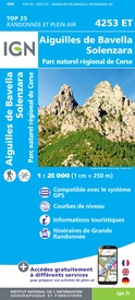
Wandelkaart - Topografische kaart 4253ET Aiguilles-de-Bavella - Solenzara | IGN - Institut Géographique National (9782758546849)
PNR de la Corse
- ISBN / CODE: 9782758546849
- Editie: 20-05-2019
- Druk: 5
- Aantal blz.: 1
- Schaal: 1:25000
- Uitgever: IGN - Institut Géographique National
- Soort: Topografische kaart, Wandelkaart
- Serie: Top 25
- Taal: Engels, Frans
- Hoogte: 24.0 cm
- Breedte: 11.0 cm
- Gewicht: 93.0 g
- Uitvoering: Papier
- Bindwijze: -
- Schrijf als eerste een review
-
€ 16,95
Op voorraad. Voor 17.00 uur op werkdagen besteld, morgen in huis in Nederland Levertijd Belgie
Gratis verzending in Nederland vanaf €35,-
-
Topografische kaarten IGN 25.000 Corsica

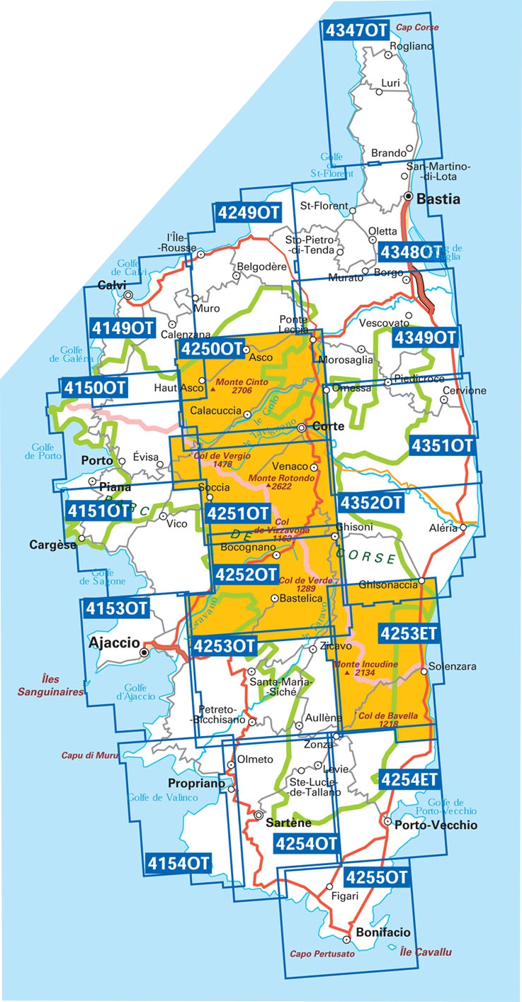
Producten op deze overzichtskaart:
Klik op een product om naar de pagina van dat product te gaan.
- Wandelkaart - Topografische kaart 4149OT Calvi - Cirque de Bonifatu | IGN - Institut Géographique National
- Wandelkaart - Topografische kaart 4150OT Porto - Calanche du Piana | IGN - Institut Géographique National
- Wandelkaart - Topografische kaart 4151OT Vico - Cargèse | IGN - Institut Géographique National
- Wandelkaart - Topografische kaart 4153OT Ajaccio | IGN - Institut Géographique National
- Wandelkaart 4154OT Propriano | IGN - Institut Géographique National
- Wandelkaart - Topografische kaart 4249OT L'Île Rousse | IGN - Institut Géographique National
- Wandelkaart - Topografische kaart 4250OT Corte - Monte Cinto | IGN - Institut Géographique National
- Wandelkaart - Topografische kaart 4251OT Monte d'Oro - Monte Rotondo | IGN - Institut Géographique National
- Wandelkaart - Topografische kaart 4252OT Monte Renoso | IGN - Institut Géographique National
- Wandelkaart - Topografische kaart 4253ET Aiguilles-de-Bavella - Solenzara | IGN - Institut Géographique National
- Wandelkaart - Topografische kaart 4253OT Petreto-Bicchisano - Zicavo | IGN - Institut Géographique National
- Wandelkaart - Topografische kaart 4254ET Porto-Vecchio | IGN - Institut Géographique National
- Wandelkaart - Topografische kaart 4254OT Sartène | IGN - Institut Géographique National
- Wandelkaart - Topografische kaart 4255OT Bonifacio | IGN - Institut Géographique National
- Wandelkaart - Topografische kaart 4347OT Cap Corse | IGN - Institut Géographique National
- Wandelkaart - Topografische kaart 4348OT Bastia | IGN - Institut Géographique National
- Wandelkaart - Topografische kaart 4349OT Vescovato | IGN - Institut Géographique National
- Wandelkaart - Topografische kaart 4351OT Cervione | IGN - Institut Géographique National
- Wandelkaart - Topografische kaart 4352OT Aléria - Ghisonaccia | IGN - Institut Géographique National
-
Wandelkaarten IGN 25.000 Corsica

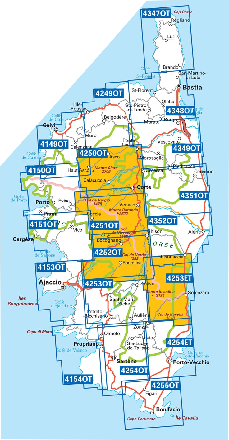
Producten op deze overzichtskaart:
Klik op een product om naar de pagina van dat product te gaan.
- Wandelkaart - Topografische kaart 4149OT Calvi - Cirque de Bonifatu | IGN - Institut Géographique National
- Wandelkaart - Topografische kaart 4150OT Porto - Calanche du Piana | IGN - Institut Géographique National
- Wandelkaart - Topografische kaart 4151OT Vico - Cargèse | IGN - Institut Géographique National
- Wandelkaart - Topografische kaart 4153OT Ajaccio | IGN - Institut Géographique National
- Wandelkaart 4154OT Propriano | IGN - Institut Géographique National
- Wandelkaart - Topografische kaart 4249OT L'Île Rousse | IGN - Institut Géographique National
- Wandelkaart - Topografische kaart 4250OT Corte - Monte Cinto | IGN - Institut Géographique National
- Wandelkaart - Topografische kaart 4251OT Monte d'Oro - Monte Rotondo | IGN - Institut Géographique National
- Wandelkaart - Topografische kaart 4252OT Monte Renoso | IGN - Institut Géographique National
- Wandelkaart - Topografische kaart 4253ET Aiguilles-de-Bavella - Solenzara | IGN - Institut Géographique National
- Wandelkaart - Topografische kaart 4253OT Petreto-Bicchisano - Zicavo | IGN - Institut Géographique National
- Wandelkaart - Topografische kaart 4254ET Porto-Vecchio | IGN - Institut Géographique National
- Wandelkaart - Topografische kaart 4254OT Sartène | IGN - Institut Géographique National
- Wandelkaart - Topografische kaart 4255OT Bonifacio | IGN - Institut Géographique National
- Wandelkaart - Topografische kaart 4347OT Cap Corse | IGN - Institut Géographique National
- Wandelkaart - Topografische kaart 4348OT Bastia | IGN - Institut Géographique National
- Wandelkaart - Topografische kaart 4349OT Vescovato | IGN - Institut Géographique National
- Wandelkaart - Topografische kaart 4351OT Cervione | IGN - Institut Géographique National
- Wandelkaart - Topografische kaart 4352OT Aléria - Ghisonaccia | IGN - Institut Géographique National
Overzichtskaarten
Beschrijving
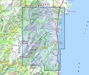
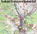
De wandelkaart die de perfectie benadert! Werkelijk alle topografische details zijn er op te vinden; van hoogtelijnen tot aan bruggetjes en allerlei wandelpaden. Daarnaast hebben de makers een flinke dosis toeristische informatie op de kaart verwerkt: campings, gites d étape, restaurants en ingetekende doorgaande wandelpaden, de grandes randonnées. Het kleurgebruik is geweldig met schaduwzijdes, bos, weiland, etc goed te onderscheiden. De kaart is uitgevoerd met raster van graden, dus deze is GPS - toepasbaar!
De TOP 25 kaarten (kaart nummers die eindigen op "T") hebben betrekking op gebieden van bijzonder toeristisch belang zoals de Alpen, de Pyreneeën,De Cevennes, de Vogezen, de Provence, en de Atlantische en Middellandse zeekusten. De kaarten hebben een opdruk en benadrukken zo de lokale wandelpaden, lange afstand GR routes en, in voorkomend geval, ski routes. Andere toeristische informatie omvat campings, paardensport of kanocentra, hutten, berghutten, etc. Elke "TOP 25" kaart bedekt een gebied van ongeveer 28 x 21 km.
De rest van Frankrijk wordt in kaart gebracht met de "Série Bleu" (eindigend op O = ouest of E = est) welke geen speciale extra overdruk heeft om de wandelroutes aan te duiden. Op deze kaarten vind je dan ook geen toeristische informatie als campings en hutten; het zijn puur topografische kaarten, maar zoals gezegd bijzonder gedetailleerd. Elke "Série Bleu" kaart bedekt een gebied van ongeveer 20 x 14 km.
Ingetekende GR-wandelroute
GR-20 GR20
L'indispensable carte de randonnée IGN 4253ET. D'une très grande précision elle contient tous les détails existants sur le terrain : voies de communication jusqu'au moindre sentier, constructions jusqu'au hangar, bois, arbre isolé, rivière, source... Sans oublier la représentation du relief par des courbes de niveau. Les sentiers balisés et les informations touristiques sont également représentées.
Communes couvertes : Aullène, Olivese, Guitera-les-Bains, Corrano, Sari-Solenzara, Zicavo, Sampolo, Solaro, Cozzano, Serra-di-Scopamène, Zérubia, Conca, Quenza, Sorbollano, Tasso, Chisa
Lieux à découvrir : Corse, Forêt de Vittoli, Forêt Territoriale de Sambucu, Forêt Territoriale de Pineta, Forêt Territoriale du Coscione, Forêt Territoriale de Bavella, Forêt Territoriale de Tova, Forêt Territoriale de l'Ospedale, Forêt Territoriale de St-Antoine,Monte Malo, Punta di Tintennaja, Massif de Zonza est, Plateau du Coscione, Punta di Quercitella, Monte Incudine, Col de Bavella, Col de la Vaccia, Aiguilles de Bavella,Château de Crans, Abbaye de Bonmont, Château, Cabane du Carroz, Sapins de Borsattaz, Saut du Day, Grotte de Réclère, Cabane les Pralets, Cabane Rochefort, Signal de Roche d'Or, Cabane Trois Chalets, Chalet de la Dent de Vaution, Résurgence de l'Orbe
Dit product heeft meerdere varianten:

