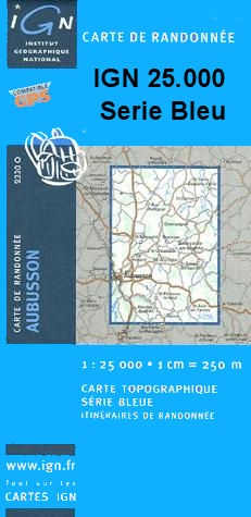
Wandelkaart - Topografische kaart 2303O Watten | IGN - Institut Géographique National (9782758521914)
- ISBN / CODE: 9782758521914
- Editie: meest recente editie
- Schaal: 1:25000
- Uitgever: IGN - Institut Géographique National
- Soort: Topografische kaart, Wandelkaart
- Serie: Serie bleue
- Taal: Frans
- Schrijf als eerste een review
-
€ 16,95
Uitverkocht, nooit meer leverbaar
-
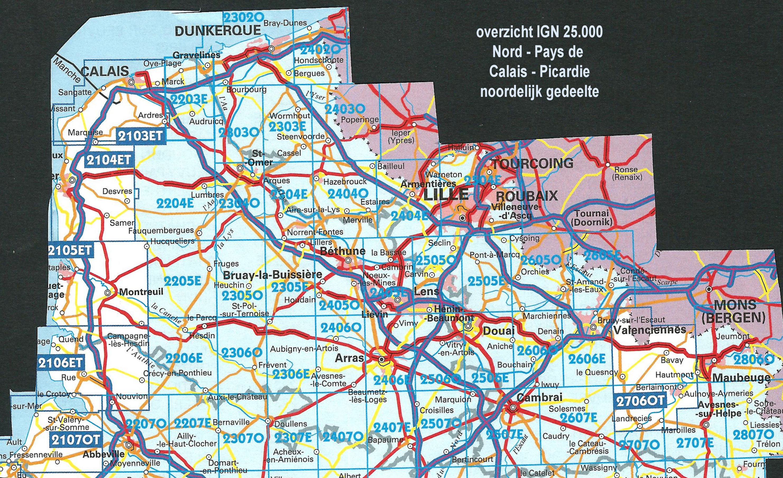
Overzicht IGN 25.000 Pays de Calais - Picardië: Noord

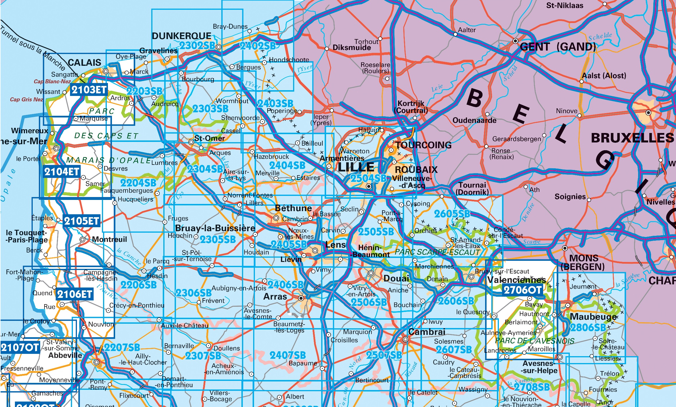
Producten op deze overzichtskaart:
Klik op een product om naar de pagina van dat product te gaan.
- Wandelkaart - Topografische kaart 2103ET Calais | IGN - Institut Géographique National
- Wandelkaart - Topografische kaart 2104ET Boulogne-Sur-Mer | IGN - Institut Géographique National
- Wandelkaart - Topografische kaart 2105ET Le Touquet-Paris-Plage, Berck, Étaples, Vallée de la Canche | IGN - Institut Géographique National
- Wandelkaart - Topografische kaart 2106ET Baie de Somme, Le Crotoy, Fort-Mahon-Plage | IGN - Institut Géographique National
- Wandelkaart - Topografische kaart 2107OT Le Tréport | IGN - Institut Géographique National
- Wandelkaart - Topografische kaart 2203SB Gravelines - Andruicq | IGN - Institut Géographique National
- Wandelkaart - Topografische kaart 2204SB Lumbres - Fruges | IGN - Institut Géographique National
- Wandelkaart - Topografische kaart 2206SB Hesdin, Auxi-le-Château | IGN - Institut Géographique National
- Wandelkaart - Topografische kaart 2207SB Abbeville, Domart-en-Ponthieu | IGN - Institut Géographique National
- Topografische kaart - Wandelkaart 2302SB Dunkerque - Gravelines | IGN - Institut Géographique National
- Wandelkaart - Topografische kaart 2303SB Wormhout - Cassel - Watten | IGN - Institut Géographique National
- Wandelkaart - Topografische kaart 2304SB Aire-Sur-La-Lys, St-Omer | IGN - Institut Géographique National
- Wandelkaart - Topografische kaart 2305SB Lillers - Heuchin | IGN - Institut Géographique National
- Wandelkaart - Topografische kaart 2306SB Saint-Michel-Sur-Ternoise, Frévent | IGN - Institut Géographique National
- Wandelkaart - Topografische kaart 2307SB Doullens - Beauval | IGN - Institut Géographique National
- Wandelkaart - Topografische kaart 2402SB Hondschoote - Bergues | IGN - Institut Géographique National
- Wandelkaart - Topografische kaart 2403SB Steenvoorde - Bailleul | IGN - Institut Géographique National
- Wandelkaart - Topografische kaart 2404SB Armentieres - Hazebrouck | IGN - Institut Géographique National
- Wandelkaart - Topografische kaart 2405SB Lens - Béthune | IGN - Institut Géographique National
- Wandelkaart - Topografische kaart 2406SB Arras, Avesnes-le-Comte | IGN - Institut Géographique National
- Wandelkaart - Topografische kaart 2407SB Bapaume, Acheux-en-Amiénois | IGN - Institut Géographique National
- Wandelkaart - Topografische kaart 2504SB Lille - Roubaix - Tourcoing | IGN - Institut Géographique National
- Wandelkaart - Topografische kaart 2505SB Leforest - Cysoing - Hénin-Beaumont - Carvin | IGN - Institut Géographique National
- Wandelkaart - Topografische kaart 2506SB Douai - Rouvroy - Vitry-en-Artois | IGN - Institut Géographique National
- Wandelkaart - Topografische kaart 2507SB Cambrai - Bertincourt | IGN - Institut Géographique National
- Wandelkaart - Topografische kaart 2606SB Valenciennes - Denain | IGN - Institut Géographique National
- Wandelkaart - Topografische kaart 2607SB Le Cateau-Cambrésis, Caudry | IGN - Institut Géographique National
- Wandelkaart - Topografische kaart 2706OT Foret De Mormal | IGN - Institut Géographique National
- Wandelkaart - Topografische kaart 2806SB Jeumont - Maubeuge | IGN - Institut Géographique National
-
Overzicht IGN 25.000 Pays de Calais - Picardië: Noord

Producten op deze overzichtskaart:
Klik op een product om naar de pagina van dat product te gaan.
- Wandelkaart - Topografische kaart 2103ET Calais | IGN - Institut Géographique National
- Wandelkaart - Topografische kaart 2104ET Boulogne-Sur-Mer | IGN - Institut Géographique National
- Wandelkaart - Topografische kaart 2105ET Le Touquet-Paris-Plage, Berck, Étaples, Vallée de la Canche | IGN - Institut Géographique National
- Wandelkaart - Topografische kaart 2106ET Baie de Somme, Le Crotoy, Fort-Mahon-Plage | IGN - Institut Géographique National
- Wandelkaart - Topografische kaart 2107OT Le Tréport | IGN - Institut Géographique National
- Wandelkaart - Topografische kaart 2203SB Gravelines - Andruicq | IGN - Institut Géographique National
- Wandelkaart - Topografische kaart 2204SB Lumbres - Fruges | IGN - Institut Géographique National
- Wandelkaart - Topografische kaart 2206SB Hesdin, Auxi-le-Château | IGN - Institut Géographique National
- Wandelkaart - Topografische kaart 2207SB Abbeville, Domart-en-Ponthieu | IGN - Institut Géographique National
- Topografische kaart - Wandelkaart 2302SB Dunkerque - Gravelines | IGN - Institut Géographique National
- Wandelkaart - Topografische kaart 2303SB Wormhout - Cassel - Watten | IGN - Institut Géographique National
- Wandelkaart - Topografische kaart 2304SB Aire-Sur-La-Lys, St-Omer | IGN - Institut Géographique National
- Wandelkaart - Topografische kaart 2305SB Lillers - Heuchin | IGN - Institut Géographique National
- Wandelkaart - Topografische kaart 2306SB Saint-Michel-Sur-Ternoise, Frévent | IGN - Institut Géographique National
- Wandelkaart - Topografische kaart 2307SB Doullens - Beauval | IGN - Institut Géographique National
- Wandelkaart - Topografische kaart 2402SB Hondschoote - Bergues | IGN - Institut Géographique National
- Wandelkaart - Topografische kaart 2403SB Steenvoorde - Bailleul | IGN - Institut Géographique National
- Wandelkaart - Topografische kaart 2404SB Armentieres - Hazebrouck | IGN - Institut Géographique National
- Wandelkaart - Topografische kaart 2405SB Lens - Béthune | IGN - Institut Géographique National
- Wandelkaart - Topografische kaart 2406SB Arras, Avesnes-le-Comte | IGN - Institut Géographique National
- Wandelkaart - Topografische kaart 2407SB Bapaume, Acheux-en-Amiénois | IGN - Institut Géographique National
- Wandelkaart - Topografische kaart 2504SB Lille - Roubaix - Tourcoing | IGN - Institut Géographique National
- Wandelkaart - Topografische kaart 2505SB Leforest - Cysoing - Hénin-Beaumont - Carvin | IGN - Institut Géographique National
- Wandelkaart - Topografische kaart 2506SB Douai - Rouvroy - Vitry-en-Artois | IGN - Institut Géographique National
- Wandelkaart - Topografische kaart 2507SB Cambrai - Bertincourt | IGN - Institut Géographique National
- Wandelkaart - Topografische kaart 2606SB Valenciennes - Denain | IGN - Institut Géographique National
- Wandelkaart - Topografische kaart 2607SB Le Cateau-Cambrésis, Caudry | IGN - Institut Géographique National
- Wandelkaart - Topografische kaart 2706OT Foret De Mormal | IGN - Institut Géographique National
- Wandelkaart - Topografische kaart 2806SB Jeumont - Maubeuge | IGN - Institut Géographique National
Overzichtskaarten
Beschrijving
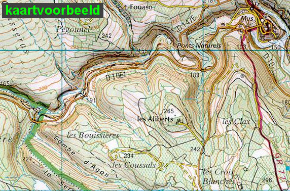
Let op: deze kaartenserie (de O en E versies) wijkt af van de OT en ET versie, het zijn zuiver topografische kaarten zonder ingetekende wandelroutes of GR paden. Ook andere toeristische aspecten staan niet als zodanig ingetekend. Wel zijn ze bijzonder goed en gedetaileerd. Een gemiddeld kaartlezer kan hier zonder meer de weg op vinden. Van dit gebied zijn op deze schaal geen andere kaarten beschikbaar.
Reviews
Geen reviews gevonden voor dit product.
Schrijf een review
Graag horen wij wat u van dit artikel vindt. Vindt u het goed, leuk, mooi, slecht, lelijk, onbruikbaar of erg handig: schrijf gerust alles op! Het is niet alleen leuk om te doen maar u informeert andere klanten er ook nog mee!
Ook interessant voor europa/frankrijk/picardie-nw-frankrijk
-

Reisgids Michelin groene gids Picard
€ 22,99Reisgidsen Picardie - Noordwest Frankrijk -

Wandelkaart - Topografische kaart 23
€ 16,95Topografische kaarten Picardie - Noordwest Frankrijk -

Wandelkaart - Topografische kaart 25
€ 16,95Topografische kaarten Picardie - Noordwest Frankrijk -

Wandelgids RE15 Dans les traces de l
€ 19,95Wandelgidsen Picardie - Noordwest Frankrijk -

Wegenkaart - landkaart 301 Pas de Ca
€ 9,95Wegenkaarten Picardie - Noordwest Frankrijk