Wegenkaart - landkaart 106 Kythnos | Road Editions (9789608189140)
- ISBN / CODE: 9789608189140
- Schaal: 1:50000
- Uitgever: Road Editions
- Soort: Wegenkaart
- Taal: Engels
- Schrijf als eerste een review
-
€ 8,25
Dit artikel is (tijdelijk) niet leverbaar
-
Overzicht Eilanden groepen indeling
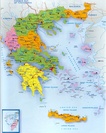

Producten op deze overzichtskaart:
Klik op een product om naar de pagina van dat product te gaan.
- Wegenkaart - landkaart 101 Andros | Road Editions
- Wegenkaart - landkaart 102 Tinos | Road Editions
- Wegenkaart - landkaart 104 Syros | Road Editions
- Wegenkaart - landkaart 105 Tzia - Kea | Road Editions
- Wegenkaart - landkaart 106 Kythnos | Road Editions
- Wegenkaart - landkaart 107 Serifos | Road Editions
- Wegenkaart - landkaart 109 Sifnos | Road Editions
- Wegenkaart - landkaart 113 Ios | Road Editions
- Wegenkaart - landkaart 118 Spetses | Road Editions
- Wegenkaart - landkaart 201 Karpathos - Kassos | Road Editions
- Wegenkaart - landkaart 213 Lemnos | Road Editions
- Wegenkaart - landkaart 215 Samothraki – Samothraki | Road Editions
- Wegenkaart - landkaart 216 Skyros | Road Editions
- Wandelkaart - Wegenkaart - landkaart 218 Skopelos | Road Editions
- Wegenkaart - landkaart 303 Lefkada | Road Editions
Overzichtskaarten
Beschrijving
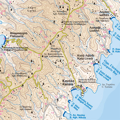
Gedetailleerde wegenkaart met aanduiding van de wandelwegen, lijst van hotels en toeristische informatie. Voor alle doeleinden een zeer geschikte kaart.
It was published in 2003, based on data of that same year. The geophysical background was provided by the Hellenic Military Geographic Service and there are contour lines at 20m intervals as well as a full hydrography (all ravines and dry torrents are visible). As in all ROAD maps, all beaches are illustrated in blue with their names, as are all location names of villages and settlements and of course the precise distances in kilometers from intersection to intersection.
This map introduces an innovation in that the locations of the early Cycladic (or protocycladic) metal smelting centres are indicated by a special symbol (the locals call these locations 'skouries' or 'rust marks') and it is especially worthwhile to see them.
On the back of the map, there are photographs of characteristic Kythnos landscapes, historical data and information for tourists and a listing of the accommodations available on the island.
Reviews
Geen reviews gevonden voor dit product.
Schrijf een review
Graag horen wij wat u van dit artikel vindt. Vindt u het goed, leuk, mooi, slecht, lelijk, onbruikbaar of erg handig: schrijf gerust alles op! Het is niet alleen leuk om te doen maar u informeert andere klanten er ook nog mee!
Ook interessant voor europa/griekenland/eilandencycladenzuid
-

Wandelgids Santorini, Sifnos, Kea -
€ 17,95Wandelgidsen Cycladen Zuid -

Wandelkaart 10.25 Serifos | Anavasi
€ 9,95Wandelkaarten Cycladen Zuid -

Fotoboek Cyclades | teNeues
€ 44,95Fotoboeken Cycladen Zuid -

Reisgids Insel|Trip Naxos - Paros |
€ 16,50Reisgidsen Cycladen Zuid -

Wegenkaart - landkaart 105 Tzia - Ke
€ 8,95Wegenkaarten Cycladen Zuid