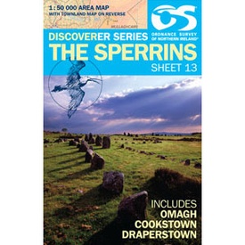
Wandelkaart 13 Discoverer The Sperrins | Ordnance Survey Northern Ireland (9781905306848)
- ISBN / CODE: 9781905306848
- Editie: 27-08-2015
- Aantal blz.: 1
- Schaal: 1:50000
- Uitgever: Ordnance Survey Northern Ireland
- Soort: Wandelkaart
- Serie: Discoverer
- Taal: Engels
- Hoogte: 18.0 cm
- Breedte: 11.0 cm
- Gewicht: 84.0 g
- Uitvoering: Papier
- Bindwijze: -
- Schrijf als eerste een review
-
€ 19,50
Op voorraad. Voor 17.00 uur op werkdagen besteld, morgen in huis in Nederland Levertijd Belgie
Gratis verzending in Nederland vanaf €35,-
-
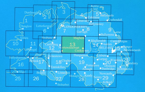
Overzicht Wandelkaarten Noord Ierland Ordnance Survey 1:50000


Producten op deze overzichtskaart:
Klik op een product om naar de pagina van dat product te gaan.
- Wandelkaart 04 Discoverer Coleraine | Ordnance Survey Northern Ireland
- Wandelkaart 05 Discoverer Ballycastle | Ordnance Survey Northern Ireland
- Wandelkaart 07 Discoverer Londonderry | Ordnance Survey Northern Ireland
- Wegenkaart - landkaart 08 Discoverer Ballymoney | Ordnance Survey
- Wandelkaart 09 Discoverer Larne | Ordnance Survey Northern Ireland
- Wandelkaart 12 Discoverer Strabane | Ordnance Survey Northern Ireland
- Wandelkaart 13 Discoverer The Sperrins | Ordnance Survey Northern Ireland
- Wandelkaart 14 Discoverer Lough Neagh | Ordnance Survey Northern Ireland
- Wandelkaart 17 Discoverer Lower Lough Erne | Ordnance Survey Northern Ireland
- Wandelkaart 18 Discoverer Enniskillen | Ordnance Survey Northern Ireland
- Wandelkaart 19 Discoverer Armagh | Ordnance Survey Northern Ireland
- Wandelkaart 20 Discoverer Craigavon | Ordnance Survey Northern Ireland
- Topografische kaart - Wandelkaart 21 Discovery Strangford Lough | Ordnance Survey Ireland
- Wandelkaart 26 Discoverer Lough Allen | Ordnance Survey Northern Ireland
- Wandelkaart 27 Discoverer Upper Lough Erne | Ordnance Survey Northern Ireland
- Wandelkaart 28 Discoverer Monaghan - Keady | Ordnance Survey Northern Ireland
- Wandelkaart 29 Discoverer The Mournes | Ordnance Survey Northern Ireland
Overzichtskaarten
Beschrijving
Zeer gedetailleerde topografische kaart met een aantal toegevoegde toeristische symbolen voor bijv. Bezienswaardigheden en campings. Met hoogtelijnen, mooi kleurgebruik.
Reviews
Geen reviews gevonden voor dit product.
Schrijf een review
Graag horen wij wat u van dit artikel vindt. Vindt u het goed, leuk, mooi, slecht, lelijk, onbruikbaar of erg handig: schrijf gerust alles op! Het is niet alleen leuk om te doen maar u informeert andere klanten er ook nog mee!


