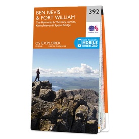
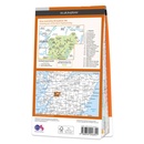
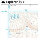
Wandelkaart - Topografische kaart 392 OS Explorer Map Ben Nevis & Fort William | Ordnance Survey (9780319246351)
The Mamores & The Grey Corries Kinlochleven & Spean Bridge
- ISBN / CODE: 9780319246351
- Editie: 2016
- Schaal: 1:25000
- Uitgever: Ordnance Survey
- Soort: Topografische kaart, Wandelkaart
- Serie: OS Explorer Map
- Taal: Engels
- Hoogte: 23.0 cm
- Breedte: 13.0 cm
- Dikte: 1.0 cm
- Gewicht: 150.0 g
- Bindwijze: -
- Uitvoering: Papier
- Beoordeling: 4,0 ★★★★★ (1 review) Schrijf een review
-
€ 19,50
Levertijd 2 - 4 werkdagen in huis in Nederland Levertijd Belgie
Gratis verzending in Nederland vanaf €35,-
-
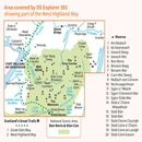
Overzichtskaart Explorer 25.000 topografische kaarten Ben Nevis - Glen Coe

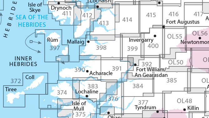
Producten op deze overzichtskaart:
Klik op een product om naar de pagina van dat product te gaan.
- Wandelkaart - Topografische kaart 372 OS Explorer Map Coll / Tiree | Ordnance Survey
- Wandelkaart - Topografische kaart 374 OS Explorer Map Isle of Mull North, Tobermroy | Ordnance Survey
- Wandelkaart - Topografische kaart 376 OS Explorer Map Oban & North Lorn Explorer | Ordnance Survey
- Wandelkaart - Topografische kaart 377 OS Explorer Map Loch Etive, Glen Orchy Explorer | Ordnance Survey
- Wandelkaart - Topografische kaart 383 OS Explorer Map Morvern, Lochaline | Ordnance Survey
- Wandelkaart - Topografische kaart 384 OS Explorer Map Glen Coe & Glen Etive | Ordnance Survey
- Wandelkaart - Topografische kaart 385 OS Explorer Map Rannoch Moor, Ben Alder | Ordnance Survey
- Wandelkaart - Topografische kaart 390 OS Explorer Map Ardnamurchan | Ordnance Survey
- Wandelkaart - Topografische kaart 391 OS Explorer Map Ardgour, Strontian | Ordnance Survey
- Wandelkaart - Topografische kaart 392 OS Explorer Map Ben Nevis & Fort William | Ordnance Survey
- Wandelkaart - Topografische kaart 397 OS Explorer Map Rum, Eigg, Muck, Canna, Sanday | Ordnance Survey
- Wandelkaart - Topografische kaart 398 OS Explorer Map Loch Morar, Mallaig | Ordnance Survey
- Wandelkaart - Topografische kaart 399 OS Explorer Map Loch Arkaig Explorer | Ordnance Survey
- Wandelkaart - Topografische kaart 400 OS Explorer Map Loch Lochy, Glen Roy | Ordnance Survey
- Wandelkaart - Topografische kaart 413 OS Explorer Map Knoydart, Loch Hourn, Loch Duich | Ordnance Survey
- Wandelkaart - Topografische kaart 414 OS Explorer Map Glen Shiel & Kintail Forest | Ordnance Survey
- Wandelkaart - Topografische kaart 415 OS Explorer Map Glen Affric, Glen Moriston explorer | Ordnance Survey
- Wandelkaart - Topografische kaart 416 OS Explorer Map Inverness, Loch Ness, Culloden | Ordnance Survey
- Wandelkaart - Topografische kaart OL48 OS Explorer Map Ben Lawers & Glen Lyon | Ordnance Survey
- Wandelkaart - Topografische kaart OL50 OS Explorer Map Ben Alder, Loch Ericht & Loch Laggan | Ordnance Survey
- Wandelkaart - Topografische kaart OL55 OS Explorer Map Loch Laggan & Creag Meagaidh | Ordnance Survey
-
Overzichtskaart Explorer 25.000 wandelkaarten Ben Nevis - Glen Coe

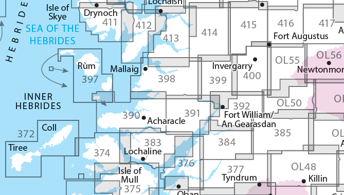
Producten op deze overzichtskaart:
Klik op een product om naar de pagina van dat product te gaan.
- Wandelkaart - Topografische kaart 372 OS Explorer Map Coll / Tiree | Ordnance Survey
- Wandelkaart - Topografische kaart 374 OS Explorer Map Isle of Mull North, Tobermroy | Ordnance Survey
- Wandelkaart - Topografische kaart 376 OS Explorer Map Oban & North Lorn Explorer | Ordnance Survey
- Wandelkaart - Topografische kaart 377 OS Explorer Map Loch Etive, Glen Orchy Explorer | Ordnance Survey
- Wandelkaart - Topografische kaart 383 OS Explorer Map Morvern, Lochaline | Ordnance Survey
- Wandelkaart - Topografische kaart 384 OS Explorer Map Glen Coe & Glen Etive | Ordnance Survey
- Wandelkaart - Topografische kaart 385 OS Explorer Map Rannoch Moor, Ben Alder | Ordnance Survey
- Wandelkaart - Topografische kaart 390 OS Explorer Map Ardnamurchan | Ordnance Survey
- Wandelkaart - Topografische kaart 391 OS Explorer Map Ardgour, Strontian | Ordnance Survey
- Wandelkaart - Topografische kaart 392 OS Explorer Map Ben Nevis & Fort William | Ordnance Survey
- Wandelkaart - Topografische kaart 397 OS Explorer Map Rum, Eigg, Muck, Canna, Sanday | Ordnance Survey
- Wandelkaart - Topografische kaart 398 OS Explorer Map Loch Morar, Mallaig | Ordnance Survey
- Wandelkaart - Topografische kaart 399 OS Explorer Map Loch Arkaig Explorer | Ordnance Survey
- Wandelkaart - Topografische kaart 400 OS Explorer Map Loch Lochy, Glen Roy | Ordnance Survey
- Wandelkaart - Topografische kaart 413 OS Explorer Map Knoydart, Loch Hourn, Loch Duich | Ordnance Survey
- Wandelkaart - Topografische kaart 414 OS Explorer Map Glen Shiel & Kintail Forest | Ordnance Survey
- Wandelkaart - Topografische kaart 415 OS Explorer Map Glen Affric, Glen Moriston explorer | Ordnance Survey
- Wandelkaart - Topografische kaart 416 OS Explorer Map Inverness, Loch Ness, Culloden | Ordnance Survey
- Wandelkaart - Topografische kaart OL48 OS Explorer Map Ben Lawers & Glen Lyon | Ordnance Survey
- Wandelkaart - Topografische kaart OL50 OS Explorer Map Ben Alder, Loch Ericht & Loch Laggan | Ordnance Survey
- Wandelkaart - Topografische kaart OL55 OS Explorer Map Loch Laggan & Creag Meagaidh | Ordnance Survey
Overzichtskaarten
Beschrijving
Met zijn 4cm voor 1 km (2 ½ cm voor 1 mijl) schaal, is de OS Explorer kaartenserie de ideale en meest gedetailleerde kaartenreeks voor mensen die graag outdoor-activiteiten zoals fietsen, wandelen, paardrijden, klimmen en watersporten.
Deze kaart is nog gedetailleerder dan de 'gewone' Landranger maps. Voor- en achterzijde bedrukt! Zeker op de moors en andere natuurgebieden van onschatbare waarden met echt alle aspecten van het landschap op de kaart ingetekend. Zeer goede detailkaart met topografische ondergrond. Hierop zijn toeristische symbolen van bezienswaardigheden ingetekend, daarnaast staan bijvoorbeeld campings en jeugdherbergen vermeld en - voor wandelaars het belangrijkst - alle right of way paden en Lange afstands Wandelpaden zijn er op te vinden. De ideale kaart voor het wandelen in Engeland, Wales of Schotland.
These highly detailed maps show all the administrative boundaries, settlements as small as isolated farms, the road network down to unfenced roads and country tracks, and field boundaries (hedges and drystone walls) which make navigation across the countryside much easier. Steep gradients on roads are indicated. Various landmarks, e.g. powerlines, archaeological sites, windmills, churches and lighthouses are shown and additional graphics indicate natural terrain features such as cliffs, scree, mud and vegetation variations. The contour interval is 5 metres in the lower parts of the country and 10 metres in the uplands, and spot heights are marked. Each map covers an area of 30 x 20km (i.e. approx. 19 x 12 miles), with some double-sided maps covering more, as indicated in the individual descriptions. The maps are fully GPS compatible, with the National Grid shown at 1km intervals and latitude and longitude indicated by margin ticks at 1'.
The Explorer series has replaced the earlier, green-cover Pathfinder maps. The Explorer series is now complete and covers all of England, Wales & Scotland. Some sheets for popular areas like the National Parks are still branded as Outdoor Leisure (OL) maps, but are now included in this series as the cartography is the same as that in the Explorer Maps. The Explorer maps offer a substantial improvement on the Pathfinder series, with greater use of colour, larger area per map, and stronger emphasis on information for ramblers and tourists.
This series is ideal for walking and other outdoor pursuits and each map shows a large amount of information for ramblers and tourists. Public rights of way are shown (except in Scotland), together with other routes with public access: National Trails and Recreational Paths, permitted paths and bridleways, and selected cycle routes. Open access land created under the Countryside and Rights of Way Act 2000 is marked. Tourist information includes caravan and camp sites, Park & Ride locations, recreation/leisure/sport centres, museums, historic buildings, English Heritage and National Trust sites, rural pubs, etc. The map legend is in English only, except for the tourist information content which is also in French and German.
Dit product heeft meerdere varianten:
Reviews
Zeer gedetailleerde kaart, prima te gebruiken voor wandelen. Sommige landmarks missen een naam, en bijvoorbeeld bothy's staan er niet allemaal op. Bij de kaart zit een code om de kaart te downloaden in de OS Maps app. Dat werkt prima, alleen tijdens het wandelen kan de app soms geen gps fix krijgen waardoor je er je positie niet op de kaart te zien krijgt.
★★★★★ door Lodewijk van Walraven 26 september 2016Vond u dit een nuttige review? (login om te beoordelen)
Schrijf een review
Graag horen wij wat u van dit artikel vindt. Vindt u het goed, leuk, mooi, slecht, lelijk, onbruikbaar of erg handig: schrijf gerust alles op! Het is niet alleen leuk om te doen maar u informeert andere klanten er ook nog mee!

