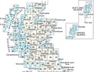
Wandelkaarten - Schotland
Overzichtskaarten
-
Overzicht wandelkaarten / topografische kaarten Schotland Ordnance Survey 1:50.000
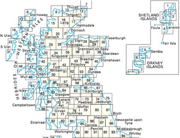
Producten op deze overzichtskaart:
Klik op een product om naar de pagina van dat product te gaan.
- Wandelkaart - Topografische kaart 001 Landranger Shetland - Yell - Unst & Fetlar | Ordnance Survey
- Wandelkaart - Topografische kaart 002 Landranger Shetland - Sullom Voe & Whalsay | Ordnance Survey
- Wandelkaart - Topografische kaart 003 Landranger Shetland - North Mainland | Ordnance Survey
- Wandelkaart - Topografische kaart 004 Landranger Shetland - South Mainland | Ordnance Survey
- Wandelkaart - Topografische kaart 005 Landranger Orkney - Northern Isles | Ordnance Survey
- Wandelkaart - Topografische kaart 006 Landranger Orkney - Mainland | Ordnance Survey
- Wandelkaart - Topografische kaart 007 Landranger Orkney - Southern Isles | Ordnance Survey
- Wandelkaart - Topografische kaart 008 Landranger Stornoway & North Lewis | Ordnance Survey
- Wandelkaart - Topografische kaart 009 Landranger Cape Wrath - Durness & Scourie | Ordnance Survey
- Wandelkaart - Topografische kaart 010 Landranger Strathnaver - Bettyhill & Tongue | Ordnance Survey
- Wandelkaart - Topografische kaart 011 Landranger Thurso & Dunbeath | Ordnance Survey
- Wandelkaart - Topografische kaart 012 Landranger Thurso & Wick, John O'Groats | Ordnance Survey
- Wandelkaart - Topografische kaart 013 Landranger West Lewis & North Harris | Ordnance Survey
- Wandelkaart - Topografische kaart 014 Landranger Tarbert & Loch Seaforth | Ordnance Survey
- Wandelkaart - Topografische kaart 015 Landranger Loch Assynt, Lochinver & Kylesku | Ordnance Survey
- Wandelkaart - Topografische kaart 016 Landranger Lairg & Loch Shin, Loch Naver | Ordnance Survey
- Wandelkaart - Topografische kaart 017 Landranger Helmsdale & Strath of Kildonan | Ordnance Survey
- Wandelkaart - Topografische kaart 018 Landranger Sound of Harris, North Uist, Taransay & St Kilda | Ordnance Survey
- Wandelkaart - Topografische kaart 019 Landranger Gairloch & Ullapool, Loch Maree | Ordnance Survey
- Wandelkaart - Topografische kaart 020 Landranger Beinn Dearg & Loch Broom, Ben Wyvis | Ordnance Survey
- Wandelkaart - Topografische kaart 021 Landranger Dornoch & Alness, Invergordon & Tain | Ordnance Survey
- Wandelkaart - Topografische kaart 022 Landranger Benbecula & South Uist | Ordnance Survey
- Wandelkaart - Topografische kaart 023 Landranger North Skye, Dunvegan & Portree | Ordnance Survey
- Wandelkaart - Topografische kaart 024 Landranger Raasay & Applecross, Loch Torridon & Plockton | Ordnance Survey
- Wandelkaart - Topografische kaart 025 Landranger Glen Carron & Glen Affric | Ordnance Survey
- Wandelkaart - Topografische kaart 026 Landranger Inverness & Loch Ness, Strathglass | Ordnance Survey
- Wandelkaart - Topografische kaart 027 Landranger Nairn & Forres, River Findhorn | Ordnance Survey
- Wandelkaart - Topografische kaart 028 Landranger Elgin, Dufftown & surrounding area | Ordnance Survey
- Wandelkaart - Topografische kaart 029 Landranger Banff & Huntly, Portsoy & Turriff | Ordnance Survey
- Wandelkaart - Topografische kaart 030 Landranger Fraserburgh, Peterhead & Ellon | Ordnance Survey
- Wandelkaart - Topografische kaart 031 Landranger Barra & South Uist, Vatersay & Eriskay | Ordnance Survey
- Wandelkaart - Topografische kaart 032 Landranger South Skye & Cuillin Hills | Ordnance Survey
- Wandelkaart - Topografische kaart 033 Landranger Loch Alsh, Glen Shiel & Loch Hourn | Ordnance Survey
- Wandelkaart - Topografische kaart 034 Landranger Fort Augustus, Glen Albyn & Glen Roy | Ordnance Survey
- Wandelkaart - Topografische kaart 035 Landranger Kingussie and Monadhliath Mountains | Ordnance Survey
- Wandelkaart - Topografische kaart 036 Landranger Grantown & Aviemore, Cairngorm Mountains | Ordnance Survey
- Wandelkaart - Topografische kaart 037 Landranger Strathdon & Alford | Ordnance Survey
- Wandelkaart - Topografische kaart 038 Landranger Aberdeen | Ordnance Survey
- Wandelkaart - Topografische kaart 039 Landranger Rum, Eigg & Muck | Ordnance Survey
- Wandelkaart - Topografische kaart 040 Landranger Mallaig & Glenfinnan, Loch Shiel | Ordnance Survey
- Wandelkaart - Topografische kaart 041 Landranger Ben Nevis, Fort William & Glen Coe | Ordnance Survey
- Wandelkaart - Topografische kaart 042 Landranger Glen Garry & Loch Rannoch | Ordnance Survey
- Wandelkaart - Topografische kaart 043 Landranger Braemar & Blair Atholl | Ordnance Survey
- Wandelkaart - Topografische kaart 044 Landranger Ballater & Glen Clova | Ordnance Survey
- Wandelkaart - Topografische kaart 045 Landranger Stonehaven & Banchory | Ordnance Survey
- Wandelkaart - Topografische kaart 046 Landranger Coll & Tiree | Ordnance Survey
- Wandelkaart - Topografische kaart 047 Landranger Tobermory & North Mull | Ordnance Survey
- Wandelkaart - Topografische kaart 048 Landranger Iona & West Mull, Ulva | Ordnance Survey
- Wandelkaart - Topografische kaart 049 Landranger Oban & East Mull | Ordnance Survey
- Wandelkaart - Topografische kaart 050 Landranger Glen Orchy & Loch Etive | Ordnance Survey
- Wandelkaart - Topografische kaart 051 Landranger Loch Tay & Glen Dochart | Ordnance Survey
- Wandelkaart - Topografische kaart 052 Landranger Pitlochry & Crieff | Ordnance Survey
- Wandelkaart - Topografische kaart 053 Landranger Blairgowrie & Forest of Alyth | Ordnance Survey
- Wandelkaart - Topografische kaart 054 Landranger Dundee & Montrose, Forfar & Arbroath | Ordnance Survey
- Wandelkaart - Topografische kaart 055 Landranger Lochgilphead & Loch Awe | Ordnance Survey
- Wandelkaart - Topografische kaart 056 Landranger Loch Lomond & Inveraray | Ordnance Survey
- Wandelkaart - Topografische kaart 057 Landranger Stirling & The Trossachs | Ordnance Survey
- Wandelkaart - Topografische kaart 058 Landranger Perth to Alloa, Auchterarder | Ordnance Survey
- Wandelkaart - Topografische kaart 059 Landranger St Andrews, Kirkcaldy & Glenrothes | Ordnance Survey
- Wandelkaart - Topografische kaart 060 Landranger Islay | Ordnance Survey
- Wandelkaart - Topografische kaart 061 Landranger Jura & Colonsay | Ordnance Survey
- Wandelkaart - Topografische kaart 062 Landranger North Kintyre & Tarbert | Ordnance Survey
- Wandelkaart - Topografische kaart 063 Landranger Firth Of Clyde, Greenock & Rothesay | Ordnance Survey
- Wandelkaart - Topografische kaart 064 Landranger Glasgow, Motherwell & Airdrie | Ordnance Survey
- Wandelkaart - Topografische kaart 065 Landranger Falkirk & Linlithgow, Dunfermline | Ordnance Survey
- Wandelkaart - Topografische kaart 066 Landranger Edinburgh, Penicuik & North Berwick | Ordnance Survey
- Wandelkaart - Topografische kaart 067 Landranger Duns, Dunbar & Eyemouth area | Ordnance Survey
- Wandelkaart - Topografische kaart 068 Landranger South Kintyre & Campbeltown | Ordnance Survey
- Wandelkaart - Topografische kaart 069 Landranger Isle of Arran | Ordnance Survey
- Wandelkaart - Topografische kaart 070 Landranger Ayr, Kilmarnock & Troon | Ordnance Survey
- Wandelkaart - Topografische kaart 071 Landranger Lanark & Upper Nithsdale | Ordnance Survey
- Wandelkaart - Topografische kaart 072 Landranger Upper Clyde Valley, Biggar & Lanark | Ordnance Survey
- Wandelkaart - Topografische kaart 073 Landranger Peebles, Galashiels & Selkirk, Tweed Valley | Ordnance Survey
- Wandelkaart - Topografische kaart 074 Landranger Kelso & Coldstream, Jedburgh & Duns | Ordnance Survey
- Wandelkaart - Topografische kaart 075 Landranger Berwick-upon-Tweed, Holy Island & Wooler, Farne Islands | Ordnance Survey
- Wandelkaart - Topografische kaart 076 Landranger Girvan, Ballantrae & Barrhill | Ordnance Survey
- Wandelkaart - Topografische kaart 077 Landranger Dalmellington & New Galloway, Galloway Forest Park | Ordnance Survey
- Wandelkaart - Topografische kaart 078 Landranger Nithsdale & Annandale, Sanquhar & Moffat | Ordnance Survey
- Wandelkaart - Topografische kaart 079 Landranger Hawick & Eskdale, Langholm | Ordnance Survey
- Wandelkaart - Topografische kaart 080 Landranger Cheviot Hills & Kielder Water | Ordnance Survey
- Wandelkaart - Topografische kaart 081 Landranger Alnwick & Morpeth | Ordnance Survey
- Wandelkaart - Topografische kaart 082 Landranger Stranraer & Glenluce | Ordnance Survey
- Wandelkaart - Topografische kaart 083 Landranger Newton Stewart & Kirkcudbright, Gatehouse of Fleet | Ordnance Survey
- Wandelkaart - Topografische kaart 084 Landranger Dumfries & Castle Douglas | Ordnance Survey
- Wandelkaart - Topografische kaart 085 Landranger Carlisle & Solway Firth, Gretna Green | Ordnance Survey
- Wandelkaart - Topografische kaart 086 Landranger Haltwhistle & Brampton, Bewcastle & Alston | Ordnance Survey
- Wandelkaart - Topografische kaart 087 Landranger Hexham & Haltwhistle | Ordnance Survey
- Wandelkaart - Topografische kaart 088 Landranger Newcastle upon Tyne, Durham & Sunderland | Ordnance Survey
- Wandelkaart 48 Landranger Active Schotland Iona & West Mull, Ulva | Ordnance Survey
 Wandelkaart Glen Coe | Harvey Maps
Includes Buachaille Etive Mor, the Three Sisters of Glen Coe and Bidean nam Bian. Detailed map for hillwalkers of Glen Coe and the Aonach Eagach ridge at the popular …
 Wandelkaart 57 OS Explorer Map | Active Cairn Gorm, Aviemore ACTIVE | Ordnance Survey
Met zijn 4cm voor 1 km (2 ½ cm voor 1 mijl) schaal, is de OS Outdoor Leisure kaartenserie de ideale en meest gedetailleerde kaartenreeks voor mensen die graag outdoor-activiteiten …
★★★★★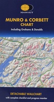 Wandelkaart Munro and Corbett Chart | Harvey Maps
Alle Munro's en Corbetts op 1 kaart! First published in 1996 this current edition of our best selling chart used for monitoring and recording your progress in completing the Munros …
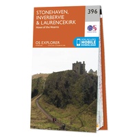 Wandelkaart - Topografische kaart 396 OS Explorer Map Stonehaven, Inverbervie & Laurencekirk | Ordnance Survey
Met zijn 4cm voor 1 km (2 ½ cm voor 1 mijl) schaal, is de OS Explorer kaartenserie de ideale en meest gedetailleerde kaartenreeks voor mensen die graag outdoor-activiteiten zoals …
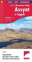 Wandelkaart Assynt & Coigach | Harvey Maps
"This is a fabulous map for a fabulous area; for the first time it shows crags, bouldering areas and clear details in what could seem a maze of rock and …
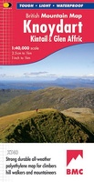 Wandelkaart Knoydart / Kintail & Glen Affric | Harvey Maps
"Clarity is the hallmark of this map. It covers magnificently honed peaks set above western seas and lochs, inviting exploration of one of Scotland's superlative and remote mountain regions", the …
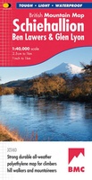 Wandelkaart Schiehallion / Ben Lawers & Glen Lyon | Harvey Maps
"I've spent most of my climbing career searching for new crags and bouldering areas and until Harvey Maps came along it was a process of trial and error. Their attention …
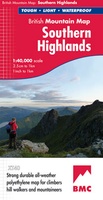 Wandelkaart Southern Highlands | Harvey Maps
"I've researched Scottish Guidebooks using HARVEY maps. They are the clearest, and the most accurate. They don't fall to pieces in the rain and the geology bits are pure bonus". …
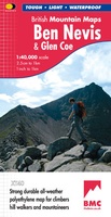 Wandelkaart Ben Nevis & Glen Coe | Harvey Maps
"This excellent Ben Nevis and Glen Coe map provides all the details needed for safe navigation on these iconic mountains". Cameron McNeish, outdoor writer and broadcaster. Detailed map for …
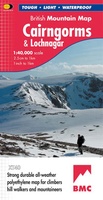 Wandelkaart Cairngorms & Lochnagar | Harvey Maps
"Inspiring map of much of Scotland's newest National Park with masses of information for walkers, mountain bikers and mountaineers. And it is virtually indestructible." Nigel Williams, Head of Training, Glenmore …
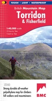 Wandelkaart Torridon & Fisherfield | Harvey Maps
"HARVEY British Mountain Maps are a joy to use. The detail and accuracy make them my first choice when I am researching a route or just out on the hills …
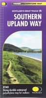 Wandelkaart Southern Upland Way | Harvey Maps
Southern Upland Way is Britain's first official coast to coast long distance footpath and is one of Scotland's Great Trails. It runs 340km (212 miles) from Portpatrick on the south …
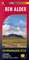 Wandelkaart Ben Alder | Harvey Maps
Superwalker is designed to be the most practical tool for navigation outdoors. The Superwalker XT25 is based on original HARVEY mapping with all the information a walker would expect on …
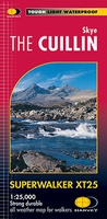 Wandelkaart Skye The Cuillin | Harvey Maps
New Revised Edition and Format. More than a map, an essential piece of equipment this new generation HARVEY Superwalker is designed to be the most practical tool for navigation outdoors. …
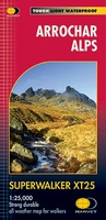 Wandelkaart Arrochar Alps | Harvey Maps
Includes Beinn Ime, Ben Vorlich and the Cobbler (Ben Arthur). Detailed map for hillwalkers of the western part of the Loch Lomond and Trossachs National Park at the popular scale …
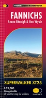 Wandelkaart Fannichs Seana Bhraigh & Ben Wyvis | Harvey Maps
Detailed map for hillwalkers of the Fannichs ridge at the popular 1:25,000 scale. This is an area located to the south of Ullapool and to the west of Dingwall. Includes …
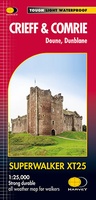 Wandelkaart Crieff & Comrie, Doune, Dunblane | Harvey Maps
Map covers the Munro, Ben Chonzie, popular Glen Artney, as well as the Braes of Doune and Doune Castle, which has featured in various film and television shows, such as …
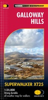 Wandelkaart Galloway Hills | Harvey Maps
The Galloway Hills form part of the Southern Uplands of Scotland. This map for hillwalkers covers Glen Trool and Loch Dee north to Loch Doon and Carrick Forest. It covers …
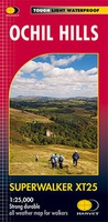 Wandelkaart Ochil Hills | Harvey Maps
Superwalker is designed to be the most practical tool for navigation outdoors. The format gives more mapping on the sheet without making the map heavy and bulky. The fold has …
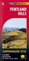 Wandelkaart Pentland Hills | Harvey Maps
The whole of the Pentlands on one side of one sheet. More than a map, an essential piece of equipment this new generation HARVEY Superwalker is designed to be the …
Laatste reviews

Heel handige plattegrond voor bezoek aan Havana. Makkelijk op te vouwen tot een klein handzaam pakketje.
★★★★★ door Marte 20 april 2024 | Heeft dit artikel gekocht
Goede, behoorlijk gedetailleerde kaart waarop je ook landschap en dorpen kunt zien.
★★★★★ door Marte 20 april 2024 | Heeft dit artikel gekocht
Een makkelijk en bruikbaar boek om planten op naam te kunnen brengen middels heldere sleutels. Het boek wordt beschouwd als een boek om altijd bij …
★★★★★ door Peter Teune 19 april 2024 | Heeft dit artikel gekocht
Mooie duidelijke gids, hopelijk ook makkelijk in gebruik. Nog niet gebruikt maar het is een duidelijke gids die ook in de voorbereidingen goed van pas …
★★★★★ door Jo 19 april 2024 | Heeft dit artikel gekocht