Wandelkaart West Highland Way | Harvey Maps (9781851374588)
Milngavie, near Glasgow to Fort William
- ISBN / CODE: 9781851374588
- Editie: 01-06-2023
- Aantal blz.: 1
- Schaal: 1:40000
- Uitgever: Harvey Maps
- Soort: Wandelkaart
- Serie: National Trail Maps
- Taal: Engels
- Hoogte: 25.0 cm
- Breedte: 14.0 cm
- Dikte: 0.6 cm
- Gewicht: 51.0 g
- Uitvoering: Scheur- en watervast
- Bindwijze: -
- Beoordeling: 4,2 ★★★★★ (5 reviews) Schrijf een review
-
€ 25,95
Op voorraad. Voor 17.00 uur op werkdagen besteld, morgen in huis in Nederland Levertijd Belgie
Gratis verzending in Nederland vanaf €35,-
-
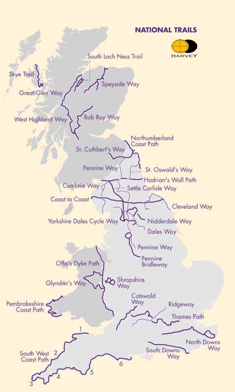
Overzicht National Trail Maps Harvey Maps


Producten op deze overzichtskaart:
Klik op een product om naar de pagina van dat product te gaan.
- Wandelkaart 1 South West Coast Path 1 | Harvey Maps
- Wandelkaart 3 South West Coast Path 3 | Harvey Maps
- Wandelkaart Affric Kintail Way | Harvey Maps
- Wandelkaart Anglesey Coastal Path | Harvey Maps
- Wandelkaart Cape Wrath Trail North | Harvey Maps
- Wandelkaart Cape Wrath Trail South | Harvey Maps
- Wandelkaart Cleveland Way | Harvey Maps
- Wandelkaart Coast to Coast | Harvey Maps
- Wandelkaart Cotswold Way | Harvey Maps
- Wandelkaart Cumbria Way | Harvey Maps
- Wandelkaart Dales Way | Harvey Maps
- Wandelkaart East Highland Way | Harvey Maps
- Wandelkaart Fife Coastal Path | Harvey Maps
- Wandelkaart Glyndwr's Way | Harvey Maps
- Wandelkaart Great Glen Way | Harvey Maps
- Wandelkaart Hadrian's Wall | Harvey Maps
- Wandelkaart John O'Groats trail | Harvey Maps
- Wandelkaart North Downs Way | Harvey Maps
- Wandelkaart Northumberland Coast Path and Berwickshire Coastal Path | Harvey Maps
- Wandelkaart Offa's Dyke Path | Harvey Maps
- Wandelkaart Peddars Way & Norfolk Coast Path | Harvey Maps
- Wandelkaart Pennine Bridleway | Harvey Maps
- Wandelkaart Pennine Way North | Harvey Maps
- Wandelkaart Pennine Way South | Harvey Maps
- Wandelkaart - Fietskaart Ridgeway | Harvey Maps
- Wandelkaart Rob Roy Way | Harvey Maps
- Wandelkaart Settle to Carlisle Way | Harvey Maps
- Wandelkaart Shropshire Way | Harvey Maps
- Wandelkaart Skye Trail | Harvey Maps
- Wandelkaart - Fietskaart South Downs Way | Harvey Maps
- Wandelkaart South Loch Ness Trail | Harvey Maps
- Wandelkaart South West Coast Path 2 | Harvey Maps
- Wandelkaart Southern Upland Way | Harvey Maps
- Wandelkaart Speyside Walk (Schotland) | Harvey Maps
- Wandelkaart St Cuthbert's Way | Harvey Maps
- Wandelkaart St Oswald's Way | Harvey Maps
- Wandelkaart Thames Path | Harvey Maps
- Wandelkaart The Great Trossachs Path | Harvey Maps
- Wandelkaart Two Moors Way | Harvey Maps
- Wandelkaart Wales Coast Path 1 | Harvey Maps
- Wandelkaart Wales Coast Path 2 | Harvey Maps
- Wandelkaart Wales Coast Path 3 | Harvey Maps
- Wandelkaart Wales Coast Path 4 | Harvey Maps
- Wandelkaart West Highland Way | Harvey Maps
Overzichtskaarten
Beschrijving
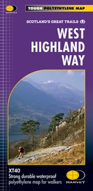
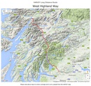
Wandelkaart van de West Highland Way met uitsnedes van de route.
Leap forward in technical excellence. Tough, light and 100% wateproof.
Compact and light - the map itself weighs just 60gms - a third of the weight of a laminated map, and much less bulky. And you can fold or refold it time and again, or stuff it in your back pocket and it won't fall to pieces. Shows the entire route on one sheet.
The Way is 153km (95 miles) from Milngavie, near Glasgow to Fort William. The map is arranged in panels so that at any one time you only have to have the part you need open. The map is printed on latex impregnated paper making it waterproof and more robust. This map is bio-degradable. It is supplied folded in a plastic pocket.
The map shows the detail you need for navigation. There is a full key and scale bar.
Information on planning your trip, accommodation, useful telephone numbers and websites, travel, and tips are all included.
Scale 1:40,000
Reviews
Zomer 2024 WHW gelopen met kaart van 2023. Geen enkele negatieve eigenschap. Goed formaat, slijtvast, licht en makkelijk te lezen.
★★★★★ door J Visser 23 juli 2024 | Heeft dit artikel gekochtVond u dit een nuttige review? (login om te beoordelen)
Kwaliteit van kaart is goed, kan inderdaad goed tegen water en beschadigt niet snel. Inhoudelijk gezien een leuke kaart om mee te hebben voor het overzicht van de route en faciliteiten. Voor meer details en navigatie buiten paden is een aanvullende kaart aan te raden.
★★★★★ door Kees 7 mei 2018Vond u dit een nuttige review? (login om te beoordelen)
Een prima wandelkaart om de west highlandway mee te lopen. Helaas is de kaart minder geschikt als je van de route (deels) wil afwijken
★★★★★ door Edwin 9 mei 2014Vond u dit een nuttige review? (login om te beoordelen)
Schrijf een review
Graag horen wij wat u van dit artikel vindt. Vindt u het goed, leuk, mooi, slecht, lelijk, onbruikbaar of erg handig: schrijf gerust alles op! Het is niet alleen leuk om te doen maar u informeert andere klanten er ook nog mee!


