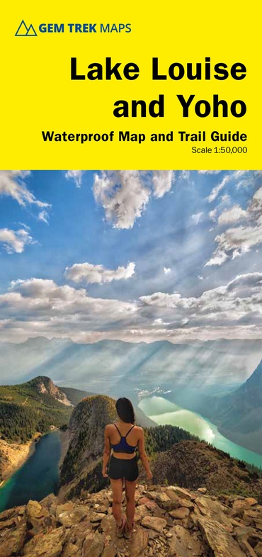
Wandelkaart 04 Lake Louise & Yoho | Gem Trek Maps (9781990161049)
- ISBN / CODE: 9781990161049
- Editie: 2022
- Schaal: 1:50000
- Uitgever: Gem Trek Maps
- Soort: Wandelkaart
- Taal: Engels
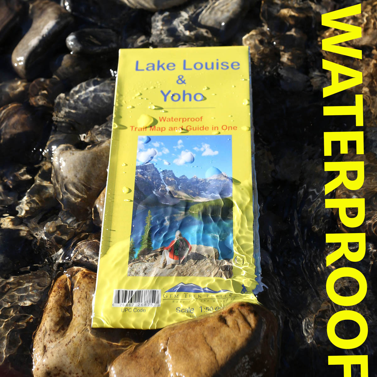
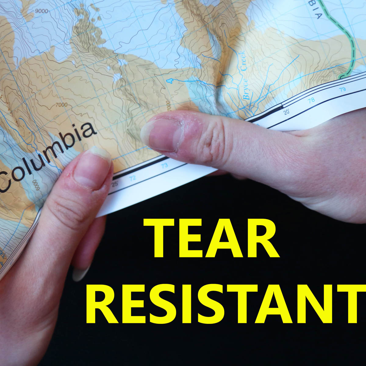
- Uitvoering: Scheur- en watervast
- Bindwijze: -
- Druk: 11
- Schrijf als eerste een review
-
€ 17,95
Op voorraad. Voor 17.00 uur op werkdagen besteld, morgen in huis in Nederland Levertijd Belgie
Gratis verzending in Nederland vanaf €35,-
-
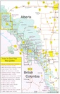
Overzicht Gem trek wandelkaarten British Columbia
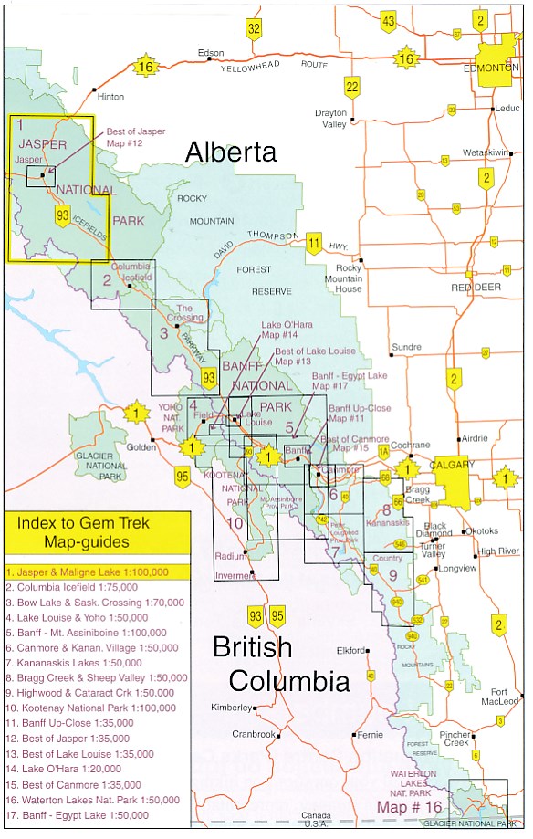
Producten op deze overzichtskaart:
Klik op een product om naar de pagina van dat product te gaan.
- Wandelkaart 01 Jasper National Park & Maligne Lake | Gem Trek Maps
- Wandelkaart 02 Columbia Icefield | Gem Trek Maps
- Wandelkaart 03 Bow Lake and Saskatchewan Crossing | Gem Trek Maps
- Wandelkaart 04 Lake Louise & Yoho | Gem Trek Maps
- Wandelkaart 05 Banff National Park and Mt. Assiniboine | Gem Trek Maps
- Wandelkaart 06 Canmore & Kananaskis Village | Gem Trek Maps
- Wandelkaart 07 Kananaskis Lakes | Gem Trek Maps
- Wandelkaart 08 Bragg Creek and Sheep Valley | Gem Trek Maps
- Wandelkaart 09 Highwood & Cataract Creek | Gem Trek Maps
- Wandelkaart 10 Kootenay National Park | Gem Trek Maps
- Wandelkaart 11 Banff Up-Close | Gem Trek Maps
- Wandelkaart 12 Best of Jasper | Gem Trek Maps
- Wandelkaart 13 Best of Lake Louise Map and Guide | Gem Trek Maps
- Wandelkaart 14 Lake O'Hara | Gem Trek Maps
- Wandelkaart 16 Waterton Lakes NP | Gem Trek Maps
- Wandelkaart Banff - Egypt Lake | Gem Trek Maps
Overzichtskaarten
Beschrijving
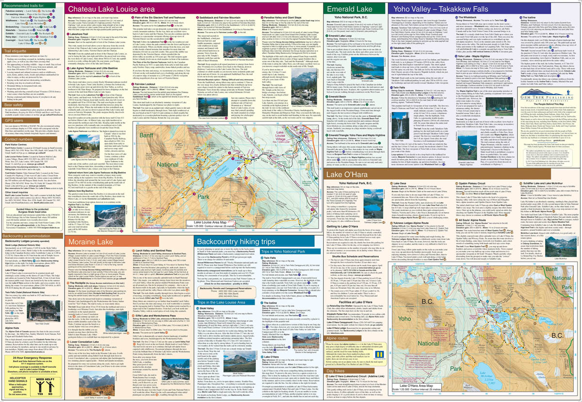
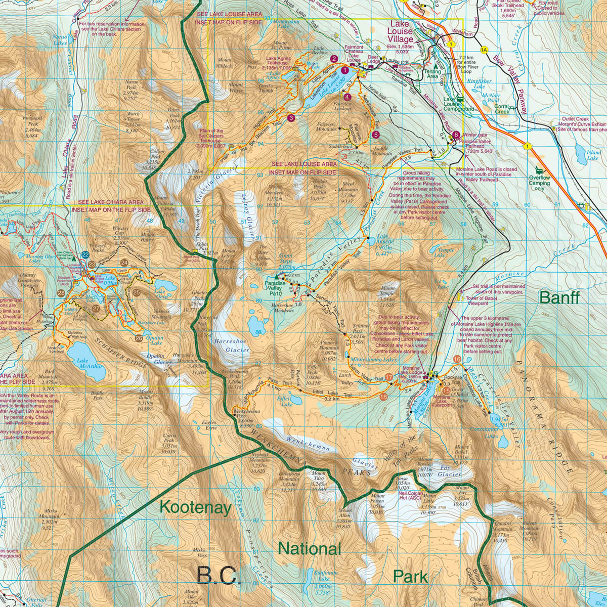
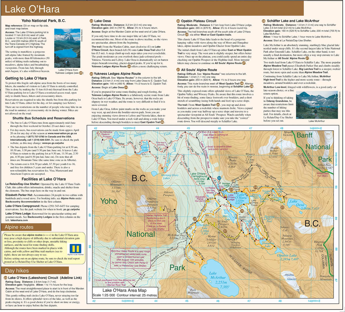
Gedetailleerde kaart van dit prachtige gebied; deze kaart is geplastificeerd, scheur- en watervast.
Reviews
Geen reviews gevonden voor dit product.
Schrijf een review
Graag horen wij wat u van dit artikel vindt. Vindt u het goed, leuk, mooi, slecht, lelijk, onbruikbaar of erg handig: schrijf gerust alles op! Het is niet alleen leuk om te doen maar u informeert andere klanten er ook nog mee!
Ook interessant voor noord-amerika/canada/british-columbia
-

Wandelkaart - Wegenkaart - landkaart
€ 17,50Wandelkaarten Alberta -

Wandelgids Canadian Rockies Trail Gu
€ 29,95Wandelgidsen Alberta -

Wegenatlas Travel Atlas Alaska Highw
€ 13,95Wegenatlassen British Columbia -

Natuurgids - Vogelgids British Colum
€ 9,95Natuurgidsen British Columbia -

Reisgids Banff, Jasper and Glacier N
€ 23,95Reisgidsen British Columbia