Mandje Tel: +31503126950 Menu
Winkelwagen
Geen items in winkelwagen
Ga naar winkelwagen

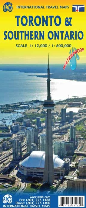
Wegenkaart - landkaart - Stadsplattegrond Toronto & Southern Ontario - Ontario zuid | ITMB (9781771298056)

  • ISBN / CODE: 9781771298056
  • Editie: 2024
  • Schaal: 1:600000
  • Uitgever: ITMB
  • Soort: Stadsplattegrond, Wegenkaart
  • Taal: Engels
  • Bindwijze: -
  • Uitvoering: Scheur- en watervast
  • Beoordeling: 4,0 ★★★★★ (2 reviews) Schrijf een review
  • 13,95

    Op voorraad. Binnen 2 - 3 werkdagen in huis in Belgie Levertijd Nederland Voor 17.00 uur op werkdagen besteld, morgen in huis in Nederland Levertijd Belgie

    Gratis verzending in Nederland vanaf €35,-

Beschrijving

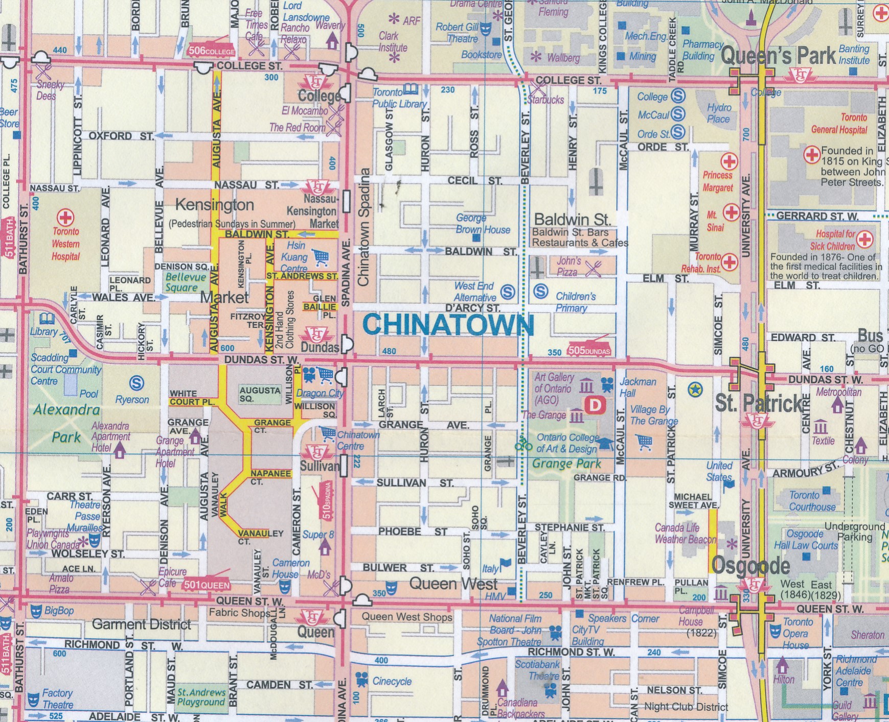
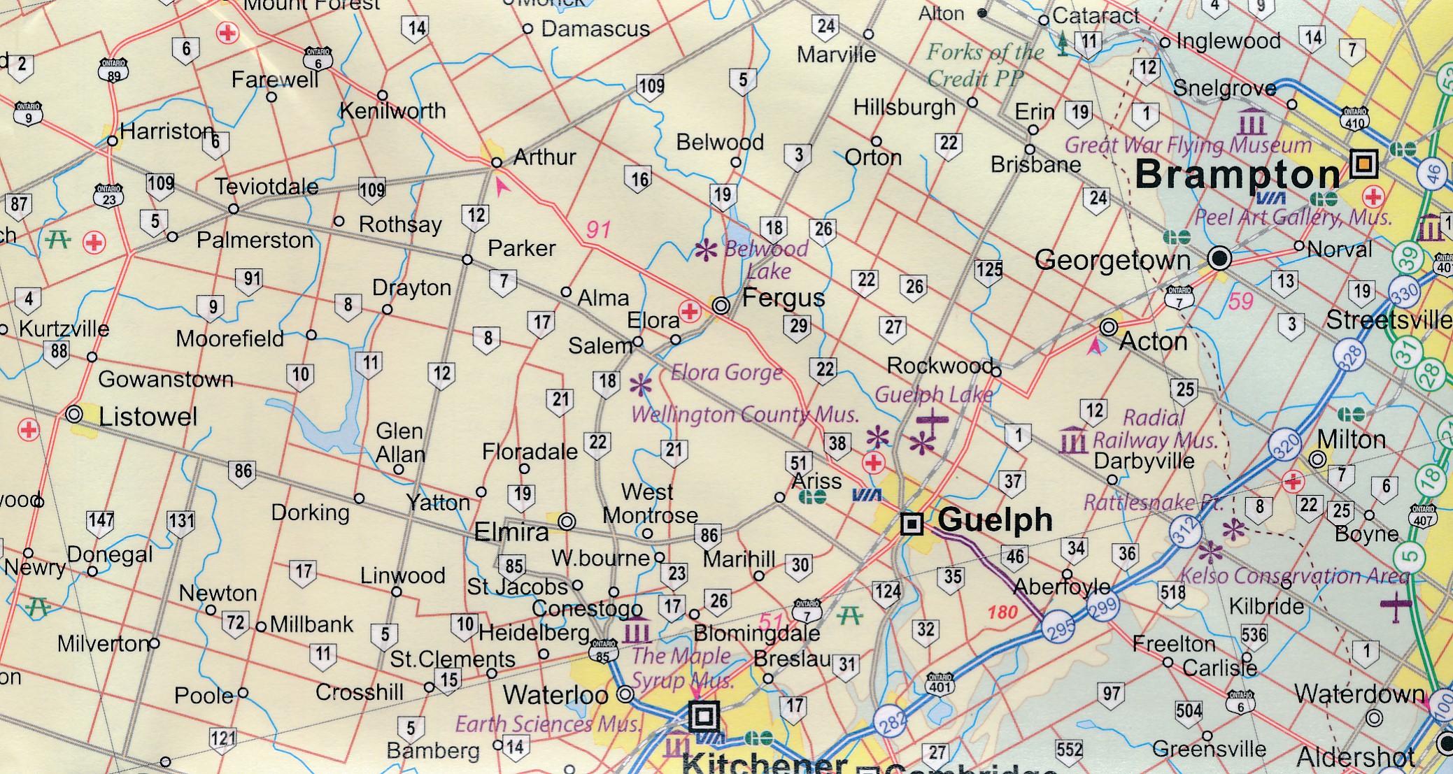
Overzichtskaart van het zuiden van Ontario - schaal 1:600.000 - met op de andere kant een grote plattegrond van Toronto op schaal 1:12.000

Legend Includes:
Roads by classification, Accomodations, Museum, Churches, Buildings, Points of tourist, Public Interests, Post Offices, Police Stations, Schools, Live Theatres, Cinemas, Ruins, Bus Terminals, Ferry Terminals, Service Areas, Hospitals, Ports, Mines, RCMP, Major Airports, Secondary Airports, Camp Grounds, National Park and Equivalent Reserves, Ski, Picnic Sites, and much more.
 
Toronto is the largest city in Canada by far. Touristically, its attraction rests with its central core, from High Park in the west to the Don River in the east, and from the park-like islands in Lake Ontario to Bloor Street in the north. In this area, one finds remnants of the oldest portion of ‘muddy York’, the original fort built to deter American raiders (close to the exhibition grounds), Campbell House (at Queen & University), and the first public school in Canada (1807). The city is exceptionally multi-cultural, with a vibrant Chinatown just north of City Hall, Little Italy and Little Brasil bordering College Street, and Greek town along the Danforth. The Yorkville area has been a focal point for coffee shops and night clubs for more than half a century, and the university campus is one of the most-respected in the world. The Islands have been largely converted into parkland, and have ferries going to five destinations on a regular basis. The streetcar network is not just for tourists, as it is vital to Toronto’s mass transit operation, as are the subway system and GO trains serving the city centre. The other side of the sheet is equally important. Geographically, Southern Ontario juts into the American heartland to the 42nd parallel. Detroit is actually north of Windsor, and Point Pelée is south of Erie, Ohio. Most residents of Ontario live in the part of the province deemed to be ‘southern”. This map covers from Detroit/Windsor in the west to Kingston and Syracuse in the east and from Erie north to Orillia, showing lakes Huron, St. Claire, Erie, and Ontario and the border between two great nations. This is a part of North America rich in history and acts as a natural expansion point for anyone visiting Toronto.


Reviews

Heel blij

Wij zijn heel blij met de aankoop van de wegenkaart Ontario South & Toronto. Zo kunnen we alvast wat routes bekijken. De voorpret is tenslotte ook een deel van de vakantie.

★★★★★ door L. Zwanenburg 1 november 2016

Vond u dit een nuttige review? (login om te beoordelen)

-
Nee (0)
wegenkaart

Combinatie plattegrond Toronto en kaart Ontario niet echt handig. Voor een stadsplattegrond is de kaart erg groot en lastig te hanteren. Kaart Ontario voldoet aardig.

★★★★★ door Toon van Helmond 7 oktober 2013

Vond u dit een nuttige review? (login om te beoordelen)

-
Nee (0)

Schrijf een review

Graag horen wij wat u van dit artikel vindt. Vindt u het goed, leuk, mooi, slecht, lelijk, onbruikbaar of erg handig: schrijf gerust alles op! Het is niet alleen leuk om te doen maar u informeert andere klanten er ook nog mee!