Wegenatlas - Atlas Road Atlas Large Scale 2020 - USA Verenigde Staten - Amerika | Rand McNally (9780528021046)
spiraal
- ISBN / CODE: 9780528021046
- Editie: 2020
- Aantal blz.: 264
- Uitgever: Rand McNally
- Soort: Atlas, Wegenatlas
- Taal: Engels
- Bindwijze: -
- Uitvoering: -
- Beoordeling: 4,8 ★★★★★ (10 reviews) Schrijf een review
-
€ 23,95
Uitverkocht, nooit meer leverbaar
Beschrijving
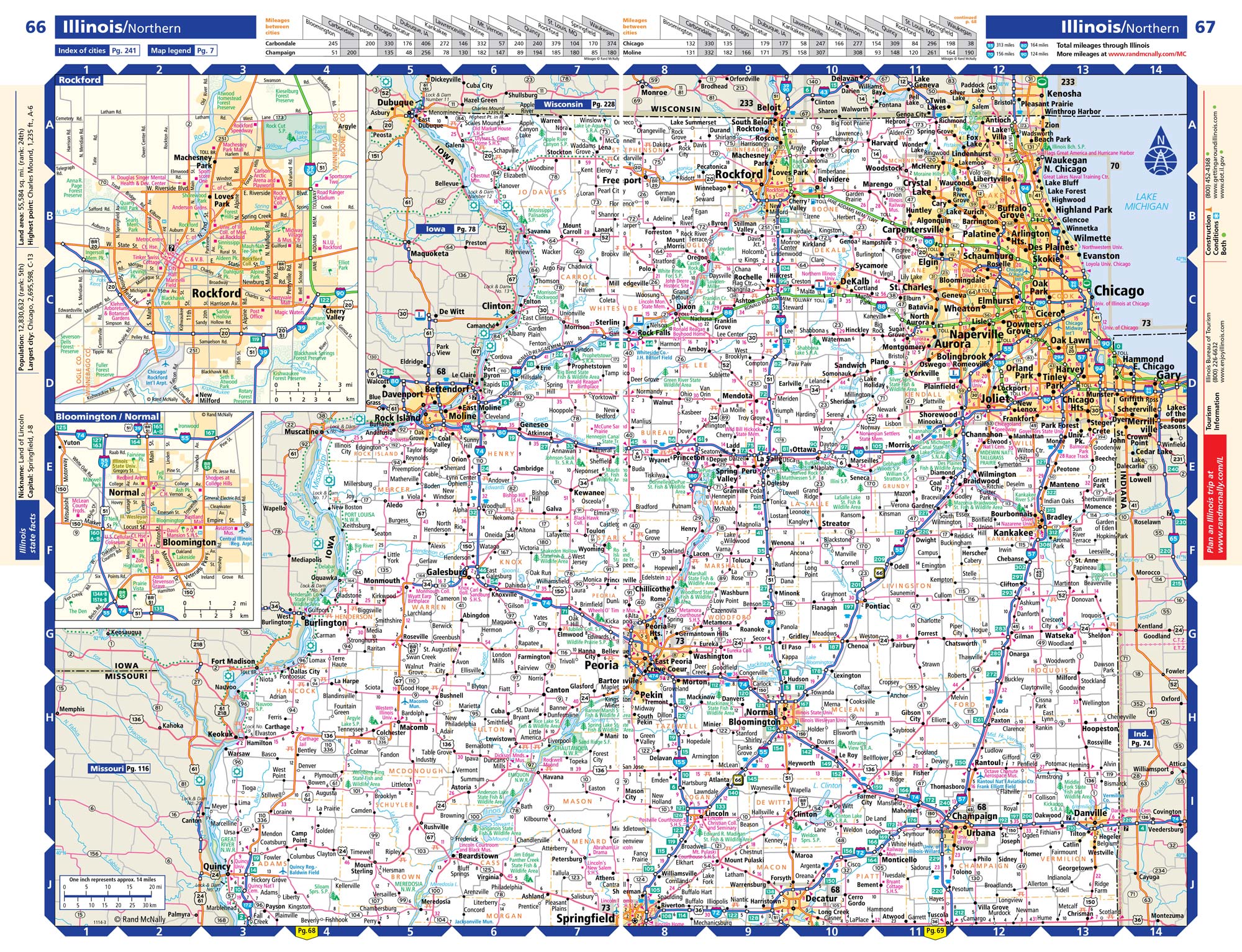
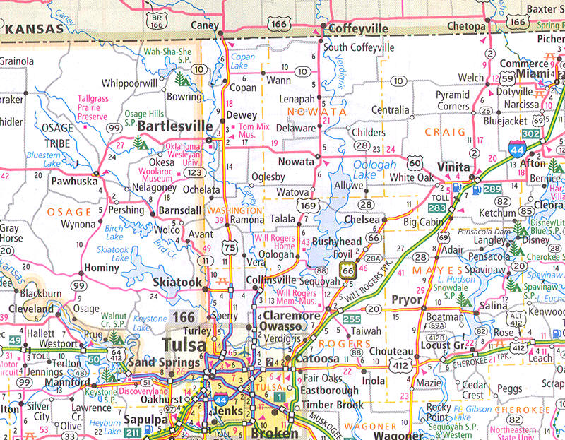
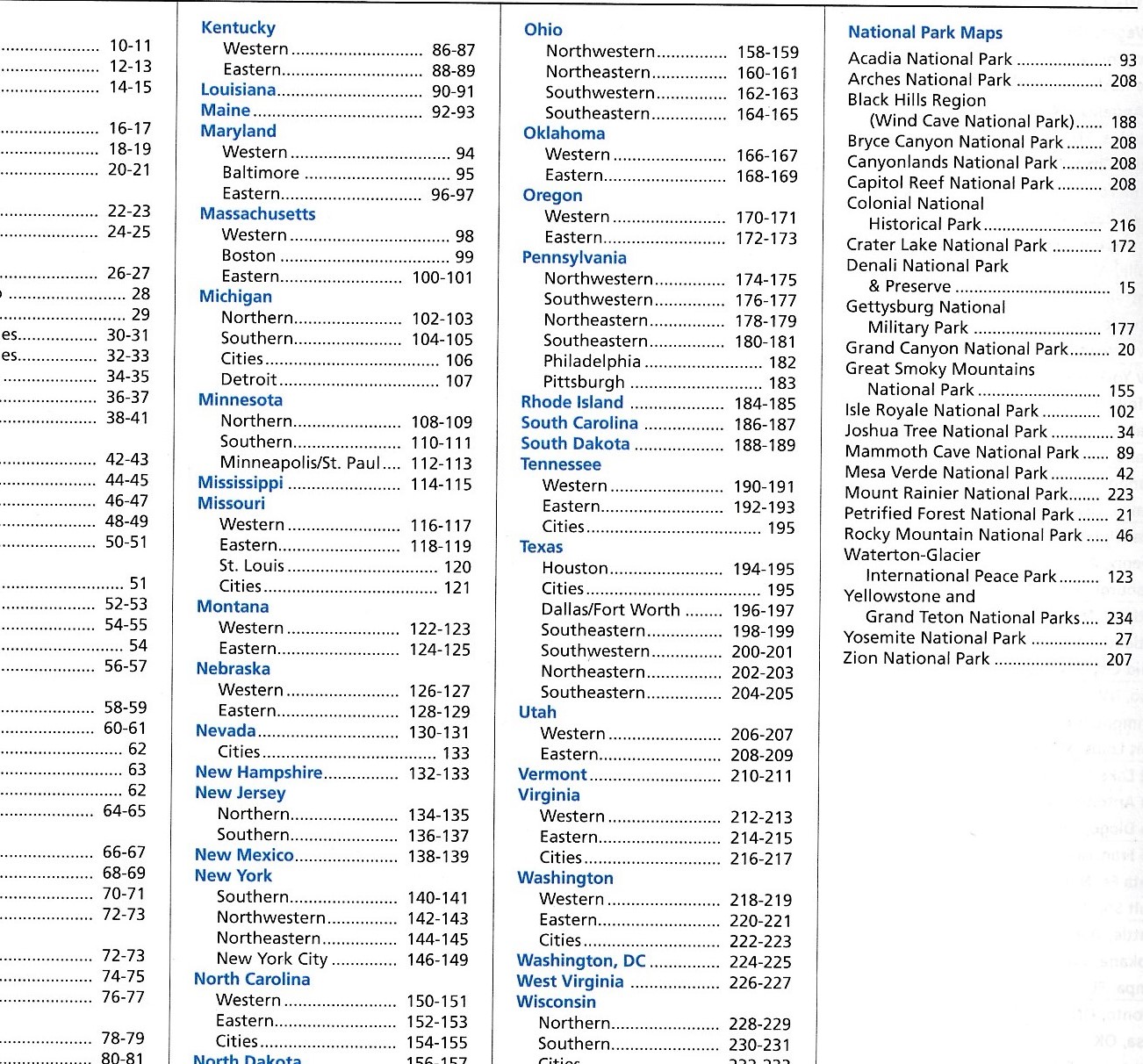
De beroemde wegenatlas van Rand McNally op groot formaat, bijna dubbel A4 én large scale, dus gedetailleerder kaartmateriaal dan andere Rand McNally atlassen. Elke staat een aantal pagina's. Uitgebreid register. Zoals de Amerikanen zelf zeggen: America's number 1 Road Atlas, maar dan gedetailleerder.
Met ringband!
LET OP: CANADA EN MEXICO STAAN NIET IN DEZE ATLAS!
- Best of the Road®—Our editor’s favorite road trips from our Best of the Road® collection follows scenic routes along stretches of coastline, both east and west, to forests mountains, and prairies; and through small towns and big cities. For a weekend or a week—there’s something for everyone.
- Tourism websites and phone numbers for every U.S. state and Canadian province on map pages
Reviews
Heel snel geleverd, en precies wat ik er van verwacht had. Overzichtelijk ingedeeld en gemakkelijk in gebruik.
★★★★★ door Rita 4 februari 2019Vond u dit een nuttige review? (login om te beoordelen)
Prachtige duidelijke atlas met alle wegen, stadsplattegronden, gebiedsomschrijvingen en zelfs campings/hotels staan aangegeven. Met deze atlas maak je een succes van je american dream!!
★★★★★ door Harm Esschendal 15 augustus 2018Vond u dit een nuttige review? (login om te beoordelen)
Zit nu in America (ik ben momenteel een rondreis door dit geweldige natuurrijke land aan het maken) en gebruik de atlas dagelijks ben er dan ook heel blij en tevreden mee. De wegenatlas voldoet precies aan mijn verwachtingen.
★★★★★ door Rob grootendorst 3 februari 2018Vond u dit een nuttige review? (login om te beoordelen)
Schrijf een review
Graag horen wij wat u van dit artikel vindt. Vindt u het goed, leuk, mooi, slecht, lelijk, onbruikbaar of erg handig: schrijf gerust alles op! Het is niet alleen leuk om te doen maar u informeert andere klanten er ook nog mee!
Ook interessant voor noord-amerika/verenigde-staten-van-amerika
-

Reisgids USA | Rough Guides
€ 31,95Reisgidsen Verenigde Staten van Amerika -

Wandkaart USA - Verenigde Staten pol
€ 28,95Wandkaarten van landen Verenigde Staten van Amerika -

Campinggids - Campergids Northern Ca
€ 22,50Campergidsen Californië -

Wandelgids Oregon Hiking | Moon Trav
€ 19,95Wandelgidsen Oregon -

Wegenkaart - landkaart Florida Keys
€ 13,95Wegenkaarten Florida