Wegenkaart - landkaart USA Verenigde Staten | ITMB (9781771298452)
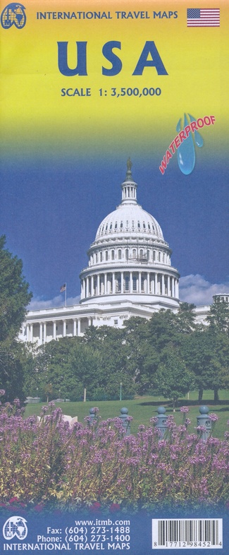
- ISBN / CODE: 9781771298452
- Schaal: 1:3500000
- Uitgever: ITMB
- Soort: Wegenkaart
- Taal: Engels
- Uitvoering: scheur- en watervast
- Schrijf als eerste een review
-
€ 13,95
Op voorraad. Voor 17.00 uur op werkdagen besteld, morgen in huis in Nederland Levertijd Belgie
Gratis verzending in Nederland vanaf €35,-
Beschrijving
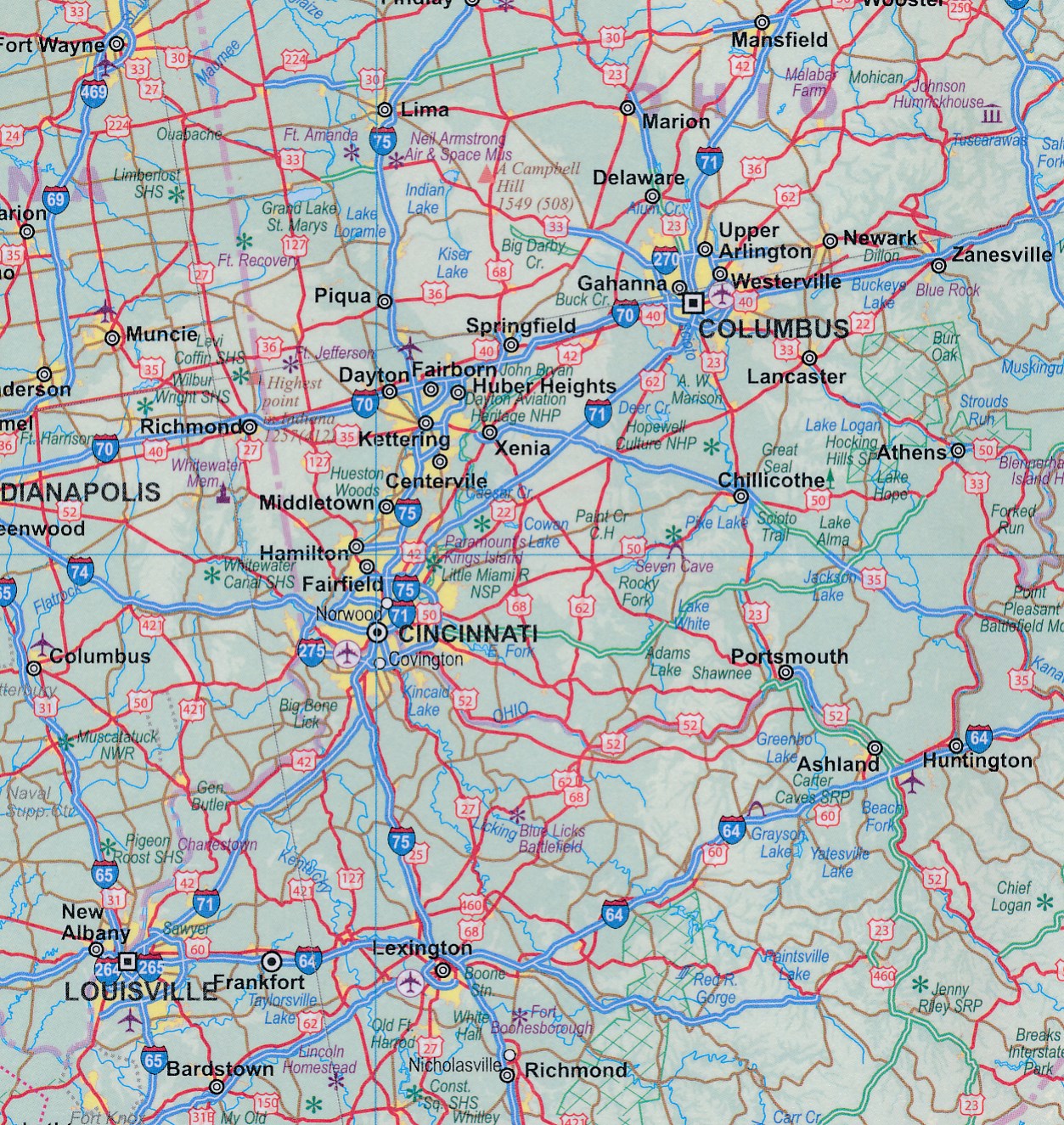
Een degelijke kaart met aanduidingen van o.a. nationale parken, vliegveld, benzinepomp, dirt-roads en kleine plattegrond van hoofdstad. Als overzichtskaart goed te gebruiken.
United States of America (USA) Travel Reference Map has been mapped before, but the USA is a huge country, extremely developed, and almost impossible to show on a map without over-simplification. Most commercial maps use small sheets of paper and print single-sided, making it impossible to show this vast country to advantage. Well, Lan’s been hard at work developing a ‘proper’ traveller’s aid to navigating around the USA, and here it is. We printed it on an exceptionally large sheet of paper, 39” tall by 54” wide (our normal printing size is 27”x39”). To do this, we merged our four existing databases into one, then split them so that the west side is on one side and the east side on the other. What results is a very large sheet, but a map at a VERY good scale. We were able to fit in 6,765 urban areas, all the Interstate motorways, major highways, state highways, pretty much all of the secondary highways, physical features, parks, historic/natural sites, battlefields, airports, dinosaur pits (yes, they exist), and so much more. This is a great map! As a country, the USA offers so much for visitors that it is one of the most-visited countries on earth. Now, finally, it has its own ITMB map. I never thought I’d see the day when I’d be writing such a press release! How far we’ve come in 30 years! Seriously, the USA NEEDS new maps to replace the rather staid and basic Rand-type of maps with a fresh approach. This is new, and hot off the press.
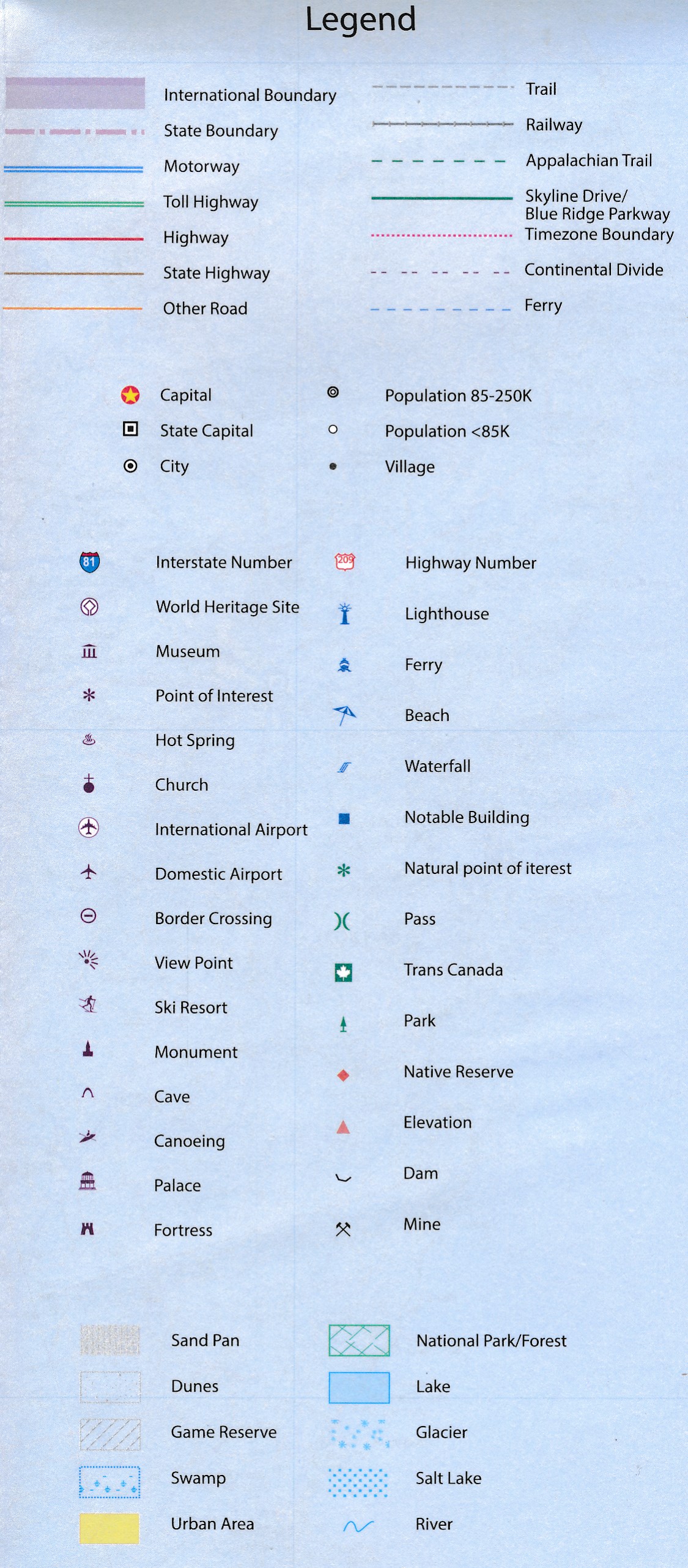
Legend Includes:
Roads by classification, borders, highways, world heritage sites, airports, point of interests, hot springs, museums, fishing, caves, lighthouses, water falls, beaches, parks, forests, lakes, and more.
Reviews
Geen reviews gevonden voor dit product.
Schrijf een review
Graag horen wij wat u van dit artikel vindt. Vindt u het goed, leuk, mooi, slecht, lelijk, onbruikbaar of erg handig: schrijf gerust alles op! Het is niet alleen leuk om te doen maar u informeert andere klanten er ook nog mee!
Ook interessant voor noord-amerika/verenigde-staten-van-amerika
-

Stadsplattegrond Boston | Borch
€ 10,25Stadsplattegronden Boston -

Wegenkaart - landkaart USA West - Ve
€ 13,95Wegenkaarten Verenigde Staten van Amerika -

Wandelgids Hawaii | Rother Bergverla
€ 18,50Wandelgidsen Hawaii -

Reisverhaal De wildernis in | Jon Kr
€ 17,50Reisverhalen Alaska -

Reisgids New Orleans | Rough Guides
€ 20,95Reisgidsen New Orleans