Winkelwagen
Geen items in winkelwagen
Ga naar winkelwagen
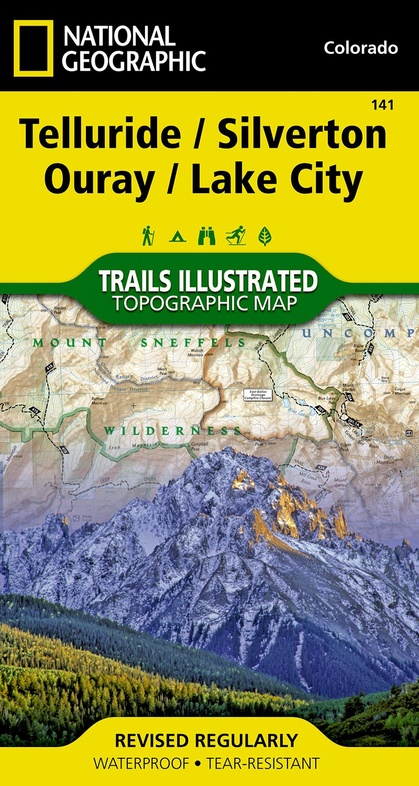
Wandelkaart - Topografische kaart 141 Telluride, Silverton, Ouray, Lake City | National Geographic (9781566953405)
Colorado
- ISBN / CODE: 9781566953405
- Schaal: 1:63360
- Uitgever: National Geographic
- Soort: Topografische kaart, Wandelkaart
- Taal: Engels
- Schrijf als eerste een review
-
€ 17,95
Dit artikel is (tijdelijk) niet leverbaar
-
Overzicht Wandelkaarten Colorado Trails Illustrated National Geographic
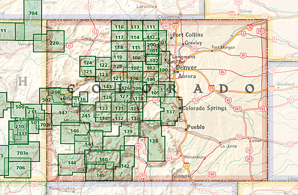
Producten op deze overzichtskaart:
Klik op een product om naar de pagina van dat product te gaan.
- Wandelkaart - Topografische kaart 110 Trails Illustrated Leadville Fairplay | National Geographic
- Wandelkaart - Topografische kaart 123 Trails Illustrated Flat Tops SE, Glenwood Canyon | National Geographic
- Wandelkaart - Topografische kaart 127 Trails Illustrated Aspen, Independence Pass | National Geographic
- Wandelkaart - Topografische kaart 139 Trails Illustrated La Garita, Cochetopa Hills | National Geographic
- Wandelkaart - Topografische kaart 141 Telluride, Silverton, Ouray, Lake City | National Geographic
- Wandelkaart - Topografische kaart 144 Durango, Cortez | National Geographic
- Wandelkaart - Topografische kaart 146 Uncompahgre Plateau South | National Geographic
- Wandelkaart - Topografische kaart 147 Uncompahgre Plateau North | National Geographic
- Wandelkaart 200 Rocky Mountain National Park | National Geographic
- Wandelkaart - Topografische kaart 208 Colorado National Monument | National Geographic
- Wandelkaart - Topografische kaart 245 Black Canyon of the Gunnison National Park | National Geographic
Overzichtskaarten
Beschrijving
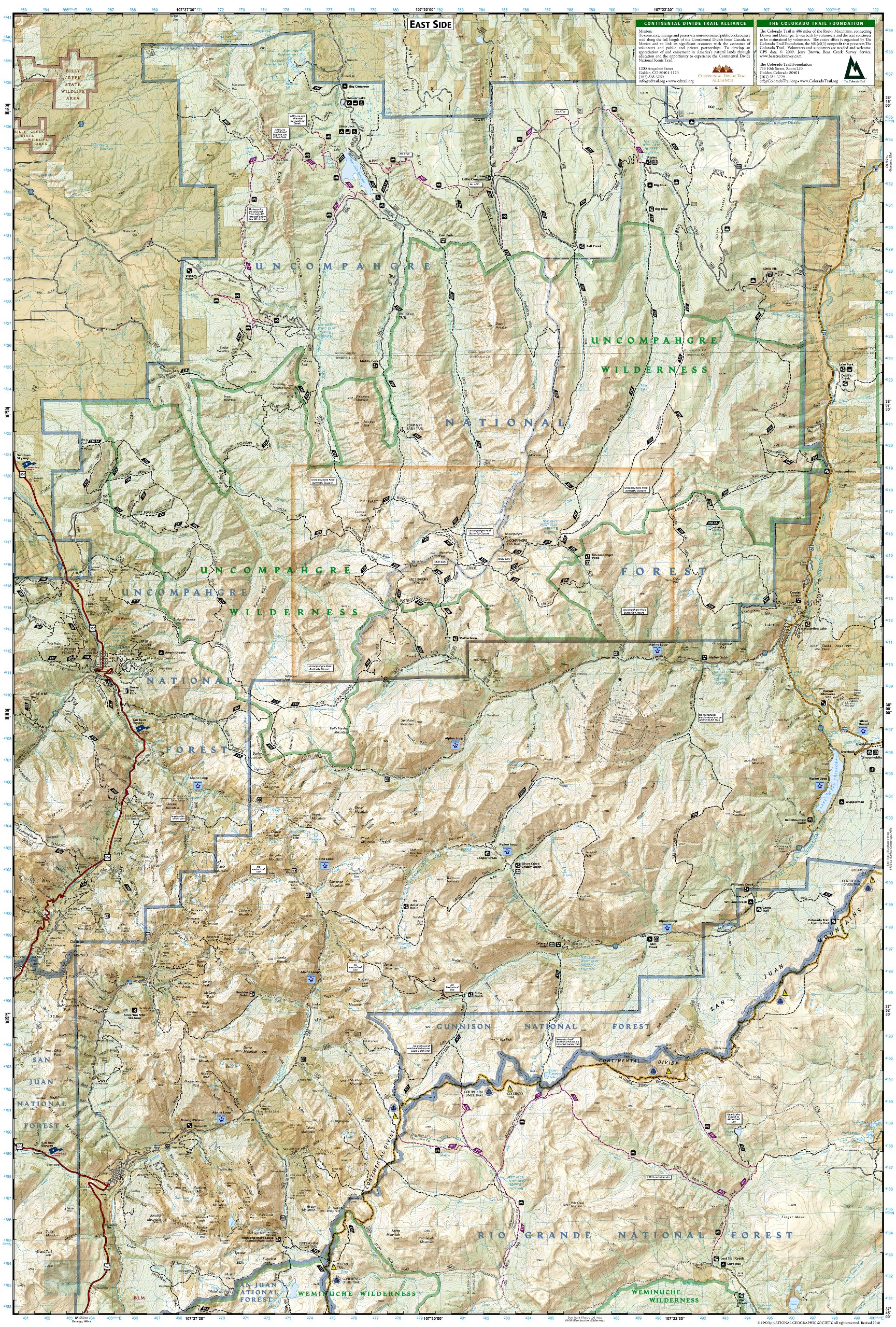
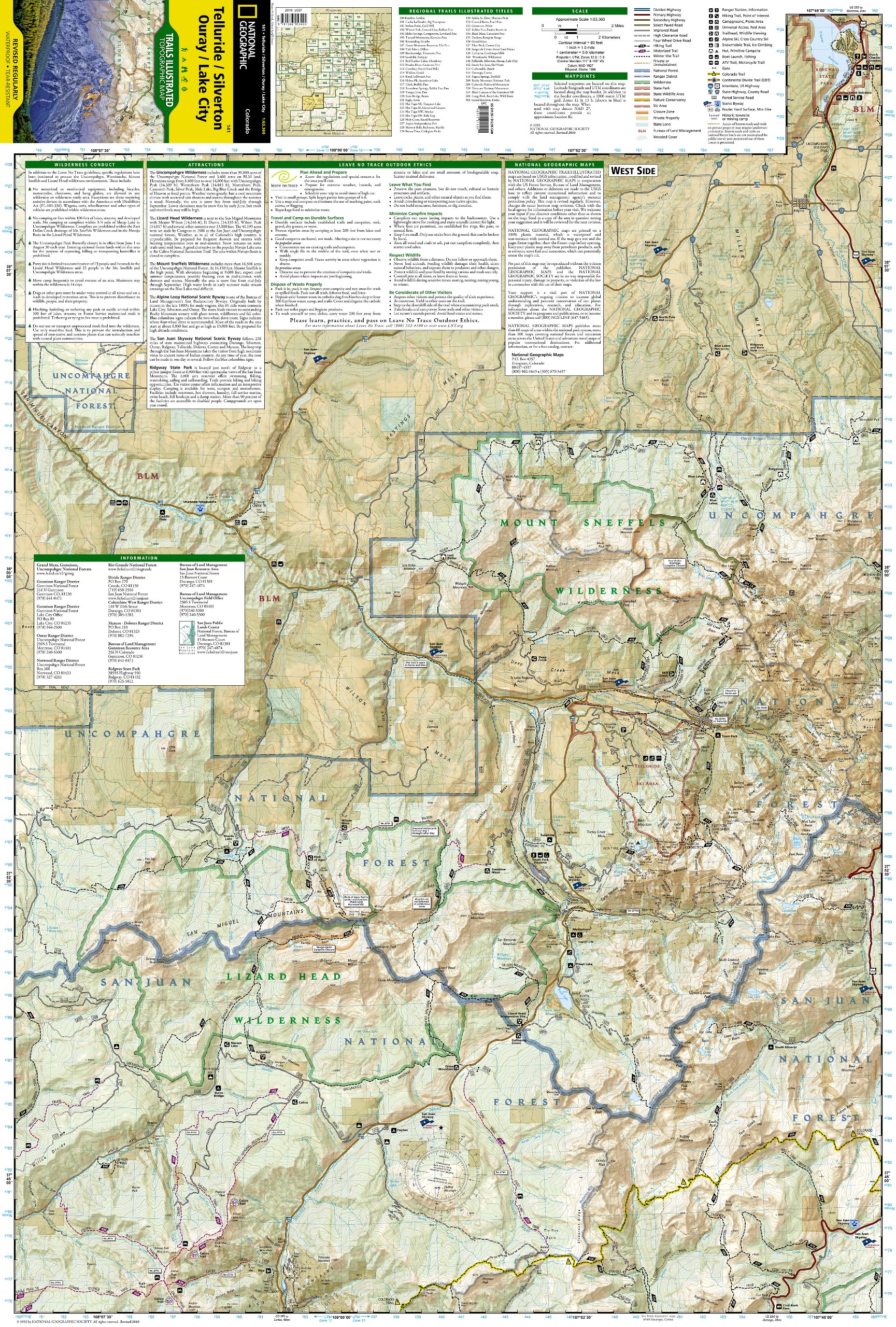
Prachtige geplastificeerde kaart van het bekende nationaal park. Met alle recreatieve voorzieningen als campsites, maar ook met topografische details en wandelroutes ed. Door uitgekiend kleurgebruik zeer prettig in gebruik. Scheur en watervast!
Beautiful waterproof and tear-resistant topographical hiking map of a well-loved National Park, with campsites and walking routes clearly marked. Coverage area includes parts of San Juan and Uncompahgre national forests; south San Juan Mountains; Lizard Head, Mt Sneffels and Uncompahgre wilderness areas; Calico National Recreation Trail; portions of the Colorado Trail; the trail networks at Coal Bank Pass and Silver Jack Reservoir; and the cities and surrounds of Telluride and Ouray. 14ers: Mt Wilson, El Diente Peak, Wilson Peak, Mt Sneffels, Uncompahgre Peak, Wetterhorn Peak, Redcloud Peak, Sunshine Peak. Includes UTM grids for use with your GPS unit.
Reviews
Geen reviews gevonden voor dit product.
Schrijf een review
Graag horen wij wat u van dit artikel vindt. Vindt u het goed, leuk, mooi, slecht, lelijk, onbruikbaar of erg handig: schrijf gerust alles op! Het is niet alleen leuk om te doen maar u informeert andere klanten er ook nog mee!
Alle gerelateerde rubrieken >
Ook interessant voor noord-amerika/verenigde-staten-van-amerika/nationale-parken
-

Reisgids Idaho | Moon Travel Guides
€ 27,50Reisgidsen Rocky Mountains -

Wandelkaart - Topografische kaart 24
€ 16,95Topografische kaarten Nationale Parken Verenigde Staten van Amerika -

Reisinspiratieboek The Parklands | G
€ 55,95Reisinspiratieboeken Nationale Parken Verenigde Staten van Amerika -

Campinggids - Campergids Camping Col
€ 20,95Campergidsen Rocky Mountains -

Natuurgids Adventure Set Grand Canyo
€ 18,50Natuurgidsen Nationale Parken Verenigde Staten van Amerika