Wandelkaart - Topografische kaart 147 Uncompahgre Plateau North | National Geographic (9781566955836)
Uncompahgre National Forest, Colorado
- ISBN / CODE: 9781566955836
- Schaal: 1:63360
- Uitgever: National Geographic
- Soort: Topografische kaart, Wandelkaart
- Taal: Engels
- Schrijf als eerste een review
-
€ 17,95
Dit artikel is (tijdelijk) niet leverbaar
-
Overzicht Wandelkaarten Colorado Trails Illustrated National Geographic
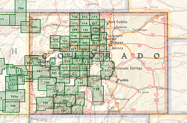
Producten op deze overzichtskaart:
Klik op een product om naar de pagina van dat product te gaan.
- Wandelkaart - Topografische kaart 110 Trails Illustrated Leadville Fairplay | National Geographic
- Wandelkaart - Topografische kaart 123 Trails Illustrated Flat Tops SE, Glenwood Canyon | National Geographic
- Wandelkaart - Topografische kaart 127 Trails Illustrated Aspen, Independence Pass | National Geographic
- Wandelkaart - Topografische kaart 139 Trails Illustrated La Garita, Cochetopa Hills | National Geographic
- Wandelkaart - Topografische kaart 141 Telluride, Silverton, Ouray, Lake City | National Geographic
- Wandelkaart - Topografische kaart 144 Durango, Cortez | National Geographic
- Wandelkaart - Topografische kaart 146 Uncompahgre Plateau South | National Geographic
- Wandelkaart - Topografische kaart 147 Uncompahgre Plateau North | National Geographic
- Wandelkaart 200 Rocky Mountain National Park | National Geographic
- Wandelkaart - Topografische kaart 208 Colorado National Monument | National Geographic
- Wandelkaart - Topografische kaart 245 Black Canyon of the Gunnison National Park | National Geographic
Overzichtskaarten
Beschrijving
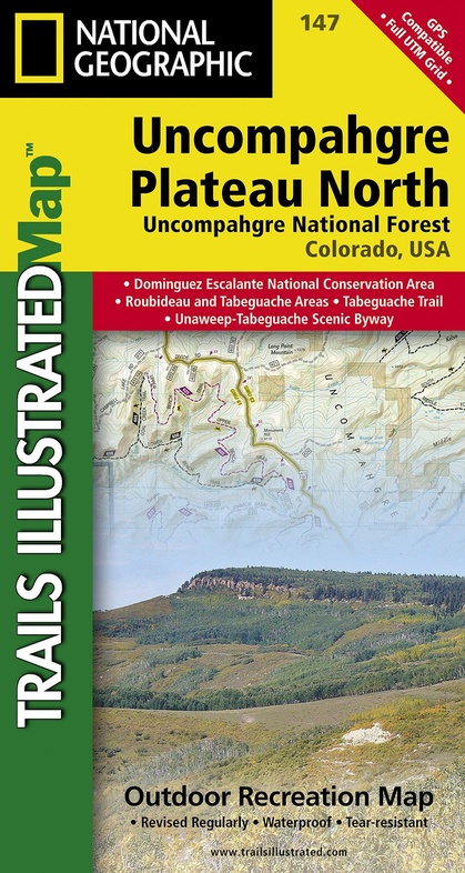
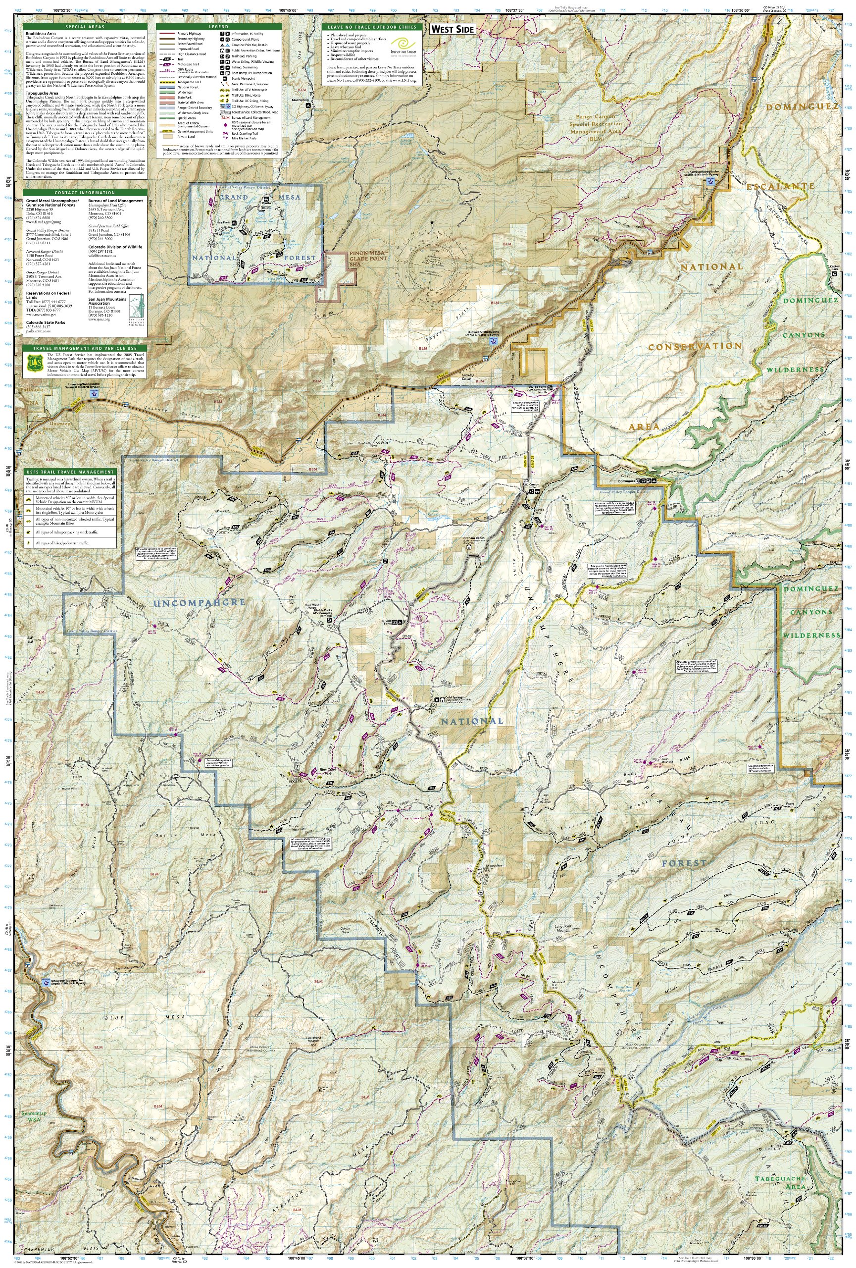
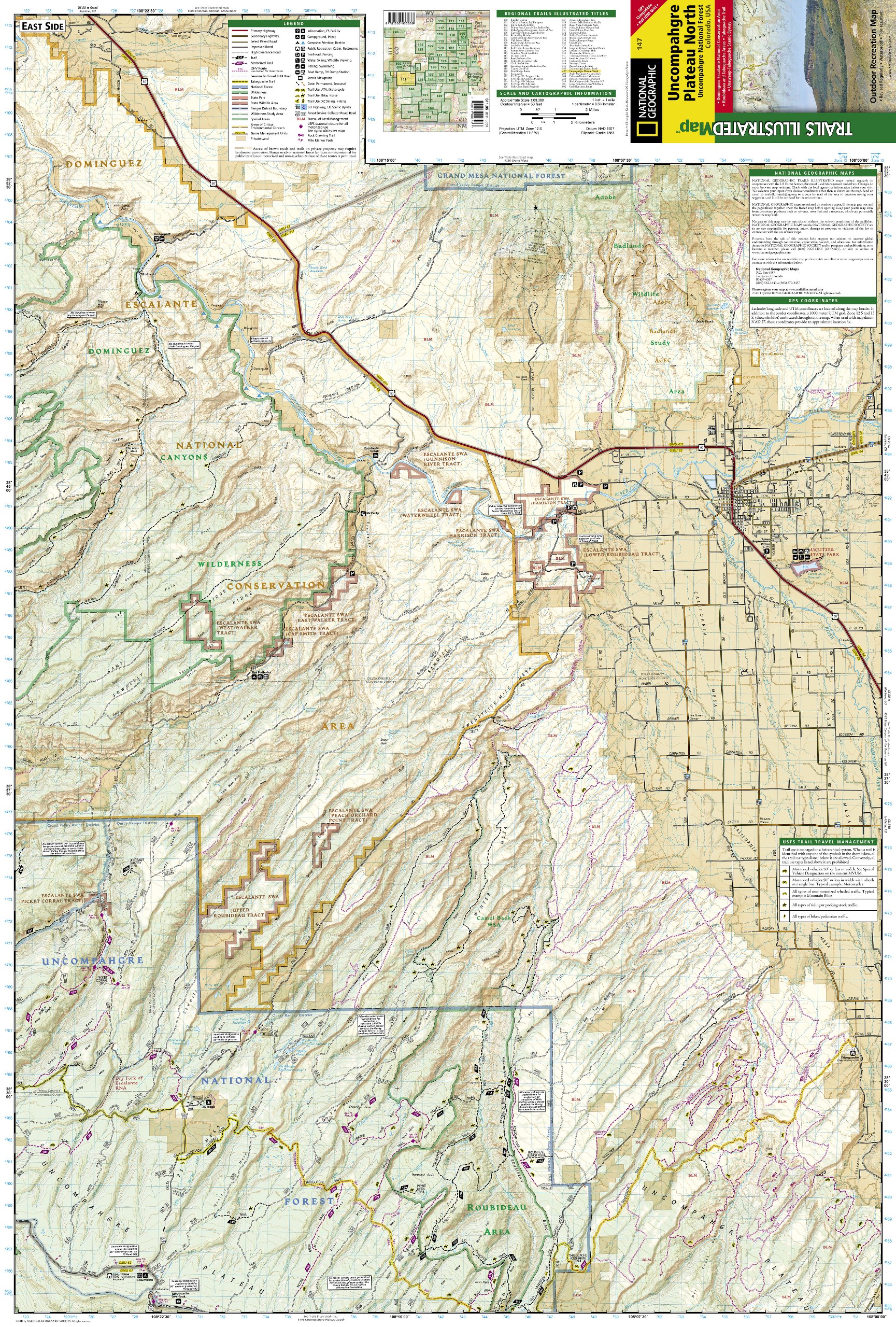
Prachtige geplastificeerde kaart van het bekende nationaal park. Met alle recreatieve voorzieningen als campsites, maar ook met topografische details en wandelroutes ed. Door uitgekiend kleurgebruik zeer prettig in gebruik. Scheur en watervast!
- Waterproof and tear-resistant
- Detailed road network and clearly marked trails for hiking, biking, horseback riding, skiing, ATV and more
- Detailed topography and clearly defined, color-coded boundaries of national forests, state parks, wilderness areas, and wildlife refuges
- Hundreds of points-of-interest, including trailheads, campgrounds, boat launches, fishing, ranger stations and more
- UTM and Latitude/Longitude grid, as well as selected waypoints and a scale bar for easy and accurate navigation.
- Useful information on United States Forest Service trail travel management and vehicle use
- Important contact information for local land management agencies
- Information on special areas including Roubideau Special Management Area and Tabeguache Area
Reviews
Geen reviews gevonden voor dit product.
Schrijf een review
Graag horen wij wat u van dit artikel vindt. Vindt u het goed, leuk, mooi, slecht, lelijk, onbruikbaar of erg handig: schrijf gerust alles op! Het is niet alleen leuk om te doen maar u informeert andere klanten er ook nog mee!
Ook interessant voor noord-amerika/verenigde-staten-van-amerika/nationale-parken
-

Natuurgids Adventure Set Yellowstone
€ 18,50Natuurgidsen Nationale Parken Verenigde Staten van Amerika -

Reisgids - Wandelgids Yellowstone &
€ 23,95Reisgidsen Nationale Parken Verenigde Staten van Amerika -

Reisinspiratieboek The Parklands | G
€ 55,95Reisinspiratieboeken Nationale Parken Verenigde Staten van Amerika -

Wandelkaart Lake Placid, High Peaks:
€ 16,95Wandelkaarten Nationale Parken Verenigde Staten van Amerika -

Wegenkaart - landkaart 06 Southwest,
€ 14,50Wegenkaarten Nationale Parken Verenigde Staten van Amerika