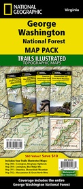
788,789,791,792 Topographic Map Guide George Washington Nat. Forest Map Pack | National Geographic (9781566958622)
- ISBN / CODE: 9781566958622
- Editie: 01-01-2020
- Aantal blz.: 1
- Schaal: 1:75000
- Uitgever: National Geographic
- Soort:
- Serie: Topographic Map Guide
- Taal: Engels
- Hoogte: 24.0 cm
- Breedte: 11.0 cm
- Gewicht: 401.0 g
- Uitvoering: Scheur- en watervast
- Bindwijze: -
- Schrijf als eerste een review
-
€ 54,95
Leverbaar in 3 - 5 werkdagen in huis in Nederland Levertijd Belgie
Gratis verzending in Nederland vanaf €35,-
Beschrijving
Van de uitgever
Explore the natural beauty, historical sites, and many recreation opportunities available in southern Virginia with National Geographic's Trails Illustrated Map Pack Bundle of Jefferson National Forest. Created in partnership with local land management agencies, these expertly researched maps deliver unmatched detail and helpful information for experienced outdoor enthusiasts and casual visitors alike. The Map Pack Bundle includes the Mount Rogers Recreation Area with coverage that extends from the border with Tennessee and North Carolina to the James River.
With miles of mapped trails including portions of the Appalachian Trail, these maps can guide you off the beaten path and back again in some of the most breathtaking scenery in the region. Extensive trail charts will help you choose a trail that's right for your activity level and recreation use whether you're hiking, horseback riding, or biking. The map base includes contour lines, shaded relief, and elevations for summits and passes.
Buy the Map Pack and save 15%!
The George Washington National Forest Map Pack includes:
Map 788 : Covington, Alleghany Highlands
Map 789 : Lexington, Blue Ridge Mountains
Map 791 : Staunton, Shenandoah Mountain
Map 792 : Massanutten and Great North Mountains
Every Trails Illustrated map is printed on "Backcountry Tough" waterproof, tear-resistant paper. A full UTM grid is printed on the map to aid with GPS navigation.
Reviews
Geen reviews gevonden voor dit product.
Schrijf een review
Graag horen wij wat u van dit artikel vindt. Vindt u het goed, leuk, mooi, slecht, lelijk, onbruikbaar of erg handig: schrijf gerust alles op! Het is niet alleen leuk om te doen maar u informeert andere klanten er ook nog mee!


