Wegenkaart - landkaart Purnululu National Park Map (The Bungle Bungle) | Hema Maps (9781865004914)
- ISBN / CODE: 9781865004914
- Schaal: 1:210000
- Uitgever: Hema Maps
- Soort: Wegenkaart
- Taal: Engels
- Schrijf als eerste een review
-
€ 13,50
Uitverkocht, nooit meer leverbaar
.gif)
Beschrijving
Detailkaart van een deel van Australië. Zeer goed leesbaar, met naast de topografische details veel symbolen waarmee allerhande toeristische zaken worden aangeduid als campsites, attracties, wandelmogelijkheden etc.
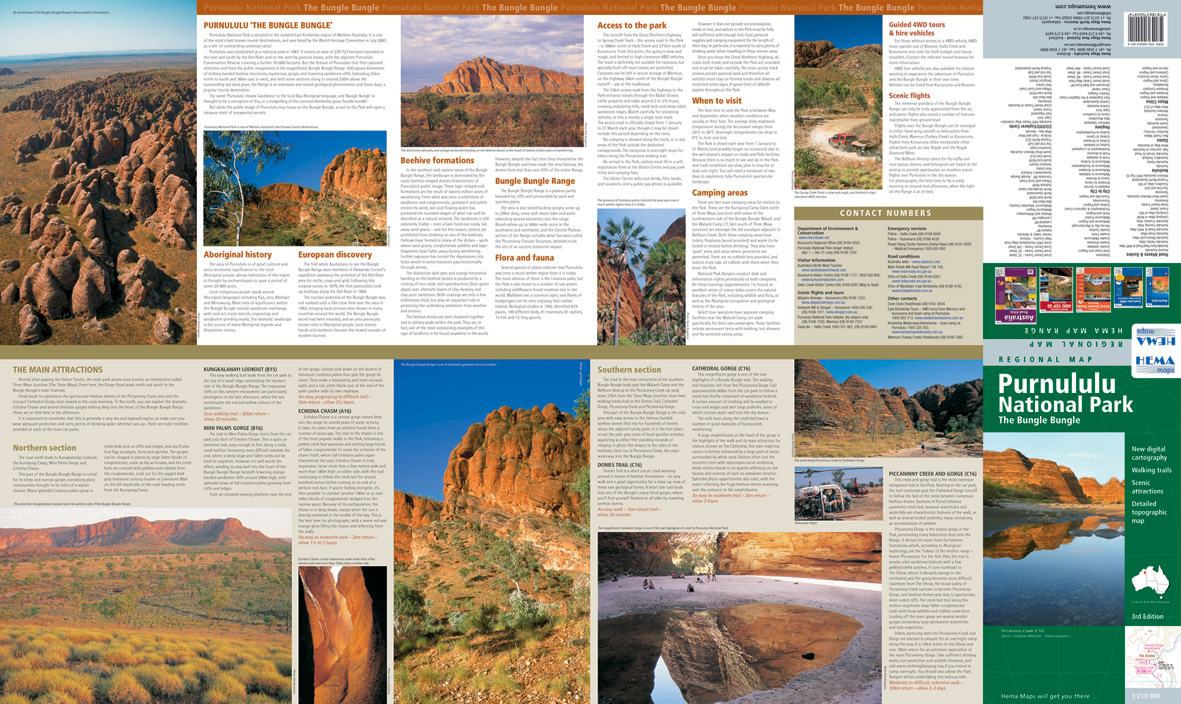
The Map gives a good indication as to the comprehensive way in which this project has been approached, with an excellent regional road map, showing roads, tracks, distances and facilities from Halls Creek to Wyndham. On the other side is a complete travel guide to the entire area, giving detailed information on particular features, all relevant contact numbers and some spectacular images, to wet the viewers appetite for what they are about to see.
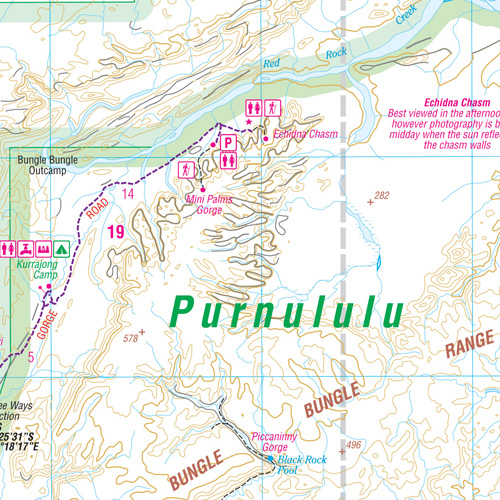
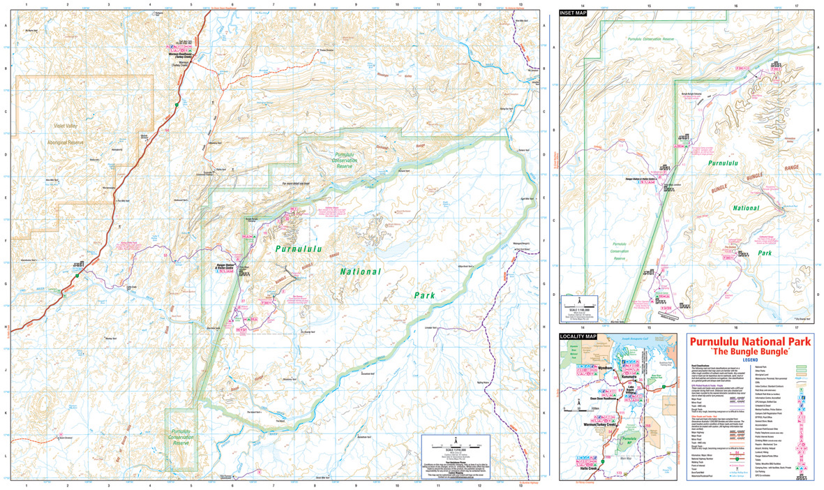
Detailed map of the national park with contours at 50m intervals and elevation colouring. The Bungle Bungle range in the centre of the park is shown enlarged to 1:100,000. The map shows local roads and 4WD tracks and highlights various facilities, including camping areas and caravan parks, general stores and eateries, fuels supplies, etc. Latitude/longitude grid is at intervals of 5’. Also included is a general map of the area showing access from regional highways and extensive notes on the park and its history.
Reviews
Geen reviews gevonden voor dit product.
Schrijf een review
Graag horen wij wat u van dit artikel vindt. Vindt u het goed, leuk, mooi, slecht, lelijk, onbruikbaar of erg handig: schrijf gerust alles op! Het is niet alleen leuk om te doen maar u informeert andere klanten er ook nog mee!
Ook interessant voor oceanie/australie/westernaustraliawestaustralie
-

Reisgids Experience West Coast Austr
€ 23,95Reisgidsen Western Australia - West Australië -

Reisgids PassePartout Australië – Ee
€ 24,50Reisgidsen South Australia - Zuid Australië -

Wegenkaart - landkaart Explorer Map
€ 13,95Wegenkaarten Western Australia - West Australië -

Wegenatlas West Australia - Road & 4
€ 38,95Wegenatlassen Western Australia - West Australië -

Wegenkaart - landkaart Planning Map
€ 8,95Wegenkaarten Western Australia - West Australië