North West England
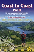 Wandelgids Coast to Coast Path: St Bees to Robin Hood's Bay | Trailblazer Guides
Goede wandelgids van de hele route van kust naar kust. Met veel details zijn alle etappes beschreven. Tevens informatie over overnachtingen en openbaar vervoer. All the information you need to …
★★★★★ Wegenkaart - landkaart 3 OS Road Map Southern Scotland & Northumberland | Ordnance Survey
Een serie uitstekende wegenkaarten van Ordnance survey, de topografische dienst van Engeland. Alle 8 delen kennen een schaal van 1:250.000. Het kleurgebruik is uitbundig maar niet storend; integendeel, de hoogtes …
★★★★★★★★★★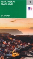 Wegenkaart - landkaart 4 OS Road Map Northern Engeland | Ordnance Survey
Een serie uitstekende wegenkaarten van Ordnance survey, de topografische dienst van Engeland. Alle 8 delen kennen een schaal van 1:250.000. Het kleurgebruik is uitbundig maar niet storend; integendeel, de hoogtes …
★★★★★★★★★★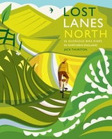 Fietsgids Lost Lanes North | Wild Things Publishing
Jack Thurston, best-selling author of the Lost Lanes series (50,000 sold) and presenter of the Bike Show, takes you on a freewheeling tour of the lost lanes and forgotten byways …
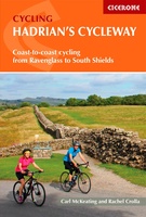 Fietsgids Hadrian's Cycleway | Cicerone
Hadrian's Cycleway is a 174 mile route from Ravenglass in Cumbria to South Shields. Also known as Route 72, this coast-to-coast route heads north up the Cumbrian coast to reach …
★★★★★ Spoorwegenkaart England North and Central Rail and Road | ITMB
This is a new title for ITMB, and continues our expanded coverage of the United Kingdom. Many publishers carry a map of Great Britain (or of the UK), and a …
 Reisgids PassePartout Eden Valley en Yorkshire Dales | Edicola
Dertig jaar geleden was de noordwestelijke Settle-Carlisle Railway nog ten dode opgeschreven. Tegenwoordig vervoert Engelands mooiste spoorlijn ieder jaar duizenden mensen door twee streken: de nog onontdekte Eden Valley met …
 Pelgrimsroute - Wandelgids The Two Saints Way | Northern Eye Books
An impressive guide book that coincides with the growing interest in pilgrimage as an aspect of ‘wellness’ tourism that benefits body, mind and spirit. The guide is packed with …
 Wandelgids The Ribble Way | Cicerone
The 72 mile (116km) Ribble Way is described in seven stages, ranging from 8.25 to 17 miles (13.3 to 27.4km). The route follows the Ribble valley, from the estuary mouth …
 Wandelgids Dales Way | Trailblazer Guides
The popular Dales Way long-distance footpath begins in Ilkley, West Yorkshire and runs for 84 miles (135km) to end in the Lake District, in Bowness-on-Windermere. It follows riverside paths along …
 Wandelgids Borders Abbeys Way | Rucksack Readers
The Borders Abbeys Way is one of Scotland's Great Trails, a fascinating circuit that takes in the historic ruined abbeys of Melrose, Dryburgh, Kelso and Jedburgh. Within its 68 miles …
 Fietskaart The C2C Cycle Route - Coast to Coast | Footprint maps
- Britains most popular loing distance route. - New clear mapping, based on OS data,ata a scale of 1:90 000 - Waterproof paper and compact size - Excellent value for …
 Fietsgids The Coast to Coast Cycle Route | Cicerone
This guidebook details the 137 mile sea-to-sea / C2C cycle route. This much loved short cycle tour across northern England takes you from Whitehaven or Workington on the west coast …
 Wandelgids 15 Short Walks Arnside and Silverdale | Cicerone
David Jordan has chosen 15 of the best short walks around Arnside and Silverdale for you to explore. Our guide comes with easy-to-read Ordnance Survey maps and clear route descriptions, …
 Wandelgids Friends Way 2 | Rucksack Readers
The Friends Way route will appeal not only to all Quakers who enjoy walking, but also to those walkers who don't yet know about Margaret Fell's remarkable story. This volume, …
 Wandelkaart The Coast to Coast Map Booklet | Cicerone
All the mapping you need to complete the 185-mile (296km) unwaymarked Coast to Coast Walk from St Bees in Cumbria to Robin Hood's Bay, North Yorkshire. This booklet of …
 Wandelkaart - Topografische kaart 315 OS Explorer Map Carlisle, Brampton, Longtown, Gretna Green | Ordnance Survey
Met zijn 4cm voor 1 km (2 ½ cm voor 1 mijl) schaal, is de OS Explorer kaartenserie de ideale en meest gedetailleerde kaartenreeks voor mensen die graag outdoor-activiteiten zoals …
★★★★★ Wandelkaart - Topografische kaart 324 OS Explorer Map Liddesdale, Kershope Forest | Ordnance Survey
Met zijn 4cm voor 1 km (2 ½ cm voor 1 mijl) schaal, is de OS Explorer kaartenserie de ideale en meest gedetailleerde kaartenreeks voor mensen die graag outdoor-activiteiten zoals …
 Wandelkaart - Topografische kaart 275 OS Explorer Map Liverpool St Helens, Widnes & Runcorn | Ordnance Survey
Met zijn 4cm voor 1 km (2 ½ cm voor 1 mijl) schaal, is de OS Explorer kaartenserie de ideale en meest gedetailleerde kaartenreeks voor mensen die graag outdoor-activiteiten zoals …
 Wandelkaart - Topografische kaart 276 OS Explorer Map Bolton Central, Wigan & Warrington | Ordnance Survey
Met zijn 4cm voor 1 km (2 ½ cm voor 1 mijl) schaal, is de OS Explorer kaartenserie de ideale en meest gedetailleerde kaartenreeks voor mensen die graag outdoor-activiteiten zoals …
Laatste reviews

Zoals altijd een prima gids van Cicerone, in feite onmisbare gids voor hiken in dit gebied. De gids bevat verschillende dagtochten van ± 1 tot …
★★★★★ door Pieter Boddaert 16 mei 2024 | Heeft dit artikel gekocht
Heel blij met de kaart geweest, uiteindelijk wel 5 keer per dag in handen gehad tijdens mijn tocht. Gebruikersvriendelijk en dankzij platsificeering ook uiterst geschickt …
★★★★★ door Jasmin 16 mei 2024 | Heeft dit artikel gekocht
Snelle levering
★★★★★ door Pierre 16 mei 2024 | Heeft dit artikel gekocht
Snelle levering
★★★★★ door Pierre Dilissen 16 mei 2024 | Heeft dit artikel gekocht