Wandelgidsen - South East England
 Wandelgids Capital Ring | Aurum Press
The Capital Ring is a 78-mile (125 km) walking route encircling inner London that links the astonishing number of islands of green space - parks, woodlands, abandoned railway lines, towpaths …
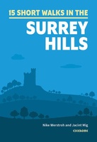 Wandelgids 15 Short Walks in the Surrey Hills | Cicerone
Our authors have chosen 15 of the best short walks around the Surrey Hills for you to explore. Our guide comes with easy-to-read Ordnance Survey maps and clear route descriptions, …
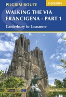 Wandelgids Via Francigena Pilgrim Route Part 1 | Cicerone
The 2000km Via Francigena from Canterbury to Rome is one of the world's great pilgrim routes, with a history spanning well over a millennium. This guide describes the first section, …
 Wandelgids 72 Pathfinder Guides The Home Counties from London by Train | Ordnance Survey
The all-revised edition contains 27 carefully selected walks, all chosen to be easily accessible from London's main railway stations. The routes lie across Essex, Bedfordshire, Oxfordshire, Surrey, West Sussex, East …
 Wandelgids Park Rangers Favourite Walks South Downs | Collins
Compacte wandelgids met 20 wandelingen geselecteerd door park rangers en met duidelijke beschrijvingen en routekaartjes. Walking guide to the South Downs National Park, with 20 best routes chosen by …
 Wandelgids 25 Pathfinder Guides Thames Valley and Chilterns | Ordnance Survey
Wandelgids van een deel van Engeland, Schotland of Wales. Deze gids bevat 28 dagwandelingen, variërend van korte tochten tot pittige dagtochten. De bijbehorende kaarten zijn uitstekend: men heeft de topografische …
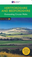 Wandelgids 54 Pathfinder Guides Hertfordshire and Bedfordshire | Ordnance Survey
Wandelgids van een deel van Engeland, Schotland of Wales. Deze gids bevat 28 dagwandelingen, variërend van korte tochten tot pittige dagtochten. De bijbehorende kaarten zijn uitstekend: men heeft de topografische …
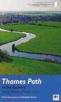 Wandelgids Thames Path | Aurum Press
Een mooie wandelgids met een goede beschrijving en hele duidelijke kaarten met ingetekende route. The official guide to the riverside path from its Gloucestershire source all the way to the …
 Wandelgids The Ridgeway | Cicerone
Uitstekende wandelgids van de Ridgeway, waarbij naast alle noodzakelijke informatie ook gebruik gemaakt wordt van de echte topografische kaart. Inclusief gidsje met routekaarten van 1:25000 This guidebook - which …
 Wandelgids Walking the North Downs Way Map Booklet | Cicerone
All the mapping you need to walk the 130 mile (208km) North Downs Way National Trail between Farnham and Dover. One of the easier National Trails, it can be comfortably …
 Wandelgids Thames Path | Trailblazer Guides
This book follows the Thames Path National Trail from the river's source in Gloucestershire to the Thames Barrier in London. Officially 184 miles (294km) in length (although the actual distance …
 Wandelgids 66 Pathfinder Guides West Sussex and the South Downs National Park | Ordnance Survey
Wandelgids van een deel van Engeland. Deze gids bevat 28 dagwandelingen, variërend van korte tochten tot pittige dagtochten. De bijbehorende kaarten zijn uitstekend: men heeft de topografische kaarten van Ordnance …
Laatste reviews

Duidelijke kaart, ook met kleinere wegen. Snelle levering
★★★★★ door Ger Sulkers 02 mei 2024 | Heeft dit artikel gekocht
Ja wij zijn tevreden, alleen is mijn vriendin het boekje al kwijtgeraakt bij onze eerste wandeling.🙁
★★★★★ door Mark 02 mei 2024 | Heeft dit artikel gekocht
Ja ik ben dik tevreden over de wegenkaart van Kazachstan. Stond alles op wat ik wou dus heel erg tevreden daarover.
★★★★★ door Sjoerd Westra 02 mei 2024 | Heeft dit artikel gekocht
Zoals altijd mooie verzorgde kaarten die tijdens de reis van pas komen en achteraf mooie herinneringen oproepen.
★★★★★ door Klaas Wijnberg 02 mei 2024 | Heeft dit artikel gekocht