Wandelkaarten - Noord-Amerika
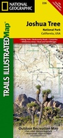 Wandelkaart - Topografische kaart 226 Joshua Tree National Park | National Geographic
Prachtige geplastificeerde kaart van het bekende nationaal park. Met alle recreatieve voorzieningen als campsites, maar ook met topografische details en wandelroutes ed. Door uitgekiend kleurgebruik zeer prettig in gebruik. Scheur …
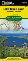 Wandelkaart - Topografische kaart 803 Lake Tahoe Basin | National Geographic
Prachtige geplastificeerde kaart van het bekende nationaal park. Met alle recreatieve voorzieningen als campsites, maar ook met topografische details en wandelroutes ed. Door uitgekiend kleurgebruik zeer prettig in gebruik. Scheur …
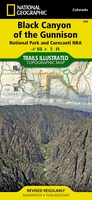 Wandelkaart - Topografische kaart 245 Black Canyon of the Gunnison National Park | National Geographic
Prachtige geplastificeerde kaart van het bekende nationaal park. Met alle recreatieve voorzieningen als campsites, maar ook met topografische details en wandelroutes ed. Door uitgekiend kleurgebruik zeer prettig in gebruik. Scheur …
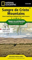 Wandelkaart 138 Trails Illustrated Great Sand Dunes National Park: | National Geographic
Prachtige geplastificeerde kaart van het bekende nationaal park. Met alle recreatieve voorzieningen als campsites, maar ook met topografische details en wandelroutes ed. Door uitgekiend kleurgebruik zeer prettig in gebruik. Scheur …
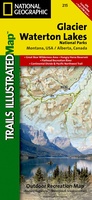 Wandelkaart - Topografische kaart 215 Glacier - Waterton Lakes National Park | National Geographic
Prachtige geplastificeerde kaart van het bekende nationaal park. Met alle recreatieve voorzieningen als campsites, maar ook met topografische details en wandelroutes ed. Door uitgekiend kleurgebruik zeer prettig in gebruik. Scheur …
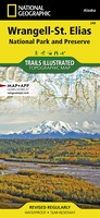 Wandelkaart 249 Wrangell and St.Elias National Park | National Geographic
Prachtige geplastificeerde kaart van het bekende nationaal park. Met alle recreatieve voorzieningen als campsites, maar ook met topografische details en wandelroutes ed. Door uitgekiend kleurgebruik zeer prettig in gebruik. Scheur …
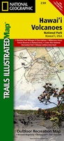 Wandelkaart 230 Hawaii Volcanoes National Park | National Geographic
Prachtige geplastificeerde kaart van het bekende nationaal park. Met alle recreatieve voorzieningen als campsites, maar ook met topografische details en wandelroutes ed. Door uitgekiend kleurgebruik zeer prettig in gebruik. Scheur …
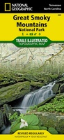 Wandelkaart 229 Great Smoky Mountains National Park | National Geographic
Prachtige geplastificeerde kaart van het bekende nationaal park. Met alle recreatieve voorzieningen als campsites, maar ook met topografische details en wandelroutes ed. Door uitgekiend kleurgebruik zeer prettig in gebruik. Scheur …
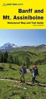 Wandelkaart 05 Banff National Park and Mt. Assiniboine | Gem Trek Maps
This map covers the most popular hiking and mountain biking terrain in Banff National Park, from Lake Louise in the north to the south end of Banff National Park, plus …
★★★★★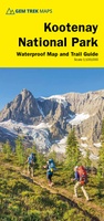 Wandelkaart 10 Kootenay National Park | Gem Trek Maps
This map covers all of Kootenay National Park, from Castle Mountain Junction south through Radium, to Windermere. All the official hiking and mountain biking trails in Kootenay National Park …
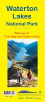 Wandelkaart 16 Waterton Lakes NP | Gem Trek Maps
The Waterton Lakes National Park map is one of our most popular trail map-guides for the Canadian Rockies. This map covers all of Waterton Lakes National Park, the eastern end …
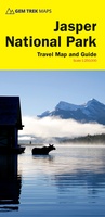 Wegenkaart - landkaart - Wandelkaart Jasper National Park (Alberta) | Gem Trek Maps
Waterproof and tear-resistant map for Jasper National Park in the Canadian Rockies. Whether you are a first-time visitor or a long-time local, you’ll find Gem Trek’s Jasper National Park …
 Wandelkaart Touring Maps Route 66 | Collins
Full color, informative map of the famous US Route 66. With detailed mapping, key tourist information and a suggested itinerary, this is a perfect guide for anyone traveling along America’s …
 Fietskaart - Wandelkaart North & West Vancouver Biking Hiking | ITMB
Dubbelzijge wandel- en fietskaart van Vanvouver en omgeving. Schaal Vancouver 1:20.000 Omgeving 1:55.000
 Wandelkaart Yosemite & Central California | ITMB
The USA is blessed with many wonderful parks, forests, and natural monuments that have been preserved for all to enjoy. The second most-visited national park (after Yellowstone) is Yosemite (pronounced …
 Wandelkaart Colorado Day Hikes | Waterford Press
Central Colorado is known as the gateway to the nearby Rocky Mountains, but there are many attractions and beautiful hikes within driving distance of some of the major urban areas …
Laatste reviews

Duidelijke kaart, ook met kleinere wegen. Snelle levering
★★★★★ door Ger Sulkers 02 mei 2024 | Heeft dit artikel gekocht
Ja wij zijn tevreden, alleen is mijn vriendin het boekje al kwijtgeraakt bij onze eerste wandeling.🙁
★★★★★ door Mark 02 mei 2024 | Heeft dit artikel gekocht
Ja ik ben dik tevreden over de wegenkaart van Kazachstan. Stond alles op wat ik wou dus heel erg tevreden daarover.
★★★★★ door Sjoerd Westra 02 mei 2024 | Heeft dit artikel gekocht
Zoals altijd mooie verzorgde kaarten die tijdens de reis van pas komen en achteraf mooie herinneringen oproepen.
★★★★★ door Klaas Wijnberg 02 mei 2024 | Heeft dit artikel gekocht