British Columbia
 Wandelkaart 01 Jasper National Park & Maligne Lake | Gem Trek Maps
Scheur- en Watervast papier Gem Trek’s JASPER AND MALIGNE LAKE MAP map is designed for outdoor enthusiasts looking to explore the section of Jasper National Park near the town and …
★★★★★ Wandelkaart 13 Best of Lake Louise Map and Guide | Gem Trek Maps
Mooie, gedetailleerde kaart uit de serie van Gem Trek Hiking map-guides, van het gebied Lake Louise. Helder kleurgebruik en met de beste / mooiste wandelroutes, hikes, fietsroutes, autoroutes en interessante …
★★★★★ Wegenkaart - landkaart British Columbia | ITMB
Wegenkaart van alleen British Columbia. Calgary in het oosten staat er nog net op. Met campsites, register en nationale parken. This is our eight printing of our most popular provincial …
★★★★★ Wegenkaart - landkaart Sunshine Coast - British Columbia | ITMB
Mooi autokaart in overzichtelijke kleur van ITMB. Indexed. English text and legends. The coastline of Canada’s British Columbia is long and varied. The best-known portion is the part just north …
★★★★★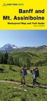 Wandelkaart 05 Banff National Park and Mt. Assiniboine | Gem Trek Maps
This map covers the most popular hiking and mountain biking terrain in Banff National Park, from Lake Louise in the north to the south end of Banff National Park, plus …
★★★★★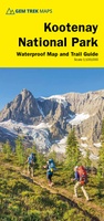 Wandelkaart 10 Kootenay National Park | Gem Trek Maps
This map covers all of Kootenay National Park, from Castle Mountain Junction south through Radium, to Windermere. All the official hiking and mountain biking trails in Kootenay National Park …
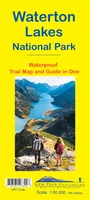 Wandelkaart 16 Waterton Lakes NP | Gem Trek Maps
The Waterton Lakes National Park map is one of our most popular trail map-guides for the Canadian Rockies. This map covers all of Waterton Lakes National Park, the eastern end …
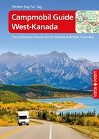 Reisgids Campmobil West-Kanada - Canada | Vistapoint
Die Routen: Die 15 in diesem Reiseführer vorgestellten, für Wohnmobilfahrer optimierten Routen durch West-Kanada geben einen detaillierten Überblick über die unterschiedlichen Landschaften, Sehenswürdigkeiten und Freizeitmöglichkeiten, die den Reisenden entlang der …
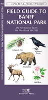 Vogelgids - Natuurgids Field guide to Banff National Park Wildlife | Waterford Press
Een bijzonder handige uitklapkaart met alle veelvoorkomende dieren en planten van Banff National Park. Duidelijke illustraties, goede korte omschrijving van soort en leefgebied, geplastificeerd. This fold-up, laminated card …
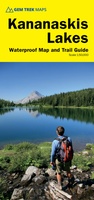 Wandelkaart 07 Kananaskis Lakes | Gem Trek Maps
This map covers what some say is the most scenic terrain in all of Kananaskis Country - the upper Smith-Dorrien-Spray Trail south of Mt. Shark, Peter Lougheed Provincial Park including …
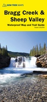 Wandelkaart 08 Bragg Creek and Sheep Valley | Gem Trek Maps
Gem Trek’s BRAGG CREEK & SHEEP VALLEY MAP is for hikers and outdoor enthusiasts looking to explore Kananaskis Country west and south of Bragg Creek. Whether you are touring along …
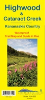 Wandelkaart 09 Highwood & Cataract Creek | Gem Trek Maps
Gedetailleerde kaart van dit prachtige gebied; deze kaart is geplastificeerd, scheur- en watervast. Gem Trek’s Highwood & Cataract Creek map meets the needs of visitors looking to explore the southern …
 Wandelkaart 11 Banff Up-Close | Gem Trek Maps
Gem Trek Map-Guides Banff Up-Close (11) - This map-and-guide-in-one is designed for people who are only going to be in Banff for one to three days, and want to …
 Wandelkaart 06 Canmore & Kananaskis Village | Gem Trek Maps
This map covers some of the most popular terrain for hikers and mountain bikers in Kananaskis Country - Bow Valley Provincial Park, the Canmore area, the Smith-Dorrien/Spray Lakes area south …
 Wandelkaart 14 Lake O'Hara | Gem Trek Maps
Mooie, gedetailleerde kaart uit de serie van Gem Trek Hiking map-guides, van het gebied Lake O'Hara. This is a detailed map of the Lake O'Hara area. On the front …
 Wegenkaart - landkaart - Wegenatlas Pan-Americana North | ITMB
Wegenatlas - A5 formaat - verschillende schalen - voor de het Noord-Amerikaanse gedeelte van de Pan-Americana ( Pan-American Highway ) van Alaska langs the Pacific kust van British Colombia in …
★★★★★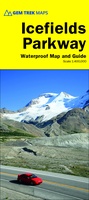 Wegenkaart - landkaart Icefields Parkway | Gem Trek Maps
Whether you have a day or a week to spend exploring the sights along the spectacular Icefields Parkway highway, Gem Trek's ICEFIELDS PAKRWAY MAP, a combination map and guide, will …
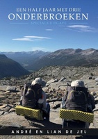 Reisverhaal Een half jaar met drie onderbroeken | André de Jel, Lian de Jel
“Een schitterend, indrukwekkend verhaal. Een prachtig boek om te lezen voor mensen die van uitdagingen houden. “De ultieme uitdaging” had ook een mooie titel voor dit boek kunnen zijn” J. …
★★★★★★★★★★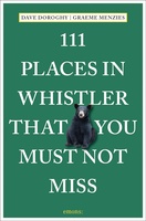 Reisgids 111 places in Places in Whistler That You Must Not Miss | Emons
The ultimate insider's guide to Whistler Features interesting and unusual places not found in traditional travel guides Part of the international 111 Places/Shops series with over 650 titles and 3.8 …
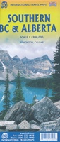 Wegenkaart - landkaart Southern Alberta & Southern British Columbia | ITMB
ITMB, being based in Vancouver, BC, understandably has a local/regional market for our map line. We have a map of Western Canada, as well as an atlas, a very nice …
★★★★★
Laatste reviews

Niet echt voor beginners. Ook zijn de routes soms moeilijk qua logistiek. Weer terugkomen aan het eind bv. En in voorseizoen (mei) blijft er niet …
★★★★★ door Tjeerd 17 mei 2024 | Heeft dit artikel gekocht
Van te voren had ik een andere kaart op het oog. Toen ik in de winkel was adviseerde zij mij deze kaart. Op hun verzoek …
★★★★★ door Koen 17 mei 2024 | Heeft dit artikel gekocht
Ideale schaal waar ook de kleinere wegen duidelijk zijn aangegeven. Beschrijving op website is correct.
★★★★★ door Peter 16 mei 2024 | Heeft dit artikel gekocht
Overzichtelijke kaart. Niks op aan te merken.
★★★★★ door Bastiaan de Leeuw 16 mei 2024 | Heeft dit artikel gekocht