Collins
Maak je reis compleet met de handige reisgidsen en wegenkaarten van Collins
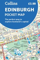 Stadsplattegrond Pocket Map Edinburgh | Collins
Handy little full colour map of central Edinburgh with a high level of detail. Clear mapping from Leith in the north to The Meadows in the south, and Edinburgh Zoo …
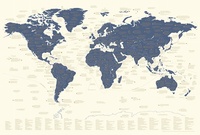 Wereldkaart Explorer's Map | 67 x 99 cm | Collins
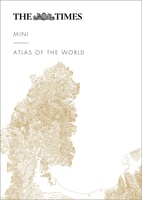 Atlas The Times Mini Atlas of the World | Collins
De kleinste uitvoering van de beste atlas ter wereld! Ook deze mini uitvoering is mooi van kleur en uiterlijk: een leuke kado voor een schappelijke prijs. A pocket-sized Times Atlas …
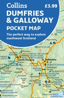 Wegenkaart - landkaart Pocket Map Dumfries & Galloway | Collins
Handy little full colour map of Dumfries & Galloway. Main features of this map include: • Clear mapping • Main tourist attractions located and described • Ideal for touring …
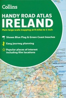 Wegenatlas Handy Road Atlas Ireland - Ierland | Collins
Handzame wegenatlas op A5 formaat van Ierland. Vrij grove schaal maar heel handig door formaat en goed kaartbeeld. Met enkele stadsplattegronden en een paar pagina's met hoogtepunten van het land. …
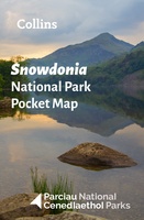 Wegenkaart - landkaart National Park Pocket Map Snowdonia | Collins
Duidelijke pocket wandelkaart met belangrijke toeristische informatie, bezienswaardigheden, campeerplekken e.d. Handy little full colour map and guide of Snowdonia National Park. Detailed mapping and visitor information to the National …
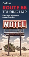 Wandelkaart Touring Maps Route 66 | Collins
Full color, informative map of the famous US Route 66. With detailed mapping, key tourist information and a suggested itinerary, this is a perfect guide for anyone traveling along America’s …
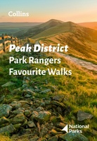 Wandelgids Park Rangers Favourite Walks Peak District | Collins
The perfect companions for exploring the National Parks. Walking guide to the Peak District National Park, with 20 best routes chosen by the park rangers. Each walk varies in length …
★★★★★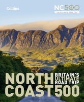 Reisgids North Coast 500 NC500 | Collins
Highly illustrated, full colour book showcasing what is unique about the North Coast 500. Striking images and descriptive text of the best places to visit are shown along with a …
★★★★★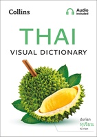 Woordenboek Visual Dictionary Thai taalgids | Collins
Super handig! Een taalgids waarbij naast de gewone vertaling en een fonetische poging daartoe ook een plaatje staat weergegeven. Ideaal voor een moeizame conversatie in een taal die je echt …
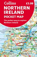 Wegenkaart - landkaart Pocket Map Northern Ireland | Collins
Handy little full colour map of Northern Ireland. Main features of this map include: • Clear mapping • Main tourist attractions located and described • Ideal for touring with …
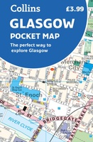 Stadsplattegrond Pocket Map Glasgow | Collins
Clear, detailed, full color Collins mapping is presented in a handy format ideal for the pocket or handbag. It is excellent value and covers the most visited area of central …
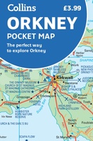 Wegenkaart - landkaart Pocket Map Orkney | Collins
Handy little full colour map of the Orkney Islands in Scotland. Detailed mapping and tourist information for Orkney mainland, Westray, Sanday, Stronsay, Shapinsay, Hoy, South Ronaldsay and the other islands. …
★★★★★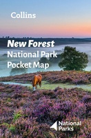 Wegenkaart - landkaart National Park Pocket Map New Forest | Collins
Handige kleine kaart van dit Nationaal Park. De kaart geeft een goed en helder overzicht van het gebied met alle plaatsen, doorgaande wandelpaden (alhoewel grof van schaal), bezienswaardigheden etc. Met …
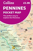 Wegenkaart - landkaart Pocket Map Pennines | Collins
Handy little full colour map of the Pennines. Main features of this map include: • Clear mapping • Main tourist attractions located and described • Ideal for touring with …
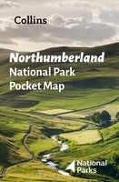 Wegenkaart - landkaart National Park Pocket Map Northumberland | Collins
Handige kleine kaart van dit Nationaal Park. De kaart geeft een goed en helder overzicht van het gebied met alle plaatsen, doorgaande wandelpaden (alhoewel grof van schaal), bezienswaardigheden etc. Met …
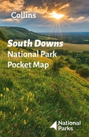 Wegenkaart - landkaart National Park Pocket Map South Downs | Collins
Handige kleine kaart van dit Nationaal Park. De kaart geeft een goed en helder overzicht van het gebied met alle plaatsen, doorgaande wandelpaden (alhoewel grof van schaal), bezienswaardigheden etc. Met …
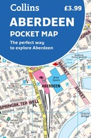 Stadsplattegrond Pocket Map Aberdeen | Collins
Handy little full colour Collins map of Aberdeen with a high level of detail. Clear mapping of the central area extending to the airport and along the coast, with all …
★★★★★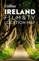 Wegenkaart - landkaart Pocket Map Ireland Film and TV Location Map | Collins
Full-colour, handy guide to more than 50 of the most popular film and TV locations in Ireland. Striking images and detailed descriptions allow for a comprehensive guide to Ireland's most …
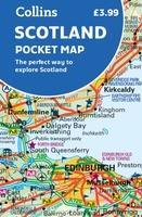 Wegenkaart - landkaart Pocket Map Scotland | Collins
Handy little full colour map of Scotland. Excellent value and very detailed for its size. Double-sided folded map with the Central Belt, southern Scotland and northern England on one side …
Laatste reviews

Heb de gids cadeau gedaan en die persoon was er heel blij mee ..
★★★★★ door J 21 november 2024 | Heeft dit artikel gekocht
De kaart van Kirgystan is prachtig, zeer gedetailleerd. Kan niet wachten tot de we echt op reis hmgaan die kant op.
★★★★★ door Marijke Eering 21 november 2024 | Heeft dit artikel gekocht
Super handig fiets boekje en mooi water bestendig. En handig om op de kaarten te kijken heel duidelijk beschrijving. Wij fietsen al jaren in Duitsland …
★★★★★ door Jenneke holterman 19 november 2024 | Heeft dit artikel gekocht
prima kaart levering en betaling allemaal vlot verlopen
★★★★★ door Marc Buts 19 november 2024 | Heeft dit artikel gekocht