South West England
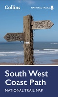 Wandelkaart National Trail Map South West Coast Path | Collins
Overzichtskaart op vrij grove schaal van deze LAW Lange Afstands Wandeling in Engeland. Let op: je kunt er niet op lopen. Wel met veel informatie op de kaart, goed ingetekend, …
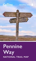 Wandelkaart National Trail Map Pennine Way | Collins
Overzichtskaart op vrij grove schaal van deze LAW Lange Afstands Wandeling in Engeland. Let op: je kunt er niet op lopen. Wel met veel informatie op de kaart, goed ingetekend, …
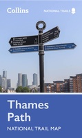 Wandelkaart National Trail Map Thames Path | Collins
Overzichtskaart op vrij grove schaal van deze LAW Lange Afstands Wandeling in Engeland. Let op: je kunt er niet op lopen. Wel met veel informatie op de kaart, goed ingetekend, …
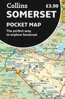 Wegenkaart - landkaart Pocket Map Somerset | Collins
Explore new places with handy pocket maps from Collins. Handy little full-colour map of county of Somerset. Detailed mapping, photographs and tourist information. Famed for its cheddar cheese, cider, …
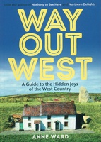 Reisgids Way Out West | Pocket Mountains
Handige compacte wandelgids met 40 dagwandelingen. Deze gids bevat kleine kaartjes en leuke uitgebreide informatie over wat er langs de route te zien is. Goede wandelkaarten zijn echter we noodzakelijk …
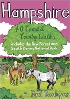 Wandelgids Hampshire | Pocket Mountains
Handige compacte wandelgids met 40 dagwandelingen. Deze gids bevat kleine kaartjes en leuke uitgebreide informatie over wat er langs de route te zien is. Goede wandelkaarten zijn echter we noodzakelijk …
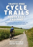 Fietsgids Traffic-Free Cycle Trails in South East England | Inspiring Adventure
Leuke gids met mooie routes: bedenk wel dat ze vrij kort zijn. Traffic-Free Cycle Trails South East England by Nick Cotton and Kathy Rogers features over 100 great cycling …
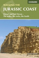 Wandelgids Jurassic Coast | Cicerone
The Jurassic Coast of Devon and Dorset, stretching between Exeter and Bournemouth, is a geological wonderland. Natural wonders like Chesil Beach, Durdle Door and fossils so numerous you'll be tripping …
★★★★★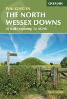 Wandelgids Walking on the North Wessex Downs | Cicerone
Guidebook to 30 circular walks in the North Wessex Downs Area of Outstanding Natural Beauty (AONB). The routes, which range from 7 to 21km (4 to 13 miles), take in …
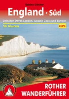 Wandelgids England Süd - Engeland Zuid | Rother Bergverlag
Uitstekende wandelgids met een groot aantal dagtochten in dal en hooggebergte. Met praktische informatie en beperkt kaartmateriaal! Wandelingen in verschillende zwaarte weergegeven in rood/blauw/zwart England at its best! Die mystischen …
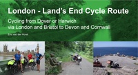 Fietsgids London - Land's End Cycle Route | EOS Cycling Holidays Ltd
The guidebook contains routes from both Dover and Harwich ferry ports to London. This makes it possible to cycle around the English Channel, when also using the Plymouth link. The …
★★★★★ Wegenkaart - landkaart Wales & south of England - Zuid Engeland | ITMB
Een degelijke kaart met aanduidingen van o.a. nationale parken, vliegveld, benzinepompen. We are gradually increasing the scales for our data of Great Britain and this is our latest effort. Most …
★★★★★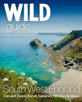 Reisgids South West | Wild Things Publishing
Wild guide Devon, Cornwall, en zuidwest Engeland is een gids met beschrijvingen en foto's van de mooiste plekken in de vrije natuur in zuidwest Engeland. The latest from the award-winning …
★★★★★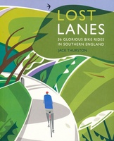 Fietsgids Lost Lanes – 36 Glorious Bike Rides in Southern England | Wild Things Publishing
Goede engelstalige fietsgids van zuid Engeland, met 36 fietsroutes. LOST LANES will take you on 36 meandering tours of the most beautiful and hidden destinations in southern England. The book …
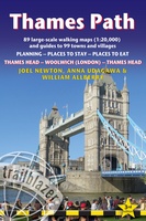 Wandelgids Thames Path | Trailblazer Guides
This book follows the Thames Path National Trail from the river's source in Gloucestershire to the Thames Barrier in London. Officially 184 miles (294km) in length (although the actual distance …
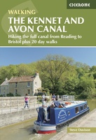 Wandelgids The Kennet and Avon Canal | Cicerone
Uitstekende wandelgids die in etappes de route nauwkeurig beschrijft; ook de zijtakken en alternatieve routes komen aan bod. Inclusief gidsje met topografische routekaarten van 1:50000 This guidebook to walking along …
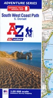 Wandelatlas 5 Adventure Atlas South West Coast Path - Dorset | A-Z Map Company
AZ heeft de meest gedetailleerde wandelkaarten van delen van het South West Coast Path gebundeld in een atlasje. Daardoor is het heel handig qua formaat. De kaarten zelf zijn perfect …
 Reisgids Eyewitness Travel England's South Coast - Zuid Engeland | Dorling Kindersley
Prachtig geillustreerde reisgids met o.a. 3D tekeningen, fraaie kaarten en geweldige foto’s. Daarnaast uitgebreide achtergrondbeschrijvingen. Echt om in de stemming te komen! Groot formaat gids. Engelstalig Taking you from Kent …
 Wandelgids Day Walks in Somerset | Vertebrate Publishing
Day Walks in Somerset features 20 routes between 7 and 15 miles (11km and 24km) in length, spread across the county of Somerset, including the Exmoor National Park. Researched and …
 Reisgids Wild Swimming Torbay | Wild Things Publishing
In this lovingly-researched new guide, Matt Newbury and Sophie Pierce take the reader beyond the popular beaches into a hidden world. Torbay's 22 miles of coastline is enormously diverse, from …
Laatste reviews

Mooie landkaart en snel bezorgd
★★★★★ door Rene van Paasen 16 december 2024 | Heeft dit artikel gekocht
Als er één ding is waardoor de Blue Guides bekendheid genieten, dan is het wel de vele aandacht voor cultuur. Zo ook deze. Ik krijg …
★★★★★ door Christine Grit 13 december 2024 | Heeft dit artikel gekocht
De coördinaten op de kaart zijn onbruikbaar. Je kan deze niet gebruiken met een kaarthoekmeter. Er is geen getekende grid voor de coördinaten. Kaart is …
★★★★★ door Robin 13 december 2024 | Heeft dit artikel gekocht
De coördinaten op de kaart zijn onbruikbaar. Je kan deze niet gebruiken met een kaarthoekmeter. Er is geen getekende grid voor de coördinaten. Kaart is …
★★★★★ door Robin 13 december 2024 | Heeft dit artikel gekocht