East Midlands
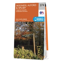 Wandelkaart - Topografische kaart 274 OS Explorer Map Skegness, Alford & Spilsby | Ordnance Survey
Met zijn 4cm voor 1 km (2 ½ cm voor 1 mijl) schaal, is de OS Explorer kaartenserie de ideale en meest gedetailleerde kaartenreeks voor mensen die graag outdoor-activiteiten zoals …
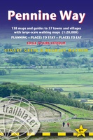 Wandelgids Pennine Way | Trailblazer Guides
Trailblazer British Walking Guide to the Pennine Way, Britain's best-known National Trail that winds for 256 miles through three National Parks - the Peak District, Yorkshire Dales and Northumberland. This …
★★★★★ Wegenkaart - landkaart Nord- und Mittelengland / Northern England & the Midlands | Reise Know-How Verlag
Hochreißfeste und 100% wasserfeste Landkarte "Nord- und Mittelengland" aus der Serie world mapping project, erschienen im Reise Know-How Verlag. Reise Know-How Landkarten zeichnen sich durch besonders stabiles Kunststoffpapier aus, …
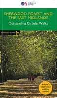 Wandelgids 020 Pathfinder Guides Sherwood Forest & the East Midlands | Ordnance Survey
Take a trip on 28 beautiful walks across Sherwood Forest & East Midlands with the OS Pathfinder Guidebooks, graded by length and ranging from 3 to 11 miles. The …
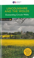 Wandelgids 050 Pathfinder Guides Pathfinder Lincolnshire & the Wolds | Ordnance Survey
Discover 28 beautiful walks across Lincolnshire & the Wolds with the OS Pathfinder Guidebooks, graded by length and ranging from 3 to 11 miles. Explore the second largest county …
 Wandelgids England Ost - Engeland oost | Rother Bergverlag
Duitstalige wandelgids van de Midlans en oost Anglia met zeer goed beschreven wandelingen in de wandelgebieden. Redelijk kaartmateriaal, vooral de beschrijving van de route en de praktische info die er …
 Wandelkaart National Trail Map Pennine Way | Collins
Overzichtskaart op vrij grove schaal van deze LAW Lange Afstands Wandeling in Engeland. Let op: je kunt er niet op lopen. Wel met veel informatie op de kaart, goed ingetekend, …
 Fietskaart Cycle Map Pennine Cycleway South | Sustrans
The official route map for the 136-mile (219km) southern part of the Pennine Cycleway on National Cycle Network Route 68 from Derby to Settle. This linear map shows the …
 Reisverhaal Call of the Kingfisher | Nick Penny
Call of the Kingfisher is the enchanting debut from composer and wildlife recordist, Nick Penny. This love letter to a short stretch of Northamptonshire's River Nene celebrates all the wild …
 Wandelgids England Nord - Engeland Noord | Rother Bergverlag
Uitstekende wandelgids met 60 dagtochten. Met praktische informatie en beperkt kaartmateriaal! Wandelingen in verschillende zwaarte weergegeven in rood/blauw/zwart. Deze wandelgidsen uitgever staat hoog aangeschreven en is een begrip onder de …
 Wandelkaart - Topografische kaart 223 OS Explorer Map | Active Northampton / Market Harborough | Ordnance Survey
Met zijn 4cm voor 1 km (2 ½ cm voor 1 mijl) schaal, is de OS Explorer kaartenserie de ideale en meest gedetailleerde kaartenreeks voor mensen die graag outdoor-activiteiten zoals …
 Wandelkaart - Topografische kaart 232 OS Explorer Map | Active Nuneaton / Tamworth / Lichfield | Ordnance Survey
Met zijn 4cm voor 1 km (2 ½ cm voor 1 mijl) schaal, is de OS Explorer kaartenserie de ideale en meest gedetailleerde kaartenreeks voor mensen die graag outdoor-activiteiten zoals …
 Reisgids Michelin groene gids Noord-Engeland/Wales | Lannoo
 Wandelgids 50 Walks in Herefordshire & Worcsestershire | AA Publishing
 Wandelgids 50 Walks in Shropshire | AA Publishing
 Wandelgids 50 Walks in Staffordshire | AA Publishing
 Wegenkaart - landkaart 4 OS Road Map Northern Engeland | Ordnance Survey
Een serie uitstekende wegenkaarten van Ordnance survey, de topografische dienst van Engeland. Alle 8 delen kennen een schaal van 1:250.000. Het kleurgebruik is uitbundig maar niet storend; integendeel, de hoogtes …
★★★★★★★★★★ Wegenkaart - landkaart 5 OS Road Map East Midlands & East Anglia, including London | Ordnance Survey
Een serie uitstekende wegenkaarten van Ordnance survey, de topografische dienst van Engeland. Alle 8 delen kennen een schaal van 1:250.000. Het kleurgebruik is uitbundig maar niet storend; integendeel, de hoogtes …
 Reisgids 111 places in 111 Places in Nottingham That You Shouldn't Miss | Emons
Scrape the surface of Nottingham and its curious charms reveal themselves – from the Victorian Lace Market through to the grave of the soul singer Edwin Starr. Nottingham’s star charms …
 Wegenatlas Local Explorer Street Atlas Lincolnshire | Philip's Maps
Who hasn't explored and enjoyed their surrounding area recently and come to appreciate what is on our respective doorsteps? Philip's have created this new series for walkers, cyclists and local …
Laatste reviews

Kan de huidige ontstuimige ontwikkelingen wereldwijd, nu ook geografisch plaatsen en daarmee beter volgen.
★★★★★ door Leo Janssen 20 december 2024 | Heeft dit artikel gekocht
We hadden Piëmonte al eens bezocht en voor onze komende reis werd ons door kennissen deze gids aanbevolen. Inderdaad is dit een heel goede gids. …
★★★★★ door DWKdB 19 december 2024 | Heeft dit artikel gekocht
Mijn bestellingen zijn altijd goed en worden altijd op tijd geleverd. Komen afspraken goed na. Erg tevreden.
★★★★★ door Ben Wegdam 19 december 2024 | Heeft dit artikel gekocht
Zeer gedetailleerde kaart van het zuidelijke deel van het douaniers pad
★★★★★ door Marian 18 december 2024 | Heeft dit artikel gekocht