Boeken - North West England
 Wandelgids Coast to Coast the Wainwright Route | Rucksack Readers
Lange afstandswandelgids van de Coast to Coast wandeling. Wandelgids met kaarten en beschrijving. op waterbestendig papier, in spiraalbinding. This challenging walk of 184 miles (296 km) crosses the north of …
 Reisgids Lake District and Yorkshire Dales | Wild Things Publishing
Imagine a summer spent swimming in mountain waterfalls, exploring lost ruins and caverns, and camping in ancient forests. In this explorer's compendium you will discover the most exciting and lesser-known …
★★★★★ Wandelgids Pennine Way | Aurum Press
Goede beschrijving van de aantrekkelijke route. Kaartmateriaal van Ordnance Survey - de Engelse topografische dienst op een schaal van 1:25.000. Praktische info voor overnachten ed. niet altijd uitgebreid, maar die …
 Wandelgids 042 Pathfinder Guides Cheshire | Ordnance Survey
175 miles of delightfully pastoral country walking from Thurstaston Common on the Wirral to Tegg's Nose on the north-western fringes of the Peak District National Park . . . …
 Fietsgids Cycling the Way of the Roses | Cicerone
Guidebook to the Way of the Roses, a 170-mile coast-to-coast cycle route across Lancashire and Yorkshire. The three-day journey (alternative two, four and five day itineraries are also outlined) begins …
 Reisgids Slow Travel Cheshire | Bradt Travel Guides
Een bijzondere serie van Bradt guides, waarin een gedeelte van Engeland of Schotland uitgebreid beschreven wordt. Met veel aandacht voor kleine details die je niet al gauw elders zult vinden. …
 Fietsgids The Coast to Coast Cycle Route | Cicerone
This guidebook details the 137 mile sea-to-sea / C2C cycle route. This much loved short cycle tour across northern England takes you from Whitehaven or Workington on the west coast …
 Wandelgids 15 Short Walks Arnside and Silverdale | Cicerone
David Jordan has chosen 15 of the best short walks around Arnside and Silverdale for you to explore. Our guide comes with easy-to-read Ordnance Survey maps and clear route descriptions, …
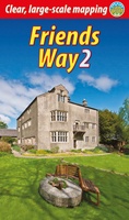 Wandelgids Friends Way 2 | Rucksack Readers
The Friends Way route will appeal not only to all Quakers who enjoy walking, but also to those walkers who don't yet know about Margaret Fell's remarkable story. This volume, …
 Reisverhaal In mijn voetsporen | Coast to Coast-route | Sarah Meuleman
 Reisgids 111 places in Places in Liverpool That You Shouldn't Miss | Emons
Liverpool’s unique history as an international port and a cultural melting pot has given it a character all its own. The city has produced music that conquered the world and …
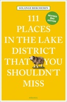 Reisgids 111 places in Places in the Lake District That You Shouldn't Miss | Emons
The Lake District delights its visitors with a series of superlatives: England’s largest national park, highest mountain, deepest lakes and now a new World Heritage status. One of Britain’s best-loved …
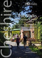 Wandelgids Cheshire & Wirral Pub Walks | Northern Eye Books
These attractive and cleverly structured guides will give walkers ten of the best themed short circular walks to Cheshire's finest pubs. With clear information, an overview and introduction for each …
 Wandelgids Easy Walks from the Sandstone Trail | Northern Eye Books
One in the popular Top 10 Walks series of pocket-sized, full colour walking guides written by the author of the Official Guide to the Sandstone Trail. This attractive and cleverly …
 Wandelgids Mysterious Walks in the Peak District | Northern Eye Books
Even the Peak District’s name conceals a mystery. Forget the obvious: a visitor expecting towering peaks will be disappointed, as the name comes from the Pecsaetan tribe who once lived …
 Wandelgids Tea Shop Walks | Northern Eye Books
The Peak District abounds with cafes and tea shops offering fabulous, freshly brewed coffee and a mouthwatering variety of speciality teas. This pocket-size guide picks carefully selected cafés across …
 Wandelgids Pub and Fell Walks Lake District | Northern Eye Books
Here in one pocket size book are ten, easy, short circular walks to the finest Lake District pubs. The words ‘Lakeland’ and ‘pub’ go together like ‘bread’ and ‘butter’ …
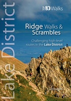 Wandelgids Lake District Ridge Walks & Scrambles | Northern Eye Books
The Lakeland Fells have some of the finest ridge walks in the country. Exploring these ridges offers fell walking at its most satisfying — staying high, taking in several summits …
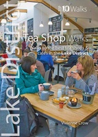 Wandelgids Tea Shop Walks | Northern Eye Books
A visit to a tea shop adds something special to a walk. It’s always a treat to sit down to coffee and cake at the end of an afternoon stroll …
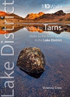 Wandelgids Walks to the Tarns in the Lake District | Northern Eye Books
This smashing little book features ten short circular walks to the loveliest tarns in the Lake District. Norsemen, who dominated Lakeland 1,000 years ago, called the small bodies of …
Laatste reviews

Heb de gids cadeau gedaan en die persoon was er heel blij mee ..
★★★★★ door J 21 november 2024 | Heeft dit artikel gekocht
De kaart van Kirgystan is prachtig, zeer gedetailleerd. Kan niet wachten tot de we echt op reis hmgaan die kant op.
★★★★★ door Marijke Eering 21 november 2024 | Heeft dit artikel gekocht
Super handig fiets boekje en mooi water bestendig. En handig om op de kaarten te kijken heel duidelijk beschrijving. Wij fietsen al jaren in Duitsland …
★★★★★ door Jenneke holterman 19 november 2024 | Heeft dit artikel gekocht
prima kaart levering en betaling allemaal vlot verlopen
★★★★★ door Marc Buts 19 november 2024 | Heeft dit artikel gekocht