South East England
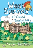 Wandelgids West Sussex | Pocket Mountains
From the city of Chichester with its ancient walls and harbour inlets standing sentinel over the English Channel to the northern heights of Black Down on its ridge of greensand …
 Wandelatlas Adventure Atlas South Downs Way | A-Z Map Company
AZ heeft de meest gedetailleerde wandelkaarten van de South Downs Way gebundeld in een atlasje. Daardoor is het heel handig qua formaat. De kaarten zelf zijn perfect voor het wandelen. …
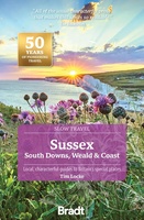 Reisgids Slow Travel Sussex - South Downs - Weald & Coast | Bradt Travel Guides
Een bijzondere serie van Bradt guides, waarin een gedeelte van Engeland of Schotland uitgebreid beschreven wordt. Met veel aandacht voor kleine details die je niet al gauw elders zult vinden. …
 Wandelgids The Ridgeway | Trailblazer Guides
Goede wandelgids waarin met veel details alle etappes zijn beschreven. Tevens informatie over overnachtingen en openbaar vervoer. This is an all-in-one hiking guide to The Ridgeway, an 87-mile trail that …
 Reisgids Slow Travel The Chilterns & the Thames Valley | Bradt Travel Guides
Een bijzondere serie van Bradt guides, waarin een gedeelte van Engeland of Schotland uitgebreid beschreven wordt. Met veel aandacht voor kleine details die je niet al gauw elders zult vinden. …
★★★★★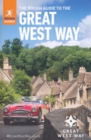 Reisgids Great West Way | Rough Guides
Discover the Great West Way with this comprehensive, entertaining, 'tell it like it is' Rough Guide, packed with comprehensive practical information and our experts' honest and independent recommendations. Whether you …
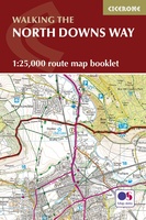 Wandelgids Walking the North Downs Way Map Booklet | Cicerone
All the mapping you need to walk the 130 mile (208km) North Downs Way National Trail between Farnham and Dover. One of the easier National Trails, it can be comfortably …
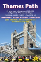 Wandelgids Thames Path | Trailblazer Guides
This book follows the Thames Path National Trail from the river's source in Gloucestershire to the Thames Barrier in London. Officially 184 miles (294km) in length (although the actual distance …
 Reisgids Marco Polo NL Zuid England | 62Damrak
Marco Polo reisgids voor Zuid-Engeland. Handig pocketformaat, boordevol informatie, met uitneembare kaart achter in het boek en atlas-pagina’s. Met Insider Tips om de échte stad/streek te ontdekken en de TOP …
 Reisgids Slow Travel Isle of Wight | Bradt Travel Guides
Een bijzondere serie van Bradt guides, waarin een gedeelte van Engeland uitgebreid beschreven wordt. Met veelv aandacht voor kleine details die je niet ao gauw elders zult vinden. Naast de …
★★★★★ Wegenkaart - landkaart 8 OS Road Map South East England including London | Ordnance Survey
Een serie uitstekende wegenkaarten van Ordnance survey, de topografische dienst van Engeland. Alle 8 delen kennen een schaal van 1:250.000. Het kleurgebruik is uitbundig maar niet storend; integendeel, de hoogtes …
★★★★★★★★★★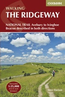 Wandelgids The Ridgeway | Cicerone
Uitstekende wandelgids van de Ridgeway, waarbij naast alle noodzakelijke informatie ook gebruik gemaakt wordt van de echte topografische kaart. Inclusief gidsje met routekaarten van 1:25000 This guidebook - which …
 Stadsplattegrond Pocket Street Map Brighton | A-Z Map Company
Navigate your way around Brighton with detailed street maps from A-Z This up-to-date, folded A-Z street map includes 2,600 streets in and around Brighton. As well as the seafront and …
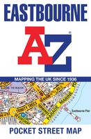 Stadsplattegrond Pocket Street Map Eastbourne | A-Z Map Company
Navigate your way around Eastbourne with detailed street maps from A-Z This up-to-date, folded A-Z street map indexes more than 2,000 streets in and around Cardiff. As well as Cardiff …
 Stadsplattegrond Pocket Street Map Chichester | A-Z Map Company
This up-to-date detailed A-Z street map indexes 780 streets in and around Chichester. As well as the harbour, the other areas covered are Fishbourne, Stockbridge, Whyke and Portfield.The large scale …
 Stadsplattegrond Pocket Street Map Reading | A-Z Map Company
Navigate your way around Reading with detailed street maps from A-Z This up-to-date, folded A-Z street map includes all of the 1,500 streets in and around Reading. As well as …
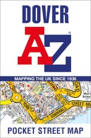 Stadsplattegrond Pocket Street Map Dover | A-Z Map Company
Navigate your way around Dover with detailed street maps from A-Z This up-to-date, folded A-Z street map includes all of the 1,500 streets in and around Dover as well as: …
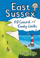 Wandelgids East Sussex | Pocket Mountains
Sitting alongside the English Channel in the southeast corner of England, East Sussex is famed for its rolling hills and magnificent wealdland, Norman battlefields and charming medieval villages, towering chalk …
 Reisverhaal Copsford | Walter J.C. Murray
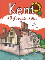 Wandelgids Kent | Pocket Mountains
Situated between the Thames Estuary and the Straits of Dover, the borderland county of Kent is home to tidal saltmarshes, high chalk downs, riverside meadows and ancient woodlands, as well …
Laatste reviews

Heb de gids cadeau gedaan en die persoon was er heel blij mee ..
★★★★★ door J 21 november 2024 | Heeft dit artikel gekocht
De kaart van Kirgystan is prachtig, zeer gedetailleerd. Kan niet wachten tot de we echt op reis hmgaan die kant op.
★★★★★ door Marijke Eering 21 november 2024 | Heeft dit artikel gekocht
Super handig fiets boekje en mooi water bestendig. En handig om op de kaarten te kijken heel duidelijk beschrijving. Wij fietsen al jaren in Duitsland …
★★★★★ door Jenneke holterman 19 november 2024 | Heeft dit artikel gekocht
prima kaart levering en betaling allemaal vlot verlopen
★★★★★ door Marc Buts 19 november 2024 | Heeft dit artikel gekocht

