Kaarten - Noord-Amerika
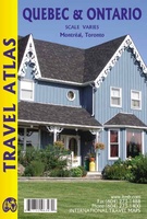 Wegenatlas Quebec & Ontario | ITMB
Wegenatlas van Quebec en Ontario. Natuurkundig kaartbeeld. Met inzetjes van stadsregio's en centrumkaarten van Montreal en Toronto. Uitgebreide index. We are blessed in North America with a state of peace …
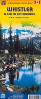 Wegenkaart - landkaart Whistler & Sea to Sky Highway | ITMB
Goede overzichtskaart van een gedeelte van Canada
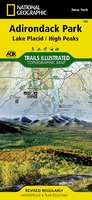 Wandelkaart Lake Placid, High Peaks: Adirondack Park Map | National Geographic
National Geographic's Trails Illustrated Maps are the most detailed and up-to-date topographic recreation maps available for US National Parks, National Forests and other popular outdoor recreation areas. A necessity for …
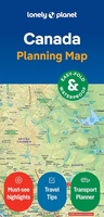 Wegenkaart - landkaart Planning Map Canada | Lonely Planet
Durable and waterproof, with a handy slipcase and an easy-fold format, Lonely Planet's Canada Planning Map is your conveniently-sized passport to traveling with ease. With this easy-to-use, full color navigation …
 Wegenkaart - landkaart Planning Map USA | Lonely Planet
Durable and waterproof, with a handy slipcase and an easy-fold format, Lonely Planet USA Planning Map is your conveniently-sized passport to traveling with ease. Get more from your map and …
 Wegenkaart - landkaart New Orleans - Mississippi River Basin | ITMB
New Orleans stadsplattegrond met schaal 1:15.000, bijzonder uitgebreid. ITMB is pleased to continue its detailed coverage of the USA with its first-ever map of the historic City of New Orleans. …
 Wegenatlas Road Atlas USA Canada Mexico 2024 | A4-Formaat | Ringband | Michelin
De beroemde wegenatlas van Rand McNally nu als Michelin atlas. Super handige atlas van Michelin in A4 formaat met stevige ringband. Let op: Canada en Mexico staan er zeer beperkt in. …
 Wegenkaart - landkaart Portland & Oregon | ITMB
This is a brand new title from ITMB. Portland is the largest city in the American state of Oregon. It is not the capital; that distinction belongs to Salem, about …
 Wegenatlas California Road and Recreation Atlas | National Geographic
From its expansive mountain ranges and vast deserts to its seemingly endless Pacific Coast, California is rich in geographical diversity and natural beauty. Explore The Golden State with this recently …
 Wegenkaart - landkaart Maui, Kauai, & Molokai | ITMB
At long last, we have finally found time to complete our detailed mapping of the American state of Hawaii. The island of Maui may not be at well-known as Oahu, …
 Wegenkaart - landkaart Montana & Idaho | ITMB
Een degelijke kaart met aanduidingen van o.a. nationale parken, vliegveld, benzinepompen. ITMB is pleased to release two more state maps, this time of Montana on one side, and adjacent Idaho …
 Wegenkaart - landkaart Nevada & Northern California | ITMB
Een degelijke kaart met aanduidingen van o.a. nationale parken, vliegveld, benzinepompen. The USA is one of the most challenging countries to map due to its strong identification with state …
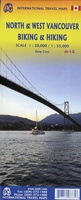 Fietskaart - Wandelkaart North & West Vancouver Biking Hiking | ITMB
Dubbelzijge wandel- en fietskaart van Vanvouver en omgeving. Schaal Vancouver 1:20.000 Omgeving 1:55.000
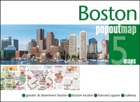 Stadsplattegrond Popout Map Boston | Compass Maps
Handig ( borstzak- ) formaat stadsplattegrond met voldoende detail, zodat je ook de kleiner straatjes erop aantreft. Van veel wereldsteden inmidddels leverbaar en dat is mooi, want juist in dit …
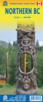 Wegenkaart - landkaart Northern British Columbia | ITMB
British Columbia is big! Gargantuan huge, in fact, although it is lightly populated. ITMB published a map of the more densely populated southern half of the province a number of …
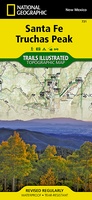 Wandelkaart 731 Santa Fe, Truchas Peak | National Geographic
Prachtige geplastificeerde kaart van het bekende nationaal park. Met alle recreatieve voorzieningen als campsites, maar ook met topografische details en wandelroutes ed. Door uitgekiend kleurgebruik zeer prettig in gebruik. Scheur …
 Wandelkaart 784 Fontana and Hiwassee Lakes | National Geographic
Prachtige geplastificeerde kaart van het bekende nationaal park. Met alle recreatieve voorzieningen als campsites, maar ook met topografische details en wandelroutes ed. Door uitgekiend kleurgebruik zeer prettig in gebruik. Scheur …
 Wegenkaart - landkaart Mississippi river | ITMB
This is the third River map that we have published (the Amazon and Nile having been in print for several years). Old Miss’ is one of America’s paramount features. Starting …
 Waterkaart Halifax & Nova Scotia | ITMB
Halifax & Nova Scotia Travel Reference Map 1:9,000/1:535,000 Halifax was founded by the British navy in 1745 as a base to patrol the North Atlantic and to place pressure …
 Wandelkaart Yosemite & Central California | ITMB
The USA is blessed with many wonderful parks, forests, and natural monuments that have been preserved for all to enjoy. The second most-visited national park (after Yellowstone) is Yosemite (pronounced …
Laatste reviews

Niet echt voor beginners. Ook zijn de routes soms moeilijk qua logistiek. Weer terugkomen aan het eind bv. En in voorseizoen (mei) blijft er niet …
★★★★★ door Tjeerd 17 mei 2024 | Heeft dit artikel gekocht
Van te voren had ik een andere kaart op het oog. Toen ik in de winkel was adviseerde zij mij deze kaart. Op hun verzoek …
★★★★★ door Koen 17 mei 2024 | Heeft dit artikel gekocht
Ideale schaal waar ook de kleinere wegen duidelijk zijn aangegeven. Beschrijving op website is correct.
★★★★★ door Peter 16 mei 2024 | Heeft dit artikel gekocht
Overzichtelijke kaart. Niks op aan te merken.
★★★★★ door Bastiaan de Leeuw 16 mei 2024 | Heeft dit artikel gekocht