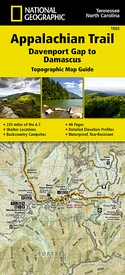
Wandelgids 1502 Topographic Map Guide Appalachian Trail – Davenport Gap to Damascus | National Geographic (9781597756396)
North Carolina, Tennessee
- ISBN / CODE: 9781597756396
- Editie: 01-12-2022
- Aantal blz.: 48
- Schaal: 1:63360
- Uitgever: National Geographic
- Soort: Wandelgids
- Serie: Topographic Map Guide
- Taal: Engels
- Hoogte: 24.0 cm
- Breedte: 11.0 cm
- Gewicht: 91.0 g
- Uitvoering: Scheur- en watervast
- Bindwijze: Paperback
- Schrijf als eerste een review
-
€ 16,95
Op voorraad. Voor 17.00 uur op werkdagen besteld, binnen 1 tot 2 werkdagen in huis in Nederland Levertijd Belgie
Gratis verzending in Nederland vanaf €35,-
-
Appalachian Trail -National Geographic
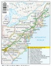
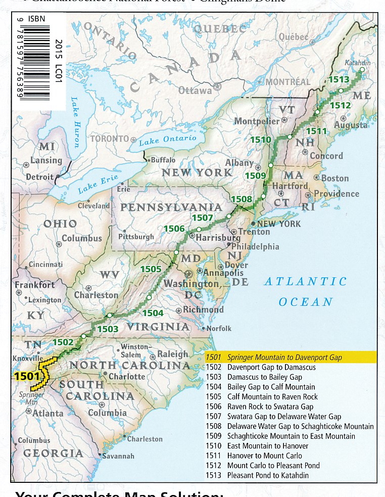
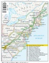
Producten op deze overzichtskaart:
Klik op een product om naar de pagina van dat product te gaan.
- Wandelgids 1501 Topographic Map Guide Appalachian Trail - Springer Mountain to Davenport Gap | National Geographic
- Wandelgids 1502 Topographic Map Guide Appalachian Trail – Davenport Gap to Damascus | National Geographic
- Wandelgids 1503 Topographic Map Guide Appalachian Trail – Damascus to Bailey Gap | National Geographic
- Wandelgids 1504 Topographic Map Guide Appalachian Trail – Bailey Gap to Calf Mountain | National Geographic
- Wandelgids 1505 Topographic Map Guide Appalachian Trail – Calf Mountain to Raven Rock | National Geographic
- Wandelgids 1506 Topographic Map Guide Appalachian Trail – Raven Rock to Swatara Gap | National Geographic
- Wandelgids 1507 Topographic Map Guide Appalachian Trail – Swatara Gap to Delaware Water Gap | National Geographic
- Wandelgids 1508 Topographic Map Guide Appalachian Trail – Delaware Water Gap to Schaghticoke Mountain | National Geographic
- Wandelgids 1509 Topographic Map Guide Appalachian Trail – Schaghticoke Mountain to East Mountain | National Geographic
- Wandelgids 1510 Topographic Map Guide Appalachian Trail – East Mountain to Hanover | National Geographic
- Wandelgids 1511 Topographic Map Guide Appalachian Trail – Hanover to Mount Carlo | National Geographic
- Wandelgids 1512 Topographic Map Guide Appalachian Trail – Mount Carlo to Pleasant Pond | National Geographic
- Wandelgids 1513 Topographic Map Guide Appalachian Trail – Pleasant Pond to Katahdin | National Geographic
Overzichtskaarten
Beschrijving
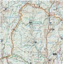
Wandelgids/wandelatlas met weinig tekst, maar goede kaarten van een gedeelte van de Appalachian Trail.
Reviews
Geen reviews gevonden voor dit product.
Schrijf een review
Graag horen wij wat u van dit artikel vindt. Vindt u het goed, leuk, mooi, slecht, lelijk, onbruikbaar of erg handig: schrijf gerust alles op! Het is niet alleen leuk om te doen maar u informeert andere klanten er ook nog mee!

