Kaarten - Oceanië
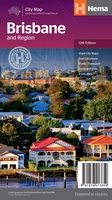 Stadsplattegrond Brisbane and Region | Hema Maps
Mooie, duidelijk kaart van Brisbane en de omgeving van Brisbane. A map of the greater Brisbane region, Bribe Island to Coomera and west to Ipswich, on one side (1:100,000) …
★★★★★ Wegenkaart - landkaart - Stadsplattegrond Perth and Region | Hema Maps
A map that has the Perth suburbs (1:80,000) and Perth city (1:15,000) maps on one side and the Perth region (1:750,000) and Fremantle (1:20,000) maps on the other. Included is …
 Wegenkaart - landkaart Australia South & Northern Territory | ITMB
Australia was one of the first countries ITMB published, back in the 1980s, albeit a licensed version. Our own original artwork was completed in the mid-1990s, but until recently, we …
 Wegenkaart - landkaart Western Australia | ITMB
The State of Western Australia occupies the western third of the continental country of Australia. The main city is Perth, in the southwest portion, and this is the part of …
 Wegenkaart - landkaart New Zealand North Island | ITMB
ITMB is very pleased to be expanding our coverage of New Zealand with the release of this fourth title (the others being the country map, the South Island, and Auckland). …
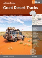 Wegenatlas Australië - Great Desert Tracks Atlas & Guide | Hema Maps
Whether you're a desert lover or just looking to tackle some of Australia's favourite 4WD destinations, the Hema Great Desert Tracks Atlas & Guide - Edition 5 is an indispensable …
 Stadsplattegrond Canberra en omgeving | Hema Maps
Stadsplattegrond van Canberra met een omgevingskaart. Inclusief register. A map that has the Canberra suburbs (1:60,000) on one side and the Canberra city, Canberra region (1:850,000) and ACT (1:375,000) …
 Wandelkaart 01 Bachgau-Maintal - Odenwald | Geo-Naturpark Bergstraße-Odenwald
Offizielle Freizeitkarte der Naturparke Geo-Naturpark Bergstraße-Odenwald und Neckartal-Odenwald mit neuer Kartengrafik Sie finden für das Gebiet der beiden Naturparke 21 regionale Wanderkarten im Maßstab 1:20.000. Die verschiedenen Blattschnitte mit …
 Wegenkaart - landkaart Queensland | ITMB
Een degelijke wegenkaart van Queensland met aanduidingen van o.a. nationale parken, vliegveld, benzinepomp, dirt-roads en kleine plattegrond van hoofdstad. Als overzichtskaart goed te gebruiken. We complete our series of regional …
 Wegenkaart - landkaart Planning Map New Zealand's South Island - Zuidereiland Nieuw Zeeland | Lonely Planet
Durable and waterproof, with a handy slipcase and an easy-fold format, Lonely Planet's New Zealand's South Island Planning Map helps you explore with ease. Get more from your map and …
 Wegenkaart - landkaart Planning Map New Zealand's North Island - noordereiland Nieuw Zeeland | Lonely Planet
Durable and waterproof, with a handy slipcase and an easy-fold format, Lonely Planet's New Zealand's North Island Planning Map helps you explore with ease. Get more from your map and …
★★★★★ Wegenkaart - landkaart Planning Map New Zealand - Nieuw Zeeland | Lonely Planet
Durable and waterproof, with a handy slipcase and an easy-fold format, Lonely Planet New Zealand Planning Map is your conveniently-sized passport to traveling with ease. Get more from your map …
★★★★★ Wegenkaart - landkaart New South Wales, Victoria, & Tasmania | ITMB
Een degelijke wegenkaart , schaal 1:1.900.000, met aanduidingen van o.a. nationale parken, vliegveld, benzinepomp, dirt-roads. Als overzichtskaart goed te gebruiken. We are pleased to announce the completion of our regional …
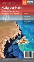 Wegenkaart - landkaart Explorer Map Nullarbor Plain - Eastern Map | Hema Maps
This map is part of Hema's new Nullarbor Plain Map Series (East and West) and covers Border Village to Port Pirie including the Eyre Peninsula. Truly one of the …
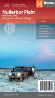 Wegenkaart - landkaart Explorer Map Nullarbor Plain - Western Map | Hema Maps
This map is part of Hema's new Nullarbor Plain Map Series and covers the area from Kalgoorlie to Border Village and its surrounds. Truly one of the worlds great …
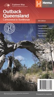 Wegenkaart - landkaart Explorer Map Outback Queensland | Hema Maps
Outback Queensland Map (4th edition - now on Waterproof Paper) Outback Queensland (QLD) contains mapping and visitor information for one of the most iconic regions in Australia. Mapping at a …
 Wegenkaart - landkaart Australia East Coast - Oost Australie | ITMB
Wegenkaart van de oostelijke kuststreek van Australië met uitvergrotingen van Brisbane, Sydney en Melbourne en een inzet van Tasmanië. This double-sided map begins at Australia’s northernmost point of Cape …
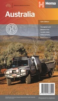 Wegenkaart - landkaart Australia - Australië | Hema Maps
Mooie, grote, duidelijke kaart van Australië met veel informatie. Oa bezinestations (ook in de outback) en een goed overzicht van de doorgaande (grote) wegen waardoor de kaart erg handig is …
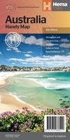 Wegenkaart - landkaart Australia - Australië | Hema Maps
Een handzame kaart van Australië met op de achterkant een aantal stadsplattegrondjes. A country map of Australia that includes city maps on the reverse for compact travel use. …
 Stadsplattegrond City map Melbourne | Lonely Planet
De stadsplattegronden van Lonely Planet zijn uitgevoerd op scheur- en watervast papier, zijn lichtgewicht en kennen een handig formaat. Het centrum van de stad is in heldere kleuren in beeld …
Laatste reviews

Kan de huidige ontstuimige ontwikkelingen wereldwijd, nu ook geografisch plaatsen en daarmee beter volgen.
★★★★★ door Leo Janssen 20 december 2024 | Heeft dit artikel gekocht
We hadden Piëmonte al eens bezocht en voor onze komende reis werd ons door kennissen deze gids aanbevolen. Inderdaad is dit een heel goede gids. …
★★★★★ door DWKdB 19 december 2024 | Heeft dit artikel gekocht
Mijn bestellingen zijn altijd goed en worden altijd op tijd geleverd. Komen afspraken goed na. Erg tevreden.
★★★★★ door Ben Wegdam 19 december 2024 | Heeft dit artikel gekocht
Zeer gedetailleerde kaart van het zuidelijke deel van het douaniers pad
★★★★★ door Marian 18 december 2024 | Heeft dit artikel gekocht

