National Geographic
Dit bekende tv-kanaal heeft naast prachtige natuurdocumontaires en magazines ook zijn eigen reisgidsen en wegenkaarten uitgegeven. De landkaarten zijn gedrukt op scheurvast en waterbestendig papier wat een vergrootte levensduur betekent. De kaarten zijn helder en bevatten een schat aan informatie voor zowel de 'gewone' toerist als de avonturier. De hoofdwegen zijn duidelijk aangegeven, maar ook de secundaire wegen en tracks staan er op. Met de nationale parken duidelijk en mooie zwemplekken of attracties aangegeven onderscheidt deze kaartenserie zich van de andere wegenkaarten. De kaarten heten dan ook niet voor niets Adventure Maps! Het avontuur wacht!
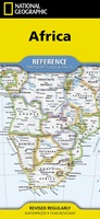 Wegenkaart - landkaart Africa - Afrika | National Geographic
• Waterproof • Tear-Resistant • Reference Map Expertly researched and designed, National Geographic's Africa Flags & Facts Map is the authoritative map of Africa by which other reference …
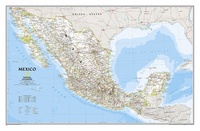 Wandkaart Mexico, 78 x 54 cm | National Geographic
Decoratieve wandkaart van Mexico. Naast de mooie kleuren staan er bijzonder veel plaatsen op vermeld. This finely detailed National Geographic political map of Mexico shows country boundaries, cities and towns, …
★★★★★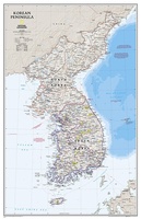 Wandkaart Korean Peninsula Noord- en Zuid Korea, 59 x 91 cm | National Geographic
Amid increasingly combative rhetoric from Pyongyang, North Korea, do you know where its underground nuclear test site or missile launch centers are located? Are you aware that the South Korean …
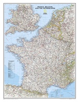 Wandkaart Frankrijk, België en Nederland, 60 x 77 cm | National Geographic
Our classic wall map of France, Belgium, and the Netherlands shows political boundaries, major highways and roads, cities and towns, and a wealth of other incredibly accurate geographic detail. n …
★★★★★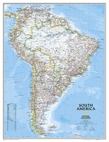 Wandkaart Zuid Amerika, politiek, 91 x 117 cm | National Geographic
Staatkundige kaart van Zuid-Amerika (in kleur). De kaart wordt verzonden in een koker. This classic map of South America shows political boundaries, place names, airports, major roads and highways, and …
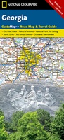 Wegenkaart - landkaart State Guide Map Georgia | National Geographic
Makkelijk leesbare kaart aan 2 zijden bedrukt. De ene kan met informatie en beperkte stadsplattegronden, de andere met de daadwerkelijke kaart. De kaart is geplastificeerd en dus watervast! The front …
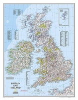 Magneetbord - Wandkaart British Isles - Groot Brittannië en Ierland, 61 x 76 cm | National Geographic
Magneetbord van een wandkaart van Groot Brittannië en Ierland: prachtig kaartbeeld met heel veel details, gemaakt door de gerenommeerde makers van National Geographic. British Isles at 1:1,687,000 on a small …
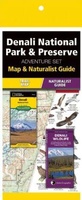 Natuurgids Adventure Set Denali National Park & Preserve | National Geographic
Handige combinatie van een uitstekende wegenkaart van National Geographic en de uitklapkaart van natuur van uitgever Waterford. National Geographic: Zeer gedetailleerde kaart. Misschien wel de beste kaart! Gedrukt op …
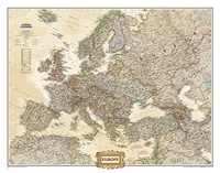 Wandkaart Europa, politiek & antiek, 249 x 194 cm | National Geographic
Deze kaart wordt gemaakt in drie delen - te groot om in 1 keer te fabriceren met kans op beschadigingen - die vervolgens zeer nauwkeurig aan elkaar worden geplakt. …
 Reisinspiratieboek National Geographic Atlas of Wild America | National Geographic
From the deep forests of the Canadian Northwest to the red-rock deserts of the American Southwest, North America offers a myriad of opportunities for hiking, camping, trekking, and simply enjoying …
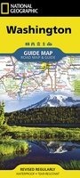 Wegenkaart - landkaart State Guide Map Washington | National Geographic
The front side features insets of Olympia, Yakima and Spokane. The back includes a map and information for Seattle, information for Olympic, North Cascades, and Mt. Rainier National Parks, points …
★★★★★ Wandkaart Brazil - Brazillië Antiek, 104 x 97 cm | National Geographic
Presented in National Geographic’s classic wall map style, our large, earth-tone Brazil wall map is ideal for home or office. Inherent to all National Geographic reference cartography, this map contains …
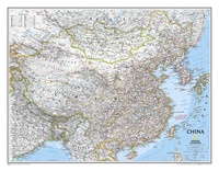 Wandkaart China, 76 x 59 cm | National Geographic
Decoratieve wandkaart van China. Naast de mooie kleuren staan er bijzonder veel plaatsen op vermeld. Het gaat soms een beetje ten kosten van de schoonheid van de kaart, maar daardoor …
★★★★★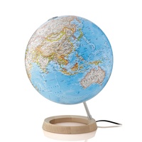 Wereldbol - Globe Neon Classic ø 30 cm | Met verlichting | (Engelstalig) | National Geographic
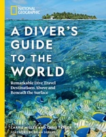 Reisgids - Duikgids National Geographic A Diver's Guide to the World | National Geographic
From Okinawa to the Outer Banks of North Carolina, find the ultimate travel itineraries for above and below water in this inspiring and comprehensive guide to the worlds 50 best …
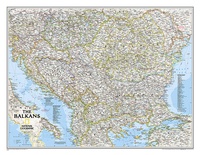 Wandkaart The Balkans - Balkan landen, 77 x 60 cm | National Geographic
Study the countries of the Balkans with our new map featuring the classic National Geographic reference styling. Features thousands of place names, accurate political boundaries, national parks, and major infrastructure …
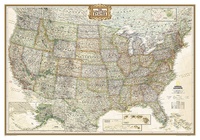 Wandkaart USA - Verenigde Staten Antiek, 111 x 77 cm | National Geographic
Wandkaart van de USA waarbij de kleuren in 'antieke' look zijn weergegeven, de staatgrenzen zeer duidelijk zijn en er veel plaatsen op staan. This Antique-style USA Wall Map by …
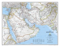 Wandkaart Middle East - Midden Oosten 76 x 58 cm | National Geographic
Wandkaart van het Midden Oosten, met o.a. Afghanistan - Pakistan - National Geographic wandkaart geplastificeerd - Afmeting ca 76 x 58 cm National Geographic Maps' recently updated wall map of …
 Wandkaart China, antiek, 76 x 59 cm | National Geographic
This detailed political map of China accurately shows locations of provincial boundaries, cities and towns, major highways and roads, rivers and waterways, and other geographic features.
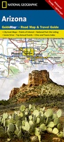 Wegenkaart - landkaart State Guide Map Arizona | National Geographic
Makkelijk leesbare kaart aan 2 zijden bedrukt. De ene kan met informatie en beperkte stadsplattegronden, de andere met de daadwerkelijke kaart. De kaart is geplastificeerd en dus watervast! The front …
Laatste reviews

Heb de gids cadeau gedaan en die persoon was er heel blij mee ..
★★★★★ door J 21 november 2024 | Heeft dit artikel gekocht
De kaart van Kirgystan is prachtig, zeer gedetailleerd. Kan niet wachten tot de we echt op reis hmgaan die kant op.
★★★★★ door Marijke Eering 21 november 2024 | Heeft dit artikel gekocht
Super handig fiets boekje en mooi water bestendig. En handig om op de kaarten te kijken heel duidelijk beschrijving. Wij fietsen al jaren in Duitsland …
★★★★★ door Jenneke holterman 19 november 2024 | Heeft dit artikel gekocht
prima kaart levering en betaling allemaal vlot verlopen
★★★★★ door Marc Buts 19 november 2024 | Heeft dit artikel gekocht