National Geographic
Dit bekende tv-kanaal heeft naast prachtige natuurdocumontaires en magazines ook zijn eigen reisgidsen en wegenkaarten uitgegeven. De landkaarten zijn gedrukt op scheurvast en waterbestendig papier wat een vergrootte levensduur betekent. De kaarten zijn helder en bevatten een schat aan informatie voor zowel de 'gewone' toerist als de avonturier. De hoofdwegen zijn duidelijk aangegeven, maar ook de secundaire wegen en tracks staan er op. Met de nationale parken duidelijk en mooie zwemplekken of attracties aangegeven onderscheidt deze kaartenserie zich van de andere wegenkaarten. De kaarten heten dan ook niet voor niets Adventure Maps! Het avontuur wacht!
 Wandelkaart - Wegenkaart - landkaart 903 Jasper North National Park | National Geographic
Goede kaart van een deel van Jasper National Park. Geschikt voor overzicht maar ook voor de langere trails: campsites, rivieren, paden, alles kun je er op terug vinden. National Geographic's …
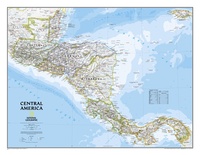 Wandkaart Centraal Amerika, 73 x 55 cm | National Geographic
This Central America Wall Map by National Geographic contains extensive political information with political boundaries clearly presented with different color-bands for each country. Beautifully shaded to show physical terrain, this …
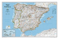 Wandkaart Spain - Spanje & Portugal, 83 x 55 cm | National Geographic
This classic-style map of Spain and Portugal shows political boundaries, major highways and roads, cities and towns, airports and other geographic details. Thousands of place-names and exact borders are carefully …
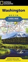 Wegenkaart - landkaart State Guide Map Washington | National Geographic
The front side features insets of Olympia, Yakima and Spokane. The back includes a map and information for Seattle, information for Olympic, North Cascades, and Mt. Rainier National Parks, points …
★★★★★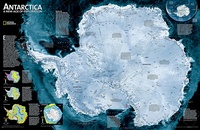 Wandkaart Antarctica Satellite Map, 78 x 50 cm | National Geographic
This digital mosaic of 4,500 satellite scans shows incredible detail of Antarctica's terrain. Includes insets that show the surface elevation, ice sheet thickness, ice flow velocity, and sea ice movement …
★★★★★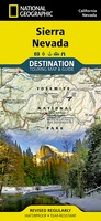 Wegenkaart - landkaart Sierra Nevada | National Geographic
&; Waterproof &; Tear-Resistant &; Travel Map National Geographic's Sierra Nevada Destination Map strikes the perfect balance between map and guidebook and is an ideal resource for touring the …
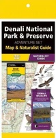 Natuurgids Adventure Set Denali National Park & Preserve | National Geographic
Handige combinatie van een uitstekende wegenkaart van National Geographic en de uitklapkaart van natuur van uitgever Waterford. National Geographic: Zeer gedetailleerde kaart. Misschien wel de beste kaart! Gedrukt op …
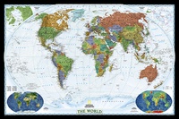 Wereldkaart World Decorator, 108 x 75 cm | National Geographic
This map has spectacular color and detail to bring the world alive! Enjoy the accuracy and beauty of this world map, which features the Winkel Tripel projection to reduce distortion …
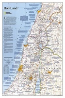 Wandkaart Holy Land – Israël, 53 x 80 cm | National Geographic
National Geographic Wall Maps offer a special glimpse into current and historical events, and they inform about the world and environment. Offered in a variety of styles and formats, these …
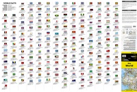 Wegenkaart - landkaart Wereld + vlaggen + info per land | National Geographic
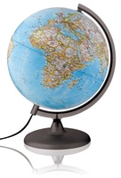 Wereldbol - Globe Classic Ø30 Nederlands met Verlichting | National Geographic
Deze verlichte wereldbol/globe van National Geographic (30 cm) met blauwe oceaan bevat meer dan 3800 plaatsnamen in het Nederlands. De tekst is duidelijk en elk land is afgebeeld in een …
★★★★★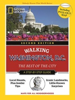 Wandelgids Walking Washington D.C. | National Geographic
Discover the best of Washington, D.C. with this handy guide, through 13 itineraries with step-by-step maps to help you explore its lively, eclectic neighborhoods. In a practical pocket format, the …
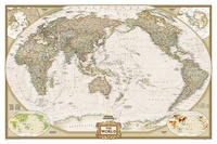 Wereldkaart Politiek & antiek, pacific centered, 117 x 78 cm | National Geographic
National Geographic's World map is the standard by which all other reference maps are measured. The World map is meticulously researched and adheres to National Geographic's convention of making independent, …
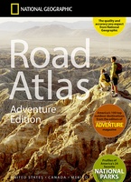 Wegenatlas Adventure Edition USA - Amerika - Canada - Mexico - Puerto Rico | A3-Formaat | Ringband | National Geographic
Duidelijk leesbare wegenatlas van de USA, Mexico, Canada, en Puerto Rico, met groot register en ook kleine plattegronden van centra van belangrijke steden. Ook met informatie over nationale parken en …
★★★★★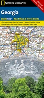 Wegenkaart - landkaart State Guide Map Georgia | National Geographic
Makkelijk leesbare kaart aan 2 zijden bedrukt. De ene kan met informatie en beperkte stadsplattegronden, de andere met de daadwerkelijke kaart. De kaart is geplastificeerd en dus watervast! The front …
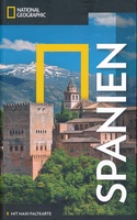 Reisgids Spanien | National Geographic
Duitstalige versie van de National Geographic Spanje Die Höhle von Altamira, das Barri Gòtic in Barcelona, die majestätische Alhambra oder der Palacio Real in Madrid. In Spanien sind die Highlights …
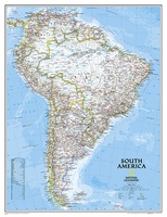 Wandkaart Zuid Amerika, politiek, 91 x 117 cm | National Geographic
Staatkundige kaart van Zuid-Amerika (in kleur). De kaart wordt verzonden in een koker. This classic map of South America shows political boundaries, place names, airports, major roads and highways, and …
 Reisgids National Geographic Secrets of the National Parks, 2nd Edition | National Geographic
Discover a side of America's national parks that you've never seen before with more than 500 tips and tricks for getting away from the crowds, exploring little-known hikes, and finding …
 Fotoboek America the Beautiful | National Geographic
"America the Beautiful' showcases the stunning spaces closest to our nation's heart--from the woods in the Great Appalachian Valley that Davy Crockett once called home to the breathtaking sweep of …
 Wegenkaart - landkaart State Guide Map Virginia | National Geographic
Makkelijk leesbare kaart aan 2 zijden bedrukt. De ene kan met informatie en beperkte stadsplattegronden, de andere met de daadwerkelijke kaart. De kaart is geplastificeerd en dus watervast! The front …
★★★★★
Laatste reviews

Heb de gids cadeau gedaan en die persoon was er heel blij mee ..
★★★★★ door J 21 november 2024 | Heeft dit artikel gekocht
De kaart van Kirgystan is prachtig, zeer gedetailleerd. Kan niet wachten tot de we echt op reis hmgaan die kant op.
★★★★★ door Marijke Eering 21 november 2024 | Heeft dit artikel gekocht
Super handig fiets boekje en mooi water bestendig. En handig om op de kaarten te kijken heel duidelijk beschrijving. Wij fietsen al jaren in Duitsland …
★★★★★ door Jenneke holterman 19 november 2024 | Heeft dit artikel gekocht
prima kaart levering en betaling allemaal vlot verlopen
★★★★★ door Marc Buts 19 november 2024 | Heeft dit artikel gekocht