Engeland
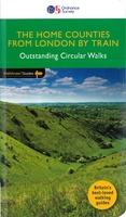 Wandelgids 072 Pathfinder Guides The Home Counties from London by Train | Ordnance Survey
The all-revised edition contains 27 carefully selected walks, all chosen to be easily accessible from London's main railway stations. The routes lie across Essex, Bedfordshire, Oxfordshire, Surrey, West Sussex, East …
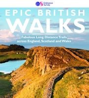 Wandelgids Epic British Walks | Ordnance Survey
This magnificent collection of truly EPIC WALKS brings together Britain’s most beautiful countryside with the long-distance trails that present the very best means of experiencing it. An inspiring introduction …
★★★★★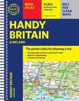 Wegenatlas Handy Road Atlas Britain A5-Formaat | Philip's Maps
"The perfect atlas for planning a trip anywhere in the UK and Ireland"The essential handy road atlas for planning a trip in Britain and Ireland. Keep it in the glove …
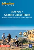 Fietsgids Bikeline Eurovelo 1 - Atlantic Coast Route | Esterbauer
Fantastische route van 11.150 km! For decades, thousands of vacationers have enjoyed cycling tours as the optimal travel method, and their numbers are growing daily. There are countless long-distance routes and …
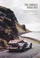 Reisverhaal The Longest Road Out | Daniel Craanen
The Longest Road Out is the road trip of a lifetime. Driving it gave us, without doubt, some of our favourite memories: from sampling succulent oysters on a sun-drenched Guernsey …
 Wegenkaart - landkaart Routemap The Longest Road Out | Longestroadout
Deze kaart hoort bij het boek The Longest Road Out
 Reisinspiratieboek Under the Stars - Europe | Lonely Planet
From wild camping to curling up in a cabin, discover 200 amazing places to sleep under the stars in Europe. Lonely Planet's experts have scoured the continent to recommend the …
 Wegenatlas Easy to Read Road Atlas Britain 2025 | Philip's Maps
"The detail you need at a size you can read". The latest 2025 Philip's Easy to Read Road Atlas of Britain from the best-selling Road Atlas range has over 350 …
★★★★★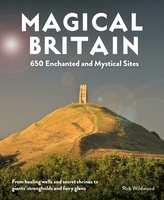 Reisgids Magical Britain Rediscovering Our Animist Landscapes & Sacred Sites | Wild Things Publishing
This richly illustrated guide to 650 places will appeal to those who want to explore Britain's lost animist landscape of fairies, folklore, myth and paganism. Discover pre-Christian healing shrines and …
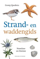 Opruiming - Natuurgids Strand en waddengids | Fontaine Uitgevers
Verkenningstochten langs het strand en op de wadden, vogels kijken, planten determineren, op bezoek gaan bij de zeehonden op hun zandbanken: de mogelijkheden om de natuur langs de boorden van …
★★★★★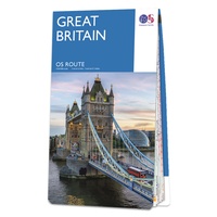 Wegenkaart - landkaart Great Britain OS route | Ordnance Survey
Tweezijdige overzichtskaart van heel Engeland en Schotland. Goed duildelijk leesbaar kaartbeeld met de doorgaande en grotere wegen. Ook Nationsle Parken staan er goed op. Ordnance Survey's double-sided OS Route Map …
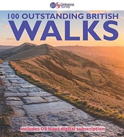 Wandelgids 100 outstanding British Walks | Ordnance Survey
Beschrijving van de 100 mooiste Pathfinder wandelingen in Engeland, Wales en Schotland. Uitstekende beschrijving van de route met een zeer duidelijke topografische kaart waarop de route is ingetekend. This magnificent …
 Spoorwegenkaart Europe Western Railroad & Road | ITMB
Spoorwegen kaart van West Europa in kleur. Schaal 1:2,500,000. Toont spoorlijnen, snelwegen, secundaire wegen en andere wegen, veerboten en belangrijke scheepvaartdiensten; internationale grenzen, de grenzen van de gebieden met reisbeperkingen; …
★★★★★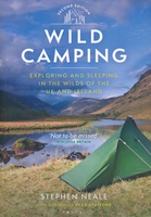 Campinggids Wild Camping UK and Ireland | Conway
Als je echt op zoek bent naar bijzondere kampeerplekken in Engeland, Schotland en Ierland dan is dit je boek: het beschijft de meest afgelegen plekkenin het wild waar je je …
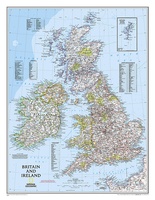 Wandkaart 02022 Britain and Ireland - Groot Brittannië en Ierland, 60 x 76 cm | National Geographic
This classic-style map of England and Wales shows political boundaries, major highways and roads, cities and towns, airports, and other geographic details. Thousands of place-names and exact borders are carefully …
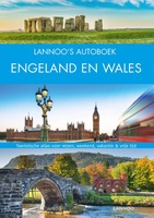 Reisgids Lannoo's Autoboek Engeland en Wales | Lannoo
Drie uitgestippelde autoroutes en twee stadswandelingen loodsen je oor de fraaiste regio's Atlas met kaarten op schaal 1:750.000 en meer dan 700 kleurenfoto's Handige geografische indeling en sterrenquotering England en …
 Campinggids - Campergids Cool Camping Coast | Punk Publishing
In recognition of the nation's love for the Great British coastline, 2018 sees the launch of a brand new guidebook - Cool Camping: Coast - the latest title in the …
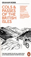 Fietsgids Cols and Passes of the British Isles
A col is the lowest point on the saddle between two mountains. Graham Robb has spent years uncovering and cataloguing the 2,002 cols and 105 passes scattered across the British …
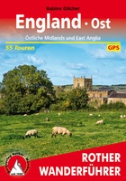 Wandelgids England Ost - Engeland oost | Rother Bergverlag
Duitstalige wandelgids van de Midlans en oost Anglia met zeer goed beschreven wandelingen in de wandelgebieden. Redelijk kaartmateriaal, vooral de beschrijving van de route en de praktische info die er …
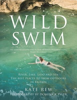 Reisgids Wild Swim Britain | Guardian Faber Publishing
In this stunning and inspiring guide, Kate Rew, founder of the Outdoor Swimming Society, takes you on a wild journey across Britain, braving the elements to experience first-hand some of …
Laatste reviews

Deze kaarten gebruik ik om mooie wandelingen uit te zetten, die ik dan met mijn liefste meisje beloop. Dank u wel voor de snelle adequate …
★★★★★ door Jacques Marks 03 december 2024 | Heeft dit artikel gekocht
Ook ik ben een zwerver, maar gelukkig niet dakloos. Deze kaarten gebruik ik om mooie wandelingen uit te zetten, die ik dan met mijn liefste …
★★★★★ door Jacques Marks 03 december 2024 | Heeft dit artikel gekocht
Perfect👍
★★★★★ door Wilma & Mari 03 december 2024 | Heeft dit artikel gekocht
Vooralsnog ben ik tevreden met de kaart. Hij werd vlot bezorgd en ik kan hem goed lezen. De echte proof of the pudding vindt echter …
★★★★★ door Jan Piebe Tjepkema 03 december 2024 | Heeft dit artikel gekocht

