Engeland
 Fietskaart 1 Tour Map Cornwall | Ordnance Survey
Overzichtelijke, gedetailleerde kaart met veel toeristische informatie, waaronder campings en jeugdherbergen. Groot voordeel, naast de prima schaal, is dat de routes van het National Cycle Network duidelijk staan ingetekend. De …
★★★★★ Wandelgids the National Trails - Great British Walks - Engeland, Wales en Schotland | Cicerone
Guidebook to Britain's National Trails - 19 long-distance walking routes through England, Wales and Scotland, describing what makes each of them so special and providing the practical information to help …
 Mountainbikegids Handbook Mountain Biking Britain ( Engeland - Schotland) | Footprint
Experienced Footprint author Chris Moran (co-author of Mountain Biking Europe and Snowboarding the World) brings you the fully revised & updated guide to mountain bike riding in Britain. Mountain Biking …
 Wegenkaart - landkaart Ancient Britain | Ordnance Survey
The Ordnance Survey Ancient Britain map is a comprehensive guide to the most important archaeological sites of early English, Welsh and Scottish history. Ordnance Survey's Ancient Britain map shows Neolithic, …
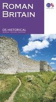 Wegenkaart - landkaart Roman Britain | Ordnance Survey
An informative map showing the location of the most important ancient monuments of Roman Britain. The map has been produced by Ordnance Survey in collaboration with the Ancient Monument Trusts …
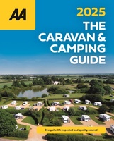 Campinggids The Caravan & Camping Guide Britain 2025 | AA Publishing
Uitgebreide gids met campings om met de tent of de caravan naar toe te gaan. 580 campings in Engeland, Schotland, Noord-Ierland, Wales, Kanaaleilanden, Isle of Man en de Schotse eilanden. …
★★★★★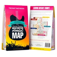 Wegenkaart - landkaart Great British Music Map | Strumpshaw, Tincleton & Giggleswick's Marvellous Maps
When it comes to music, Britain calls the tune on the world stage, playing second fiddle to nobody. This new and unique fold-out map celebrates Britain’s globe-straddling musical prowess, featuring …
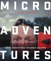 Reisgids Microadventures | Collins
Deze praktische gids staat vol met ideeën voor microadventures - om zelf of met vrienden en familie te beleven - en meer dan 150 verbluffende foto's, plus tips en advies …
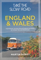 Campergids - Reisgids Take the Slow Road: England - Engeland and Wales | Bloomsbury
The ultimate guide to the very best scenic and fun routes for camper vans and motorhomes around the valleys, mountains and coastlines of wonderful England and Wales. In this book …
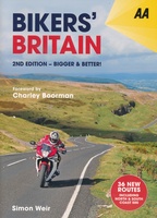 Reisgids Motorgids Bikers' Britain | AA Publishing
UItgebreide gids, met handige ringband, voor motortochten door Engeland, Wales en Schotland. 2nd edition of Bikers' Britain with updated content and 82 routes, 36 of them are brand new for …
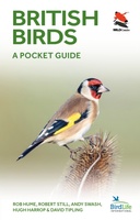 Vogelgids British Birds | Princeton University
A carefully designed and lavishly illustrated photographic guide This innovative and carefully designed photographic guide provides a concise introduction to the identification of the 246 birds most likely to be …
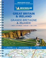 Wegenatlas Great Britain and Ireland 2024 - Main Roads Atlas (A4-Spiral) | Michelin
Full of practical features, the Michelin Great Britain & Ireland 2024 - Main Roads Atlas (A4-Spiral) is the perfect companion for your everyday journey and holiday planning. Updated every year, …
★★★★★ Reisverhaal Landlijnen | Raynor Winn
In haar unieke, beeldende, empathische stijl, doet bestsellerauteur Raynor Winn in het spectaculaire Landlijnen verslag van de zwaarste wandeltocht die zij en haar man Moth tot nu toe ondernamen. Te …
 Wegenatlas Navigator Britain - Engeland en Schotland 1:100.000 | Philip's Maps
Bijzonder gedetaileerde wegenatlas van Engeland en Schotland op schaal 1:100.000 (met het noorden van Schotland 1:200.000). Alle wegen, bezienswaardigheden, National Trails, campings ... noem maar op en je vindt het …
★★★★★ Fietsgids Britain's Best Bike Ride from Land's End to John o' Groats | Inspiring Adventure
There are many ways to cycle between Land’s End and John o’ Groats, but the route specially created for this book, LEJOG1000, is designed to show you the quiet roads, …
 Wandelgids Great Walks on the England Coast Path | Cicerone
Guidebook to 30 routes celebrating the best day and weekend walks on the England Coast Path, a new National Trail. Includes a varied selection of walks along the country's diverse …
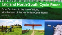 Fietsgids England North - South Cycle Route | EOS Cycling Holidays Ltd
This guidebook allows you to cycle from the Scottish border across England to the Isle of Wight, all via continuous traffic-calmed routes. The book also features the best of the …
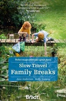 Reisgids Slow Travel Family Breaks | Bradt Travel Guides
Een bijzondere serie van Bradt guides. Met veel aandacht voor kleine details die je niet gauw elders zult vinden. Naast de beschrijvende informatie vind je ook een schat aan praktische …
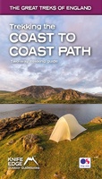 Wandelgids Trekking the Coast to Coast Path | Knife Edge Outdoor
The definitive two-way guide to the Coast to Coast Path: both eastbound and westbound routes are described in full. Real Maps: Full Ordnance Survey mapping inside (1:25,000). All accommodation is …
★★★★★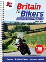 Wegenatlas Britain for Bikers | Voor Motoren | A-Z Map Company
Discover the best biking routes around Great Britain and Northern Ireland. Your essential rideout roadbook covering the best biking routes around Great Britain and Northern Ireland, including short trips and …
Laatste reviews

Deze kaarten gebruik ik om mooie wandelingen uit te zetten, die ik dan met mijn liefste meisje beloop. Dank u wel voor de snelle adequate …
★★★★★ door Jacques Marks 03 december 2024 | Heeft dit artikel gekocht
Ook ik ben een zwerver, maar gelukkig niet dakloos. Deze kaarten gebruik ik om mooie wandelingen uit te zetten, die ik dan met mijn liefste …
★★★★★ door Jacques Marks 03 december 2024 | Heeft dit artikel gekocht
Perfect👍
★★★★★ door Wilma & Mari 03 december 2024 | Heeft dit artikel gekocht
Vooralsnog ben ik tevreden met de kaart. Hij werd vlot bezorgd en ik kan hem goed lezen. De echte proof of the pudding vindt echter …
★★★★★ door Jan Piebe Tjepkema 03 december 2024 | Heeft dit artikel gekocht